

There is as much data generated around every acre of land as there is around consumers. Athena gives Voice to the Acre for wildfire and other terrain risks.
Sacramento, CA
Joined July 2016
- Tweets124
- Following62
- Followers94
- Likes108







Pinned Tweet
Want to know about #prefire #wildfire #riskassessment from the leading #ai #geospatial and conditional #profiling #algorithm for #utilities and #propertyinsurance - join our LI Group - Athena Voice of the Acre medium.com/@athenaintelligen…

1
111

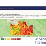
Contact us at [email protected] for a free map of 2025 fire risk for communities and utilities. This map is the service territory for Ak-chin Power which serves @Harrahs_AkChin @akchinairport @AkChinPavilion

23
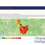
Athena's assessment of the 2025 #Wildfire risk The Fort Mojave Indian #Tribe (FMIT) which has a tribal owned/operated #utility which provides power service to the #Indian #Reservation near where #California, #Nevada, and #Arizona meet.
These maps are free to rural utilities

38
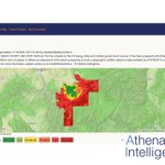
#utah - Ever wonder why one #wildfire is consequential and another, seemingly similar, doesn't spread? Athena knows - We are offering a quick assessment to all #coop and #municipal #electric @companies @Empireelectric7
@TSECooperatives @URECA_UT

12
25%+ of all #wildfires happen in areas the #WHP (USFS Wildfire Hazard Potential Maps) show as safe. Just as importantly, any good risk assessment would help you prioritize - where is the high risk and where is the low risk.

9
Just 2 more today - this is Glacier #electric #coop in #Montana - today's 5 #utilities were selected at random and posted to LI and here -Ask us for yours! #vegetationManagement #RiskMitigation #Wildfire #GIS #ArcGIS

9


Athena is rolling out a Fremium product for utilities - contact us for a free map of wildfire risk - Today posted #OrangeCounty #CA #Anaheim

34
Hello @EvFundMgt @FourthWaveUS @CapitolAlert @ALERTCalifornia @calfireSCU @CAL_FIRE @code4sac @EsriStartups @GISPublicSafety @EsriForestry @innovatesac @SacHackerLab We don't post here very often - Please find us on Medium and LI
linkedin.com/company/athena-…

23
Following up on the prior post. While there are #properties safe to #underwrite. Others, based on their #wildfire risk, belong in the #ExcessAndSurplus or #NonAdmitted market for #propertyInsurance.
athenaintelligence.medium.co…
10
Thinking about #Property #Insurers #underwriting #wildfire risk - Athena offers a simple Green/Yellow/Red label for #underwriters
athenaintelligence.medium.co…

11
Power companies aim to maintain #reliability as close to 100% as possible, but preventing #wildfires and ensuring public safety impacts reliability metrics. A well run #vegetation management program can improve #SAIFA and #PSPS
medium.com/@athenaintelligen…
17
Thrilled to announce to #utilities and #grid operators that Athena has launched its first flight on the @innovationforce platform. #PreFire #FireTech with Intelligent #Wildfire Risk
hangar.innovationforce.io/th…

5
@AthenaIntel is excited to be a part of a great group of innovators! #SacInnov8Awards nitter.gq/sacbizevents/status/92…

Congrats to #SacInnov8Awards finalists @AthenaIntel @CircularisBio @chirpmicro @RaydiantSPO2 See complete list here bizj.us/1pc34o

1
1
Today Athena is the leading #prefire #cleantech and #fintech company - working with #utilities, #communities Wildfire data for #insurance and #bond investors.
4
Athena's #prefire #FureTech tools are now available through members of the @RISE_Consortium to work on #Wildfire #Resilience in the context of the #national #Grid and #Energy and #utility infrastructure.

19
94 Followers- thank you! If you want to know what Athena is up to follow us on medium.com/@athenaintelligen…
19
#Utilities use Athena for #RiskManagement Maps which runs from dark red/brown for the highest #wildfire risk to green for lowest. Same fire as prior tweet 🙏@EsriStartups #ai #geospatial #30daymapchallenge Day 30
3
86
At @AmericanGeo We showed a #wildfire risk map with the land's propensity to host fire in red and fire probability in blue - with highest risk in purple. From ignition, you can see where the fire went. Day 30 #30daymapchallenge #geospatial #syntheticdata