

work with maps, enjoy maps
Perth, Scotland
Joined August 2013
- Tweets164
- Following117
- Followers82
- Likes40




Using @John_M_Nelson's great George Washington style to create a version that works in open source software, finally and @OrdnanceSurvey Zoomstack data.

1
5
Day 30 - Metamapping
Mapping what you want. Two maps today.
Map 1/2
Schematic map basing this off of Beck's famous map and using QGIS to create this of Scotland's Fair City of Perth.
Map 2/2
Using Aerialod to create a map of the Cairngorms to look like Mars.
#30DayMapChallenge


5
Day 29 - NULL
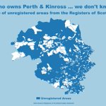
Using Registers of Scotland Inspire Registered Titles data. Inverting the data to show the areas that are unregistered ... so that are NULL.
#30DayMapChallenge


Day 27 - Heatmap
Another very traditional way of mapping. Heatmap showing earthquakes over a week earlier this month in North America.
#30DayMapChallenge

1
Day 26 - Choropleth
A very traditional map type on a very traditional map theme. Politics is one of the most mapped areas of human geography.
#30DayMapChallenge

2
Day 25 - Interactive Map
Scottish Carbon using datasets openly available through ArcGIS Online and Living Atlas.
Interactive Map Link - arcg.is/0ajOmL0
#30DayMapChallenge

1
Day 24 - Historical
I created style set based off the Ordnance Survey Maps 25 inch 1st edition, Scotland, 1855-1882, with the nearby Berwick-upon-Tweed being surveyed in 1855, using modern OS data but in a historical style.
#30DayMapChallenge

3
Day 23 - Data challenge 3: GHSL Global Human Settlement Layer
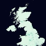
Looking at the UK Population
#30DayMapChallenge

1
Day 22 - Boundaries
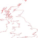
Couldn't do this challenge without a nod to archaeology in there somewhere, especially as the Channel 4 programme Time Team not only shone a light on archaeology but also GIS. Roman coastline compared to modern coastline.
#30DayMapChallenge

1
Day 21 - Elevation
Using OS 50m DEM and a nice bit of hill shading on Cairngorms National Park
#30DayMapChallenge

Day 20 - Movement
Using RNLI callout data to see where callouts have been over a year.
#30DayMapChallenge
1
Day 19 - Island(s)
Mapping the Pilgrim's Way to Lindisfarne, showing the safe route across to the island when there is safe crossing.
#30DayMapChallenge

Day 18 - Water
The Tweed is a well known salmon fishing river. Along it's banks are fishing shiels that were used by fishermen.
#30DayMapChallenge

1
5
Day 17 - Land
Using the Land Capability for Agriculture from the James Hutton Institute showing the lower end of the scale where it is improved grassland and rough grazing.
#30DayMapChallenge

1
3
Day 16 - Urban/Rural
Map using OS Zoomstack showing the urban areas of Great Britain.
#30DayMapChallenge

2
Day 15 - Map made without using a computer
So I decided to part of the Cub Scout local knowledge badge...drawing a map of your local area when I was a cub.
#30DayMapChallenge

1
Day 14 - Map with a new tool ... using the great GS software ... Excel. Saw this done by @John_M_Nelson at the Scottish Esri Conference in 2018 and went to try it with the same dataset for the last week. #30DayMapChallenge

1
7
Day 13 - Data challenge 2: Natural Earth
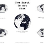
Using Natural Earth ocean bottom data and turning it into land. With the land masses as ocean.
#30DayMapChallenge

8
