

🇸🇦
Joined November 2024
- Tweets702
- Following44
- Followers1.1K
- Likes146





Eastern Arabia Archive retweeted

مجموعة من الرجال أثناء سحب جالبوت ( مركب غوص ) إلى مياه الخليج العربي في مدينة الجبيل و يظهر جزء من الجبل البحري ١٩٣٥ م


Eastern Arabia Archive retweeted
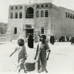
مبنى الجمارك من الداخل في ميناء العقير التاريخي في محافظة الأحساء في المملكة العربية السعودية ١٩٨٣ م


Eastern Arabia Archive retweeted

Ain Daroush in Safwa and the other water springs of Qatif Oasis tell a remarkable story of how water shaped our region’s agriculture, settlements, and community life.
Their significance extends beyond the springs themselves to the irrigation channels, gardens, and historic landmarks around them.
Preserving this heritage begins with careful documentation, supported by historical research and local memories.
Integrating it into urban planning would help future generations understand the relationship between water and life in our oases.
Thank you for shedding light on this precious part of Safwa’s history.

Eastern Arabia Archive retweeted
The Eastern Coast of Arabia has historically served as a vital waterway for trade between the East and West, acting as a main route for commercial activities and cultural exchanges among ancient civilizations. This region has been a crossroads for diverse cultures and societies throughout history, overlooking a major trade route that connects various civilizations. Traders from Eastern Arabia played significant roles in the commerce of the ancient world, serving as intermediaries. These cultural interactions represent some of the earliest human connections and highlight prominent forms of civilization. From ancient times to today, Eastern Arabian society has thrived as a sophisticated artisan community.
With the advent of Islam in the 7th century CE, Arab traders dominated trade, particularly in Eastern goods like spices. This dominance persisted until the 15th century, when Vasco da Gama’s voyage around Africa opened new trade routes for European powers, introducing competition between Arab and European sailors.
Today, Eastern Arabia is characterized by a diverse coastal culture enriched by various ethnicities and communities. Its population is not limited to a single race or nationality; it is demographically diverse, rich with numerous homogeneous cultures. Despite differing political boundaries, the people of Eastern Arabia are bonded through kinship and ethnicity, sharing a unified cultural identity and heritage.


ALT California-Arabian Standard Oil Co. Saudi Arabia expedition, 1934-1935. Three Saudi Arabian pearl merchants. Jubail (Al Jubayl), Saudi Arabia.

Eastern Arabia Archive retweeted
Flowing Springs (Al Ain)
Groundwater is located in the layers of Eocene and limestone rocks close to the earth's surface. These store water in a layer dating back to the Eocene era and appear as abundant springs due to the fracture of rocks overlaying the water-bearing Eocene layer. The oases of Al-Qatif are renowned for their numerous water springs, traditionally known as 'Ain/Ayoun' The main springs number around 170, varying in strength, with their waters distributed across several rivers.
The Safwa Oasis is famed for Ain Daroush and its historical significance, named after the visit of the Achaemenid King Darius (521-485 B.C) It is distinguished by its abundant water and numerous rivers, totaling seven: Qumayh, Sulaysil (which flows to the sea coast), Al-Awasij (also flowing to the sea coast), Al-Maslilmat, Al-Ghararif, Mudir, and a sixth river that merges with its seventh and final river, Al-Tufuf.
Daroush serves as a primary water source for most of the agricultural lands in the oasis, with its rivers reaching and nourishing these lands, alongside other main springs. It is also a key destination for all inhabitants of the oasis, fulfilling all their water needs. Adjacent to Daroush is a private bath to serve the local community's needs, alongside one of the oldest mosques in the Al-Qatif region: the Imam Hassan bin Ali Mosque (Masjid Al-Ain), first mentioned in documents around 950 AH.
Daroush is considered one of the most important water springs in the Eastern Province, being a significant tourist attraction in the past century for many European visitors.
Lady Agatha Forebord painted along the banks of one of Daroush’s rivers in the Safwa Oasis on December 11, 1957.


Eastern Arabia Archive retweeted
سنة الطبعة كارثة القطيف عام ١٩٢٥ م بصوت المؤرخ صالح الذكير youtu.be/AE0Vpa2eAu4?si=Ii1a… via @YouTube
Eastern Arabia Archive retweeted
Ahmad bin Salman Al-Sayegh, known as "Al-Kufi" because his father was born in Kufa, was born in 1907. He grew up illiterate, unable to read or write, and only learned literacy after he became a young man in his twenties while working as a pearl diver. He mastered the basics of language under the guidance of Sheikh Mirza Hussein Al-Buraiki, which led him to excel in poetry.
In the year 1925, during the catastrophic event known as "Sanat Al-Tab'a" (the Year of the Drowning), which claimed thousands of lives at sea, Al-Kufi was among those who drowned. However, he managed to cling to some floating debris from the ship and survived for two days until rescue ships arrived to retrieve the victims, saving him. Remarkably, he was the sole survivor from the entire catastrophe in the Qatif oasis region.


ALT صحيفة الايام البحرينية


Eastern Arabia Archive retweeted
Map of the Arabian Gulf from Basra to Cape Raʼs al-Hadd (1775)
"This French chart of the Arabian Gulf dating from 1775 shows the coasts of the present-day countries of Saudi Arabia and the United Arab Emirates and the coast of northern Oman, and in the northwest, coastal parts of Kuwait, Iran, and Iraq. An inset chart shows the islands of Karak and Korgo and Bundereek Bay (present-day Kharg, Kharku, and Bandar-e Rig). The map has latitude markings, rhumb lines, and soundings near coasts, particularly in the northern, well-explored part of the Gulf. The southern part of the Gulf, including Qatar is mostly featureless and undefined as the note placed there makes clear, "toute cette côte est peu fréquentée et par conséquent peu connue" (All of this coast is little visited and therefore little known). The note below the title attributes the basis for the map to René Julien Le Floch de la Carrière (born 1730), an experienced naval officer and a learned man. It was created in the form presented here by Jean-Baptiste-Nicolas-Denis d'Après de Mannevillette (1707-80), a celebrated French navigator, cartographer, and one of the first French hydrographers, who had a long and distinguished career in the Compagnie française pour le commerces des Indes orientales (French East India Company). D'Après Mannevillette studied under the famous Guillaume de L'Isle (1678-1756), the king's geographer"

ALT Après de Mannevillette, Jean-Baptiste-Nicolas-Denis d', 1707-1780 Cartographer.Delahaye, Guillaume-Nicolas, 1727-1802 Engraver.
Eastern Arabia Archive retweeted

كلنا درع للوطن #السعوديه_العظمى نحمي ترابه حتى ينقطع بنا النفس، ان كان يرضيك ياوطني فخذ حتى ترضى ...زف اهالي #بلدة #الشعبه شمال الاحساء اثنين من ابنائها ممن دونوا اسمائهم ضمن قائمة شهداء الواجب لمثواهم الاخير بعد ان ضحوا بارواحمهم في سبيل الوطن

Eastern Arabia Archive retweeted
A watchful soldier in a jeep keeps an eye on proceedings during King Saud bin Abdulaziz's visit to Dammam (1946-1954)

Eastern Arabia Archive retweeted
A family portrait of a smiling man holding a baby who wears an embroidered hat with a tassel, and a girl with plaits, from the Eastern Province (1946–1954).

Eastern Arabia Archive retweeted
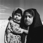
Portrait of two sisters. The older sister wears a embroidered Bukhnuq (a circular head covering with a hole cut out for the face) which is worn by girls before marriage (1946-1954)


