

Data science/tech R&D company creating innovative Location-centric Business Applications. Geospatial Big Data Analytics, Earth Observation and Cloud Computing.
Sydney, New South Wales
Joined December 2015
- Tweets545
- Following414
- Followers3.1K
- Likes2.7K

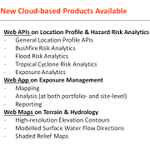




Pinned Tweet
New product release:
Mapping major #bushfires in #Australia using near real-time #Himawari8 satellite imagery, including the release of a new bushfire mapping app suited for #Emergency #Operations
Details at
bigdataearth.com/bushfire/ma…
#EarthObservation #space #remotesensing


Blog posts on #RiskAnalysis #CloudComputing
1. Review R&D in Property Location and Hazard Risk Analytics: A Transformative Journey from Desktop Computing to Cloud Computing
bigdataearth.com/australia/t…
#hazard #risk #BigDataAnalytics #AI #insurtech #Apps #APIs #geospatial #mapping


Blog posts on #RiskAnalysis #CloudComputing
2. Developing Web Mapping, Analysis & Reporting Apps for #Exposure Analysis in #Emergency #Insurance Applications
bigdataearth.com/risk/releas…
#hazard #risk #riskmanagement #BigDataAnalytics #AI #insurtech #Apps #APIs #geospatial #mapping


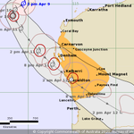
Double tropical cyclones #Seroja #Odette off the coast of #WesternAustralia - Satellite views from #JMA #Himawari8 today Friday 9 April 2021
⚠️@BOM_AU warnings: bom.gov.au/cyclone/
⚠️#JTWC warnings: metoc.navy.mil/jtwc/jtwc.htm…
#CycloneSeroja #CycloneOdette


@BOM_WA: #CycloneSeroja expected to make landfall near #Geraldton #WesternAustralia tonight ~10 pm bom.gov.au/cyclone/
- Satellite view today 11 April 2021 #Himawari8
- Animation SWIR composite imagery available at
files.bigdataearth.com/Major…
#Seroja @dfes_wa @ABCemergency
#CycloneSeroja to make landfall near #Geraldton #WA tonight:
- @BOM_WA & #JTWC are having accurate forecast of landfall location
- Last major cyclone with similar intensity for the region is #CycloneHazel in 03/1979
nitter.gq/BigDataEarth/status/13…
#Seroja @dfes_wa @ABCemergency

@BOM_WA forecast: #CycloneSeroja could be making landfall near #Geraldton #WesternAustralia
Location Profile Report showing historical cyclones & winds: Cyclones at this wind scale rarely travel south; last major event for the region was in 1979.
#Seroja
nitter.gq/BOM_WA/status/13804170…


#NSWFloods
Before/after imagery showing the latest inundation in the Mid North Coast #NSW
- #Taree
- #PortMacquarie
- Latest imagery this morning: 06:07:20 AEDT, 2021-03-20
- Previous imagery: 06:06:55 AEDT, 2021-03-08
- Image source: sentinel-1 @CopernicusEU @sentinel_hub


Imagery showing the 6-day weather systems that had caused heavy rain & widespread #flooding in eastern #Australia
- Natural-colour imagery #Himawari8 between 19-24 March 2021
files.bigdataearth.com/Major…
#NSWFloods #QLDFloods #vicfloods
@BOM_au @BOM_NSW @WeathermanABC @weatherzone
Imagery showing the 6-day weather systems that had caused heavy rain & widespread #flooding in eastern #Australia
- SWIR imagery #Himawari8 between 19-24 March 2021
files.bigdataearth.com/Major…
#NSWFloods #NSWWeather #QLDFloods #vicfloods
@BOM_au @BOM_NSW @WeathermanABC @weatherzone
#NSWFloods
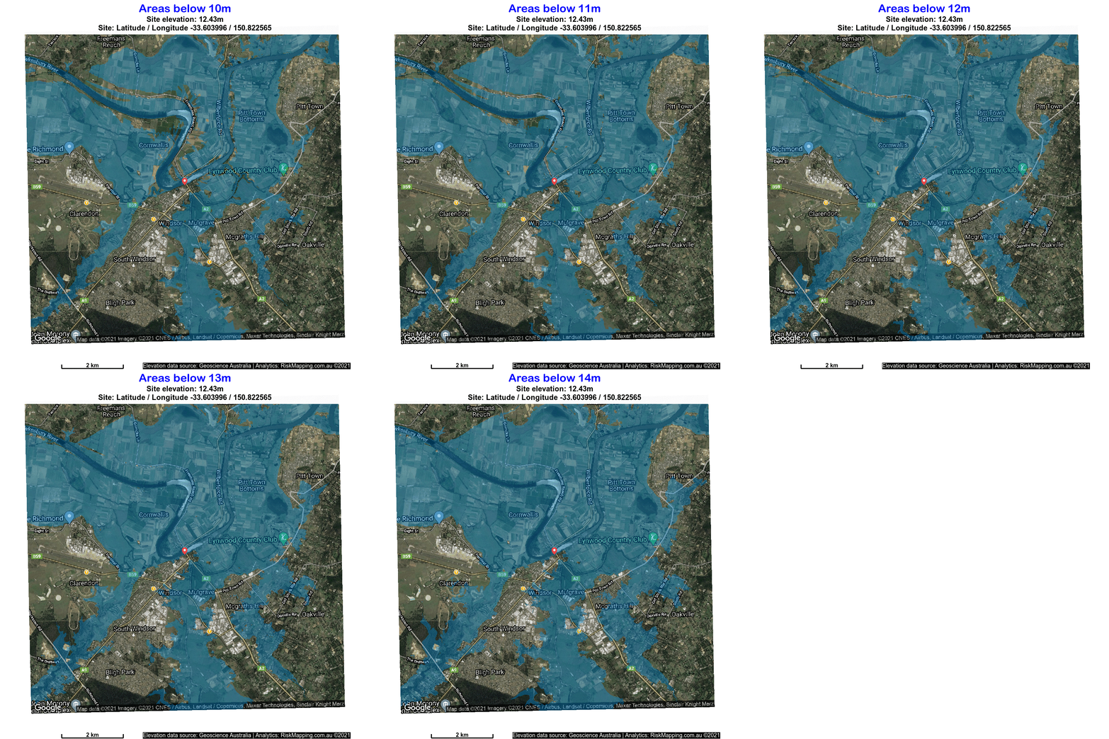
@BOM_au Major Flood Warning for the #Hawkesbury River bom.gov.au/nsw/warnings/floo…
Water Level at #Windsor PWD - 12.43m - Rising - 10:00 AM MON 22/03/21
Low-lying areas:
GIF: files.bigdataearth.com/Major…
PDF:
files.bigdataearth.com/Major…
@NSWSES @ABCemergency #SydneyFloods
#NSWFloods
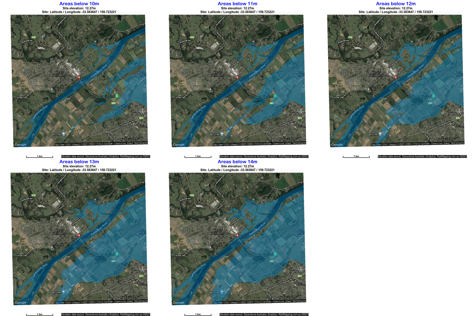
@BOM_au Major Flood Warning for the #Hawkesbury River
bom.gov.au/nsw/warnings/floo…
Water Level at #NorthRichmond WPS - 13.16m - Falling - 10:43 AM MON 22/03/21
Low-lying areas:
GIF:
files.bigdataearth.com/Major…
PDF:
files.bigdataearth.com/Major…
@NSWSES @ABCemergency #SydneyFloods
#NSWFloods
Low-lying flood-prone areas in #Windsor #NorthRichmond along the #Hawkesbury River, NW #Sydney
- Terrain & Hydrology Tiled Web Maps:
bigdataearth.com/products-an…
- DEM source: Geoscience Australia
@NSWSES @ABCemergency #SydneyFloods


