

Industry leader's in drone LiDAR. Experienced with photogrammetry, UAV forensics, solar maintenance, aerial inspection.
United Kingdom
Joined March 2017
- Tweets236
- Following131
- Followers97
- Likes63




FlyThru Ltd retweeted

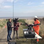
Another successful remote access survey carried out by @Geoterra_Mark & @Flythrudata for @atkinsglobal and @EnvAgencyGeomat of Dunball Sluice Gate, Bridgwater. #laserscaning#UAV#photogrammetry#confinedspace#safety @kierconstruct


Catching up with the past again.... lovely action shot from back in July. LiDAR survey of. Bridge and river embankments. #flythru #lidar #survey #uav #uas #routescene #m600 instagram.com/p/CF1YSoqnvHV/…
2
FlyThru Ltd retweeted

@pix4d Updated capture app & full of bugs, frozen images & maps and only one speed no matter what setting used.
Support said they don’t care or offer support as it’s not a paid app 🤔 Makes them look incompetent. Spent £££’s on them in the past too. Not anymore.
FlyThru Ltd retweeted
When the tough gets going the tough get going...! Survey control in Snailbeach old lead mine, Shropshire, laser scanning next. @Geoterra_Mark @LeicaGeo_UKI #mining #survey #Geoterra #FormbySurveys

It’s been a busy few months! Finally time to catch up with some posts. Here is a pic captured after a large mapping project, nearly 3,000 Ha at 1.5cm gsd 🙂 #mapping #photogrammetry #Dartmoor #uav #flythru instagram.com/p/CFvyR5QHHvB/…
1

Such a powerful tool, drone technology has moved so fast in the last few years! #dji #m300 #flythru #drone #inspection instagram.com/p/CCwRNsmnmJ-/…
2
FlyThru Ltd retweeted

The landslide area to be surveyed at Ystalyfera in South Wales was covered with dense vegetation. Unlike #photogrammetry which captures an image of the top of the vegetation, #UAV #LiDAR can penetrates through the vegetation to reach the ground below. routescene.com/case-studies/…

Interesting project today, lidar cliff survey for erosion monitoring along with shoreline survey for a pipe installation. instagram.com/p/CBvwgolHWHt/…

1
Really enjoy working with this plane. #flythru #mapping #ppk #rtk #photogrammetry #uav #drone instagram.com/p/CA57X7_n9vC/…
1
FlyThru Ltd retweeted
#LiDAR drone surveys are becoming increasingly important in preparing data for #GIS analysis. Each layer, trees, low vegetation, powerlines and pylons removed to leave a bare earth point cloud. routescene.com/applications/… #uav #3dmodelling #survey #surveying
FlyThru Ltd retweeted
Great article from #Lidar magazine @lidarmag from the Routescene #UAV Lidar project at Sand Canyon, Colorado. Locating 700 year old dwellings within a heavily wooded area. lidarmag.com/2020/02/05/mapp…
#geoweek #mapping #uavs #surveying #topography #dronesforgood #archaeology

FlyThru Ltd retweeted

Check out this interview w/@Flythrudata, a #drone #survey solutions provider who invested in a @routescene lidar system that uses #VelodyneLidar #sensors – it's had a huge positive impact on their business. Watch for more info! youtu.be/5z_d6rqes2g #lidar #mapping #surveying
FlyThru Ltd retweeted
Big thank you to London Southend Airport for facilitating our flights this morning. instagram.com/p/CANVsu3HdZz/…
Big thank you to London Southend Airport for facilitating our flights this morning. instagram.com/p/CANVsu3HdZz/…