

We are an organization excelling in the generation of diverse data types and the development of geospatial applications.
Ayacucho, Peru
Joined December 2023
- Tweets14
- Following29
- Followers59
- Likes13



At GeoCompas, we specialize in generating high-quality geospatial data and building ML training datasets. In partnership with @EarthGenome, we’ve launched the SAMGEO-API, built on top of Professor @giswqs SAMGEO framework. linkedin.com/posts/geocompas…
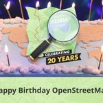
Happy 20th birthday, @OpenStreetMap! 🎉
We are happy to be part of this incredible global community that has made OSM an invaluable cartographic resource for the world. 🗺️
Here's to many more years of collaborative mapping and open cartography! ✨
#OSM20 #OpenStreetMap

Excited to share our work on the "Detecting Urban Blight" project in Dallas! 🚀 Proud to be part of an effort to improve community well-being. 🌟
Check out our blog for details 👇:
geocompas.ai/project/2024-07…
#TrainingData #DataAnnotation #MachineLearning #AI #GeospatialTechnology

Using @openstreetmap and WorldPop population datasets, we developed the Urban Public Services Inaccessibility application. This app offers a comprehensive analysis of population distribution and public service coverage across six Asia-Pacific countries.
linkedin.com/posts/geocompas…
GeoCompas AI retweeted

How the Urban Blight Tracker we built uses machine learning to help Dallas tackle urban blight and reduce crime. Learn more in our latest post by @LaneGoodman.
🌆✨ds.io/urban-blight
#AI #GeospatialTech #CommunityDevelopment #PublicSafety #MachineLearning
@GeoCompasAI

We're excited to announce our support for integrating OSM-Seed into Palestine Open Maps, significantly enhancing the platform's capability to deliver the most comprehensive geospatial data over the last century of Palestine.
🔝 See more details here: geocompas.ai/project/2024-03…

GeoCompas AI retweeted

weeklyOSM issue 711 is now available in *English* the news from the #openstreetmap #osm world weeklyosm.eu/archives/17097

GeoCompas AI retweeted
weeklyOSM issue 710 is now available in *English* the news from the #openstreetmap #osm world weeklyosm.eu/archives/17070

Climate change and the El Niño phenomenon are impacting various communities in the Amazon region.
🗺️Let's collaborate by mapping structures in these areas to support programs aimed at reducing and mitigating disaster risks.
#MapeosAmazónicos for a resilient and inclusive Amazon🌎

🌿🌎 En colaboración con las autoridades de gestión de riesgos en Ecuador, Colombia y Brasil, identificamos áreas vulnerables afectadas por el fenómeno del Niño.
Únete a los #MapeosAmazónicos en Tasking Manager. Contribuye mapeando por una Amazonía resiliente e inclusiva.
Would you like to learn about mobile signal coverage in educational institutions in Peru? @yunica__ has created an interactive 3D visualization tool ➡️developmentseed.org/peru-mob… using OSM data & @OSIPTEL OpenData, showing the coverage & mobile signal strength across Peru's regions.

GeoCompas AI retweeted
El semanario Nº 707 de OSM en *ESPAÑOL* está online, noticias del mundo #openstreetmap #osm - weeklyosm.eu/es/archives/170…

Since SAM's release, our team has been integrating it into DS-Annotate 👉 devseed.com/ds-annotate/ as a simple annotation tool for accurate, automated annotation. 🗺️🌎
See here openstreetmap.us/events/mapp… @Rub21m's virtual presentation at the last #MappingUSA conference. #GeoAI
GeoCompas AI retweeted
We are really proud of our work with the DevSeed Data Team over the past five years. We are excited for them to take this next step in becoming their own entity providing best-in-class data annotation, mapping, and ML/AI tooling services.
1/

After years of tireless work, piled up knowledge, and collaborations with leading geospatial companies like @Mapbox & @developmentseed, we learned, grew, and dreamed big, and today, we're thrilled to officially launch GeoCompas AI, based in Ayacucho 🇵🇪🚀🎉developmentseed.org/blog/202…
