

The premier GIS and IT solutions company in the Philippines
Philippines
Joined June 2011
- Tweets7.3K
- Following258
- Followers376
- Likes15
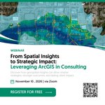




Turn spatial insights into strategic impact. 📍 Discover how ArcGIS helps consultants deliver smarter strategies and stronger client outcomes. Register: geodatasystems.info/4ifktxX | [email protected] #ArcGIS #Consulting #GIS

Turn your GIS investment into greater value. Join Session 4 of the Infrastructure Webinar Series and discover smarter licensing with Esri's Enterprise Agreement. 📅 Nov 25, 2026 | Via Zoom geodatasystems.info/4skK51a #GIS #LocationIntelligence #InfrastructureWebinarSeries

Meet our Speakers
Hear from experts in national security and geospatial technology as they share how GIS supports informed decision-making and situational awareness.
📅 Oct 14, 2026
📩 [email protected]
#NGUC2026 #GeospatialIntelligence #LocationIntelligence


Meet our Speakers
Hear from experts in public safety, resilience, and geospatial technology at the Law Enforcement & Public Safety Session.
📅 Oct 15, 2026
📩 [email protected]
#NGUC2026 #PublicSafety #LocationIntelligence


Meet our Resource Speakers
Hear insights on innovation, resilience, and location intelligence at the National Government Session.
📅 Oct 13, 2026
📩 [email protected]
#NGUC2026 #GISforGovernment #LocationIntelligence


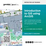
Take your first step into GIS. Learn mapping, spatial analysis, and GIS workflows with Introduction to GIS using ArcGIS. Scan the QR or visit geodatasystems.info/4yp5dFB to inquire #ArcGIS #GISTraining

Meet the speakers. Hear from GIS experts sharing how location intelligence is transforming government, defense, and public safety. Oct 13-15 | AC Hotel Manila 📩 [email protected] #NGUC2026 #GISforGovernment #LocationIntelligence


Turn geographic data into compelling maps and visualizations with ArcGIS. Learn cartographic design and mapping workflows. Scan the QR or visit geodatasystems.info/3V2mIwD to inquire! #ArcGIS #GISTraining

🛰️ A digital twin is only as reliable as the data behind it.
📖 Read: geodatasystems.info/4rhG7G7
🌐 Explore Digital Twins: geodatasystems.info/4AhtoqR
✅ Register: geodatasystems.info/4xMu7Ox
📩 [email protected]
#DigitalTwin #RealityMapping #GIS
Turn your Digital Twin vision into a clear plan of action.
🎙️ Learn from Karen Landicho as she shares practical strategies for planning and starting your Digital Twin journey.
Register: geodatasystems.info/4x8IJY9
#DigitalTwin #SmartInfrastructure #InfrastructureWebinarSeries

🚨 Could digital twins help prevent crowd congestion before an event begins?
📖 Read: geodatasystems.info/4zS80s1
🌐 Learn more: geodatasystems.info/4xEarx0
✅ Register for the Webinar: geodatasystems.info/3US8ZIF
📩 [email protected]
#DigitalTwin #ArcGIS
Discover how GIS is helping build a smarter, safer, and more resilient nation. Join exclusive sessions for Government, Defense & Intelligence, and Public Safety this Oct 13-15. Email [email protected] to know more.


In observance of National Heroes Day, our office will be closed on Aug. 31 and resume operations on Sept. 1. Customer support will be unavailable during this period. We’ll respond to inquiries upon our return. Thank you.

Take your first step into the world of GIS. Learn GIS concepts, mapping, and spatial analysis with Introduction to GIS using ArcGIS. Inquire now: geodatasystems.info/4hF2xyb #ArcGIS #GISTraining

Digital twins start with a roadmap. See how Zurich built one in 7 days with ArcGIS. Article: geodatasystems.info/3Sfqr9c Webinar: geodatasystems.info/4x400SZ
#WhatsNewWednesdays #GIS #DigitalTwin
Uncover hidden patterns and relationships in your data with Spatial Analysis Essentials for ArcGIS. Learn location-based analysis that supports better decisions. Enroll: geodatasystems.info/45c9uzm #ArcGIS #GISTraining

Turn your Digital Twin vision into action. Learn how to build a roadmap, align priorities, and lay the foundation for successful implementation.
📅 Sept 23, 2026 🔗geodatasystems.info/3Rx9eb1
#DigitalTwin #SmartInfrastructure #InfrastructureWebinarSeries

AI is only as good as the imagery behind it. 🛰️ Spatial resolution matters in GeoAI.
📖 geodatasystems.info/4wenkMB
🌐 geodatasystems.info/4q2iFvU
🎥 Join our Aug 12 webinar to know more about #GeoAI : geodatasystems.info/44CjSQr
#ArcGISUpdates #WhatsNewWednesday
Turn complex information into clear, interactive dashboards with ArcGIS Dashboards. Learn to visualize data and support informed decisions. Inquire now: geodatasystems.info/4xaOrJl #ArcGIS #GISTraining

Transform Earth observation with Remote Sensing Foundation Models in ArcGIS. 🌍 Generate embeddings, fine-tune AI models & accelerate geospatial analysis.
📖 geodatasystems.info/4vUc6fW
🌐 geodatasystems.info/4fBneK5
#GeoAI #ArcGISUpdates #WhatsNewWednesday