

Remote Sensing for GeoHazards (RS4GeoHZ) group at GFZ Potsdam, Germany, focuses on understanding the geo-hazards in light of the current Climate Crisis.
Potsdam, Germany
Joined December 2022
- Tweets146
- Following17
- Followers377
- Likes151





RS4GeoHZ retweeted

📍New paper out!
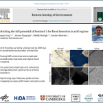
We explore how to detect floods in arid regions better using #Sentinel -1 SAR data. These areas are often ignored in global flood mapping, but our work highlights a new approach that improves detection by up to 50%!
A thread 🧵 (1/n)
sciencedirect.com/science/ar…

RS4GeoHZ retweeted
🔔New paper alert!
A cluster-based approach for mitigating #tropospheric phase delay in large-scale #Sentinel1 stacks for mapping land #subsidence
link.springer.com/article/10…

RS4GeoHZ retweeted

New study on #joshimath using #SAR #remotesensing by @GfzRemote research group
link.springer.com/article/10…
Congratulations to Wandi Wang, Prof. @MahdiMotagh and others

RS4GeoHZ retweeted

On 22 July 2024 a pair of landslides in the same location at Kencho Shacha Gozdi in Gofa Zone, Ethiopia is believed to have killed at least 55 people. The trigger is thought to have been heavy rainfall.
eos.org/thelandslideblog/gof…
Image from the Ethiopian Broadcasting Corporation.

ALT The 22 July 2024 landslide in Ethiopia. Image posted to Facebook by the Ethiopian Broadcasting Corporation:- https://www.facebook.com/share/p/whZZtHTU92kTYrqt/
RS4GeoHZ retweeted
An 800,000 cubic metre landslide on the banks of the Three Gorges Reservoir in China yesterday was captured in an interesting video that has been widely posted on social media:-
eos.org/thelandslideblog/the…

RS4GeoHZ retweeted

Dr. Mahmud Haghshenas Haghighi, Leibniz Universität Hannover, presents his lecture titled "SAR / InSAR for Geohazards" in UYGU Summer School 2024 in Istanbul Technical University. @Mahmudhh @GfzRemote @MahdiMotagh @UniHannover @gtaskink @itu1773

RS4GeoHZ retweeted

Overexploitation of #groundwater may cause #landsubsidence due to compaction of aquitards and aquifer materials.
This can result in serious settlement of building foundations, infrastructure damage and increased flood risk in coastal cities.
More: unesco.org/reports/wwdr/2022…

The recent work by @Mahmudhh & @MahdiMotagh at @ScienceAdvances estimates
~ a daily #groundwater #reservoir depletion of 5 Million Cubic Meter (MCM) across Iran. This prompted @IranNewspaper, the official daily newspaper of the government, to quickly report about this crisis.


RS4GeoHZ retweeted

چه کسی فکر میکرد نرخ تاراج آب از آبخوان در استان گلستان بیشتر از استانهایی چون فارس، اصفهان و تهران است؟
در استان گلستان دقیقا چه خبر است که با چنین شتابی آینده را به حراج نهادهاند؟
در لینک زیر اطلاعات بیشتری ارایه شده است:
t.me/darvishnameh/12092 – at Islamic Republic of Iran

RS4GeoHZ retweeted
A @Planet satellite image shows that the 29 April 2024 Mai Mahiu disaster in Kenya was caused by a channelised debris flow, which was formed from an extraordinary concentration of shallow landslides in the Kijabe Hills. About 130 people were killed:- eos.org/thelandslideblog/mai…

RS4GeoHZ retweeted

فاجعهای به وسعت یک سرزمین
ایران در چالههای خودساخته بیتدبیری فرو میرود!
مقالهای جدید از پژوهشگران ایرانی (science.org/doi/10.1126/scia…) با تخمین میزان #فرونشست_زمین در مناطق مختلف کشور، از یکی دیگر از اثرات خوفناک و برگشتناپذیر #ورشکستگی_آبی ایران پرده برمیدارد.

RS4GeoHZ retweeted

A detailed satellite survey of land subsidence in Iran from 2014 to 2020 shows that 3.5% of the country’s land area is subsiding due to groundwater pumping for irrigation. scim.ag/6W6

RS4GeoHZ retweeted

Groundwater loss in Iran is taking on dramatic proportions. In some regions, the ground is sinking almost 40 centimeters per year & huge fissures are opening up. Click here for the news about the latest study of GFZ researcher @MahdiMotagh & his colleague gfz-potsdam.de/en/press/news…


RS4GeoHZ retweeted

A great presentation by professor @MahdiMotagh on mining induced subsidence.
#egu2024


RS4GeoHZ retweeted
Excited to present some results on using #SAR #satellites for #flooddetection in arid regions this #EGU! Join me for the talk on Thursday (16:30 - 16:40) in room 2.15 :)

RS4GeoHZ retweeted

🙌 Congratulations Dr. Magdalena Vassileva!! 👩🏻🎓🥇🔝
👉 Magdalena successfully attended the final examination of her #PhD at the Leibniz Universität Hannover 🇩🇪!! I was part of the evaluation committee, she had really a brilliant presentation and 🔝 thesis! 👌
#phdlife #thesis – at Hanover, Germany


RS4GeoHZ retweeted
🙌 this morning, my lecture at Leibniz Universität Hannover @UniHannover 🎓🇩🇪
🧐 very interesting discussion on "Advanced #remotesensing monitoring 🛰🔎🌏 for sustainable management of steep-slope #agriculture 🍇🚜🏔 under #climatechange ⛈🌪☀️🔥 scenarios"


RS4GeoHZ retweeted
A recent paper in the journal Engineering Geology (Vassileva et al. 2023) describes how heavy rainfall triggered >40 m of movement in a landslide that had been reactivated by a dam:
eos.org/thelandslideblog/hos…


RS4GeoHZ retweeted

📸7⃣ @GfzRemote relató la visita de dos de sus integrantes a nuestra #CampusVivo con el fin de buscar una alianza estratégica para la creación de un sistema de alerta temprana de desastres naturales.

RS4GeoHZ retweeted

Excited to share our work on InSAR phase-based tropospheric correction using texture info. We found texture is relatively insensitive to topo-correlated deformation, thus, providing superior performance w/o compromising defo signals! @QingyueYan31126
ieeexplore.ieee.org/document…

ALT Deformation rate and time series before and after tropospheric corrections using various methods on the ALOS-2 data over Kirishima volcanoes in Japan.