

🌍 Mapping solutions to provide clean water & food 🌍 Empowering communities through data 🌍 Local focus, global impact
Joined January 2011
- Tweets832
- Following170
- Followers218
- Likes125





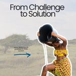

Your support helps fund:
• Field data collection
• Mapping tools
• Local partnerships on the ground
Every action counts — whether you donate, partner with us, or simply share this.
👉🏻 Get involved via the link in bio
Image credit: © Designed by Magnific & Unsplash
You’ve seen the challenge.
You’ve seen the impact.
Now you can be part of the solution. 🌍
At MapAid, we turn data into decisions — helping communities access safer water, stronger livelihoods, and more resilient futures.


Here's how we replicate impact across regions, countries, and contexts — and what that means for the communities still waiting for their place on the map.
Save this to share with funders or NGO partners.🌍
Image credit: © Designed by Magnific (magnific.com)


Because when people have better information, they can build stronger, more resilient futures.
👉🏻 Watch. Share. Be part of the next chapter.
Image & video credit: © Designed by Magnific (magnific.com) and Canva (Canva.com)
Impact isn’t a number on a report. 💚
It’s a farmer deciding where to dig.
A family finding safer water.
A community planning with confidence.
At MapAid, we use mapping, data and AI to turn uncertainty into clearer decisions — on the ground, where it matters most.
This carousel puts faces and stories to the numbers — because that's what MapAid's impact actually looks like.
Swipe to meet the people behind our impact ➡️
Image credit: © Designed by Magnific (magnific.com) & Unsplash (unsplash.com)


🤝🏻 Follow us for more on how data is changing lives.
Image & video credit: © Designed by Magnific (magnific.com) and Canva (Canva.com)
Data closing the development gap.
The challenges are real. But so are the solutions.
🌍 Watch how MapAid is using geospatial data to close the development gap in some of the world's most underserved regions — and why this work has never mattered more.
The solution isn't simple. But it starts with a map.
👉🏻 Share this with someone working in development, agriculture, or humanitarian aid
👉🏻 Save this to revisit how data drives real-world solutions
Image credit: © Designed by Magnific (magnific.com)


Every challenge we showed you this month has a data-driven answer. 🛠️
🗺️ Here's how MapAid's tools and methodology directly respond to the region's toughest problems — from WellMapr for water access mapping, to land tenure documentation, to climate vulnerability modelling.


We joined 16K+ tech leaders at #DataBricksSummit in San Francisco!
Big thanks to our new partners—we’re just getting started. 🤝
#AIForGood #MapAid #ClimateAction #TechTrends #WaterAccess


In one of the latest episodes of the Henley Personal Development Podcast by Henley Business School, our CEO, Rupert Douglas-Bate, shared the remarkable story behind the birth of WellMapr™ while speaking with Chris Dalton.
Listen here and leave a comment:
open.spotify.com/episode/6LF…

