

Fascinated by extreme weather and the extreme events that come with it. (Any fantasy hour maps posted are for entertainment & learning purposes, not forecasts.)
Westerly, Rhode Island
Joined June 2021
- Tweets3.5K
- Following534
- Followers9.1K
- Likes5.3K





Matthew Gross retweeted

The MLB playoffs have been boring. @MattGross87 has a radical solution: turn October into a pennant race.

Matthew Gross retweeted

Hurricanes and outages - from our research @PowerOutage_us showing the power outage footprints for US landfalling hurricanes producing 1 million outages. Isaias 2026 added for comparison. Each storm is unique. Large area impacted over the last decade.
Matthew Gross retweeted

We ran a power outage simulation for the Great New England Hurricane of 1938. The hurricane made landfall as a category 3 storm in Long Island, NY with a forward speed over 40 mph. Outages would happen fast and we estimated around 9 million customers out at peak with today's power grid. #hurricane #poweroutage #newengland #extremeweather
Matthew Gross retweeted
Here's a simulation showing our work @PowerOutage_us showing the track and power outage impacts of the Great New England Hurricane of 1938. We estimate outage impacts reaching 9 million customers out at peak with rapid onset given category 3 storm strength and fast movement.
Matthew Gross retweeted
Here's what our simulation shows for 100 miles west - about a million higher.

Matthew Gross retweeted
Call me Dr. Doomsday - we're doing some research on historic storm events with outage prediction @PowerOutage_us . If a storm like Great New England 1938 storm hit we estimate almost 9 million customer outages. This would be a bad day. NOT A FORECAST. #hurricane #newengland

Matthew Gross retweeted

By far the most extensive damage I have come across from Hurricane #Isaias is in Milton, Florida. An entire roof of an apartment complex with residents inside was torn off and thrown with multiple other nearby buildings missing roofs and severe damage while the High School Gymnasium roof was also damaged extensively and downed trees liter the city. Crazy to think the last time I was in this town, it was snowing! #FLwx


Matthew Gross retweeted

FLASH FLOOD EMERGENCY for Fort Walton Beach and Destin, Florida!
4-7 inches of rain have already fallen as Hurricane Isaias continues towards landfall, and another 3-5 inches are expected in the next HOUR alone. Flooding is already occurring! Do NOT attempt to travel unless fleeing flooding!

Matthew Gross retweeted

We did at the *very last* minute get rapid core collapse in Hurricane #Isaias as extreme wind shear finally began ventilating the eye. Central pressure rose 13mb in 2 hours between the last two aircraft measurements, and the eyewall structure on radar fully opened up.
However, highly dangerous conditions are ongoing on the ground as Isaias nears imminent landfall in the vicinity of Destin, #Florida. Hope everyone stays safe tonight.


Matthew Gross retweeted

Absolute chaotic day in the weather world today:
- violent tornado in Italy
- major hurricane in the Gulf approaching FL (with tornado outbreak expected in outer bands)
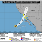
- tropical storm approaching southern CA
- major earthquake in Panama with tsunami threat
Absolutely wild stuff going on with Isaias this afternoon, both in the core, and in the increasingly tornadic bands to the east. Conditions will rapidly deteriorate throughout the Florida panhandle over the next few hours.
Matthew Gross retweeted

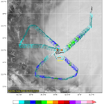
Both AF301 and NOAA3 are finding Extrap Min Pressure nearing 950 mb (when is typically around 5 mb too lower than the Dropsode) which show that #Isaias is still strengthening.


There's a common misconception that often occurs when strong hurricanes begin to interact with mid latitude vorticity. Yes, the vorticity will shear, and ultimately weaken the storm; but there's an ugly price to pay during the early stages of that process that can turn the whole equation upside-down.
Many times, including today with Isaias, shear starts to disrupt the system without truly damaging the core. The result is a tropically powered core with bursts of new convection surrounded by dynamically enhanced features producing their own chaos. In other words, the system actually gets more dangerous during the first handful of hours during this process, not less.
The key then becomes: "Where does the landfall occur in relation to this timing?" If it's delayed enough, nobody on land ever feels these consequences. But if landfall occurs during the height of this transformation, people end up stunned by the ferocity of the storm. The most famous and extreme example of this (nothing like this will happen today) is the 1938 hurricane, which produced its highest recoded wind gust of 186mph not on Long Island, where the storm made landfall, but way over near Boston at the Blue Hill Observatory in eastern Massachusetts. That's the power of mixing a major hurricane with mid latitude vorticity! And it remains one of the most awesome and misunderstood phenomenons in weather.
Right now, Isaias is getting his own shot of adrenaline from a decent dose of vorticity. So the question is: "How long does that last before the core collapses?" It's a race between this and the moment of landfall, and by the look of things, it's going to be a photo finish!

Dynamics may be taking over here as Isaias merges with the vorticity shearing it. Winds have increased dramatically on the eastern side of the structure despite the appearance on satellite looking more ragged. Fort Walton Beach and Destin are going to get raked in a few hours!


Matthew Gross retweeted

Wow, recon just found winds near Category 4 strength... 126kt flight level winds at 750 mb, which supports surface winds of about 110kt after conversion. The threshhold for category 4 is 115kt. Very interested to see what they continue to find here.


Don't let Hurricane Isaias distract you from the fact that southern California is now under a Tropical Storm Watch.

Matthew Gross retweeted

The Gulf of Rapid Intensification has won again.
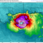
Isaias is a mid-tier Category 3 and its satellite presentation continues to improve.
Landfall likely stronger than once thought — high-end Category 2 probable.


