

Joint Cyclone Center predicted tropical cyclone track forecasting based on a tropical weather outlook for hurricanes, cyclones, typhoons & windstorms.
Global
Joined January 2015
- Tweets20.2K
- Following4.5K
- Followers12.3K
- Likes5.7K


Pinned Tweet
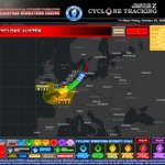
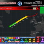
STORM BOELO — ADVISORY 9
Winds: 105 mph
CWSIS: Category 2 (C2)
MSLP: 947mb
Next Update: 2:00 PM
CURRENT SITUATION
Cyclone Boelo continues to track across the North Atlantic, with maximum wind gusts of 105 mph and a minimum central pressure of approximately 947 mb. The storm remains at Category 2 cyclone on the Cyclonic Windstorm Intensity Scale (CWSIS), bringing the potential for severe and disruptive wind conditions across affected regions.
OVERVIEW
Boelo continues to pose a significant windstorm threat as it tracks toward northwestern Europe. Residents in areas covered by wind warnings should remain alert, monitor official weather updates, and prepare for possible disruption.
FORECAST TRACK
The forecast track indicates continued movement toward northwestern Europe. The storm's path and intensity may change as the system develops. Monitor subsequent advisories for updated track projections and potential impacts.
WIND WARNINGS
🟡 YELLOW WIND WARNING
Unsettled and potentially disruptive conditions are possible. Stay informed, secure loose outdoor objects, and exercise caution when travelling.
🟠 AMBER WIND WARNING
Stronger winds may cause significant disruption, including difficult travel conditions, falling branches, and localized damage. Prepare in advance and follow official safety advice.
🔴 SEVERE WIND WARNING
Dangerous wind conditions may affect exposed and vulnerable areas. Avoid unnecessary travel during severe conditions, stay away from damaged trees and structures, and follow instructions from local authorities.
INTENSITY OUTLOOK
Boelo remains a powerful Category 2 windstorm, with sustained winds of 105 mph and a central pressure of approximately 947 mb. Further changes in intensity remain possible. Future advisories will provide updated information on the storm's strength and projected path.
Boelo remains a powerful windstorm, and further changes in intensity and track are possible. Continue monitoring forecast updates for the latest information.
NEXT ADVISORY: 2:00 PM
Stay informed. Stay prepared. Stay safe.
Follow Cyclone Tracking for further updates as Storm Boelo develops.
#StormBoelo #Advisory9 #CycloneTracking #EuropeanWindstorm #WeatherUpdate #Windstorm #SevereWeather #WindWarnings #Windstorm #Boelo

STORM BOELO — ADVISORY 8
Winds: 105 mph
CWSIS: Category 2 (C2)
MSLP: 958mb
Next Update: 12:00 PM
Boelo has reportedly strengthened to a Category 2 cyclone, according to the supplied tracking graphic. The latest reported figures indicate maximum wind gusts of 105 mph and a minimum central sea-level pressure (MSLP) of 958 mb.
CURRENT SITUATION
Storm Boelo is reported as a Category 2 cyclone, with maximum wind gusts of 105 mph and a central pressure of 958 mb, according to the supplied tracking graphic.
OVERVIEW
Advisory 8 provides an updated snapshot of the storm's reported intensity, projected movement, and potential wind-warning areas across parts of Europe. Conditions and impacts remain subject to forecast uncertainty.
FORECAST TRACK
The supplied graphic depicts a projected track toward the northern part of Europe, with the storm's circulation and associated warning areas extending across parts of western Europe. The actual path, timing, and affected locations remain uncertain and require confirmation from official forecasts.
WIND WARNINGS
The graphic displays Yellow and Amber Wind Warnings, as well as a Severe Wind warning area. These are classifications shown on the supplied graphic and should not be interpreted as verified official warnings. Follow guidance from the relevant national meteorological services.
INTENSITY OUTLOOK
The storm is listed as Category 2 (C2), with reported maximum wind gusts of 105 mph and a minimum central pressure of 958 mb. Any future strengthening or weakening remains uncertain without independently verified forecast data.
NEXT ADVISORY: 12:00 PM
Continue monitoring official meteorological updates for confirmed storm information, forecast changes, and local weather warnings.
⚠️ IMPORTANT DISCLAIMER: This bulletin is based on the supplied tracking graphic and reported figures. Storm Boelo's status, intensity, forecast track, and warning areas have not been independently verified. The information should not be treated as an official meteorological warning.
Stay informed. Stay prepared. Stay safe.
#StormBoelo #Advisory8 #CycloneTracking #EuropeanWindstorm #WeatherUpdate #Windstorm #SevereWeather

STORM BOELO — ADVISORY 7
Maximum Winds: 75 mph
CWSIS: Category 1 (C1)
MSLP: 981 mb
Next Advisory: 8:00 AM
CURRENT SITUATION
Storm Boelo continues to strengthen over the central to northeastern Atlantic. Since Advisory 6, reported maximum winds have increased by 5 mph, from 70 to 75 mph, while minimum central pressure has fallen by 6 mb, from 987 to 981 mb.
These changes are consistent with an intensifying system in the supplied tracking data. Boelo remains classified as Category 1 on the Cyclonic Windstorm Intensity Scale (CWSIS).
The latest tracking graphic depicts the storm progressing eastward to northeastward, with its forecast corridor extending towards the British Isles and parts of western Europe. Disruptive winds remain a potential concern within the projected impact area.
FORECAST TRACK
Boelo is expected to continue moving generally eastward to northeastward across the northeastern Atlantic, according to the supplied graphic.
Overnight into Saturday: The system continues along its projected track, with potentially disruptive winds in exposed areas.
Saturday: Ireland and the United Kingdom remain within the broader forecast area of concern.
Beyond Saturday: The forecast envelope extends across parts of western Europe, although the precise track, timing and extent of impacts remain uncertain.
WIND WARNING OUTLOOK
🟡 Yellow Wind Warning — Be Aware
Potentially disruptive winds may affect exposed locations and could cause local travel difficulties.
🟠 Amber Wind Warning — Be Prepared
Stronger winds could result in significant travel disruption, fallen branches and local power interruptions.
🔴 Severe Wind Warning — Take Precautions
The highest-risk zone shown on the graphic could experience damaging gusts and more significant disruption, particularly in exposed areas.
The warning zones are based on the supplied tracking graphic and should not be interpreted as official meteorological alerts.
INTENSITY OUTLOOK
The increase in reported wind speeds and the decrease in central pressure indicate that Boelo has strengthened between Advisories 6 and 7. Further intensification is possible, although the storm's eventual peak intensity and timing cannot be established from the available information alone.
The next advisory should provide an updated assessment of Boelo's intensity, forecast track and potential impacts across the northeastern Atlantic and western Europe.
NEXT ADVISORY: 8:00 AM
Continue monitoring official national meteorological services for verified forecasts and local weather warnings.
Important: This bulletin is based on the supplied tracking graphic and reported figures. The storm's status, intensity and forecast projections have not been independently verified.
#StormBoelo #Advisory7 #CycloneTracking #EuropeanWindstorm #WeatherUpdate #Windstorm

Joint Cyclone Center retweeted

Saint-Malo is getting a serious dose of Atlantic wind today!
Hold on to your hats!
STORM BOELO — ADVISORY 6
Winds: 70mph
CWSIS: Category 1 (C1)
MSLP: 987mb
NEXT ADVISORY: 1:00 AM
CURRENT SITUATION
Storm Boelo is rapidly intensifying over the central northeast Atlantic. The developing windstorm is approaching hurricane-force wind speeds, with maximum wind gusts currently estimated at 70 mph and a minimum central pressure of 987 mb.
The system is expected to continue tracking toward the northeastern Atlantic, with its projected path and expanding wind-warning zones indicating a potential for disruptive weather across parts of western Europe.
OVERVIEW
Boelo's circulation is strengthening as it moves through the Atlantic. Its forecast evolution will depend on the rate of intensification, the storm's track, and the extent of its strongest wind field.
The Cyclonic Windstorm Intensity Scale (CWSIS) classifies Boelo as a Category 1 cyclone in this advisory. This is a windstorm-specific classification, not the standard Saffir–Simpson hurricane wind scale.
FORECAST TRACK
The supplied tracking graphic depicts Boelo moving generally eastward to northeastward across the northeastern Atlantic, with the forecast corridor approaching the British Isles.
Friday: The storm continues to strengthen over the Atlantic.
Saturday: The forecast track indicates continued eastward progression, with strong winds potentially affecting Ireland and the United Kingdom.
Beyond Saturday: The broader forecast envelope covers portions of western Europe, although the precise track and timing remain uncertain.
These are interpretations of the supplied graphic, not independently verified forecasts.
WIND WARNINGS
Yellow Wind Warning - Be aware
Potentially disruptive winds. Secure loose outdoor objects and monitor local weather updates.
Amber Wind Warning - Be prepared
Stronger winds may cause travel disruption, fallen branches, power interruptions, and hazardous coastal conditions.
Severe Wind Warning - Take precautions
The most hazardous forecast zone could experience damaging gusts, dangerous exposed locations, and significant disruption.
The warning areas shown are from the supplied graphic and should not be treated as official meteorological alerts.
INTENSITY OUTLOOK
Boelo's current reported wind speed of 70 mph places it close to hurricane-force conditions. Further intensification is possible, but the eventual peak intensity and timing cannot be established from this graphic alone.
Key indicators to watch in subsequent advisories:
Changes in maximum wind gusts and central pressure.
Any shift in the forecast track toward or away from Ireland and Great Britain. Expansion or escalation of the amber and severe wind-warning areas.
Updated forecasts for coastal gusts, wave heights, and storm impacts.
Next Advisory — 1:00 AM
The next update should provide a clearer picture of Boelo's intensification and forecast track. Until then, follow official forecasts and warnings from the relevant national meteorological services.
Important: The image is a tracking graphic, not confirmation of an officially named or independently verified storm. Its figures and projections are presented here as supplied.
#StormBoelo #WeatherAware #WeatherUpdate #Windstorm #Boelo #EuropeanWindstorm

STORM BOELO — ADVISORY 5
Winds: 70mph
CWSIS: Category 1 (C1)
MSLP: 989mb
Next Advisory: 11:00 PM
Current Situation Overview
Storm Boelo has been classified as a Category 1 cyclone under the Cyclonic Windstorm Intensity Scale (CWSIS), with maximum wind gusts of 70 mph and a minimum sea-level pressure of 989 mb. The storm is tracking northeastward across the North Atlantic towards the British Isles.
Forecast Track
The forecast track indicates continued movement towards Ireland and the United Kingdom. The projected path suggests potential impacts across exposed coastal areas and inland regions, depending on the storm's eventual trajectory and intensity.
🟡 YELLOW WIND WARNING — BE PREPARED
A yellow wind warning indicates the potential for strong winds that may cause difficult driving conditions, travel delays, fallen branches and disruption to outdoor activities.
🟠 AMBER WIND WARNING — BE READY FOR DISRUPTION
An amber wind warning indicates the potential for more significant wind impacts, including falling trees, damage to unsecured objects, transport disruption and possible localised power outages. Residents in affected areas should remain alert to updated forecasts and official advice.
Intensity Outlook
Boelo is currently recorded at Category 1 intensity, with maximum wind gusts of 70 mph and a central pressure of 989 mb. Further changes in intensity remain possible as the system progresses across the Atlantic.
Next Advisory: 11:00 PM
The next advisory is scheduled for 11:00 PM and is expected to provide an updated assessment of the storm's position, intensity, forecast track and wind warning areas.
This advisory description is based on the supplied tracking graphic and should not be treated as an independently verified official weather warning.
FOLLOW THE TRACK. MONITOR THE INTENSITY. WATCH THE WEATHER EVOLVE. #StormBoelo #WeatherAware #WeatherUpdate #Windstorm #CycloneTracking #EuropeanWindstorm #SevereWeather #NorthAtlantic #UKWeather #WeatherForecast #StayWeatherAware

Joint Cyclone Center retweeted

@BBCCornwall wadebridge. Drop off to work. About 40 minutes ago. Small tree downnon west hill. And branches, surface water, plastic debris #stormausten #cornwall #weather

STORM BOELO — ADVISORY 4
Winds: 60mph
CWSIS: WS
MSLP: 995mb
CURRENT SITUATION
A developing North Atlantic windstorm is being monitored as Storm Boelo’s projected track points towards the British Isles and northwestern Europe. The latest tracking graphic reports winds of 60 mph and a minimum central pressure of 995 mb, indicating a significant low-pressure system capable of producing disruptive weather if the forecast develops as depicted.
Forecasters and weather enthusiasts are following the storm’s movement, monitoring changes in wind intensity, and watching for potential impacts across the affected regions. The forecast track shows the system moving northeastwards from the North Atlantic towards the United Kingdom, before continuing in the direction of northern Europe.
OVERVIEW
Storm Boelo is presented on the tracking chart as an extratropical cyclone within the European windstorm season. The system is associated with a deep low-pressure centre, with the chart displaying a pressure of 995 mb and winds reaching 60 mph.
As the storm progresses, changing atmospheric conditions could influence its direction, wind strength and overall structure. Areas near the projected path should remain alert to forecast updates, particularly if the system strengthens or shifts closer to populated areas.
WIND SPEEDS
With reported winds of 60 mph, exposed coastal locations, elevated areas and places directly affected by stronger gusts could experience hazardous conditions if these wind speeds occur locally.
POTENTIAL IMPACTS
Potential impacts may include:
Difficult driving conditions, particularly for high-sided vehicles.
Disruption to rail, ferry and other transport services.
Falling branches and debris from trees or unsecured objects.
Difficult conditions for pedestrians, cyclists and motorcyclists.
Possible damage to temporary structures, fences and vulnerable outdoor equipment.
Rough seas and hazardous coastal conditions where strong winds affect exposed shorelines.
Actual impacts will depend on local wind speeds, gusts, storm timing and the condition of the affected areas. The graphic lists gusts as “N/A mph,” so a maximum gust speed cannot currently be established from the supplied information.
FORECAST TRACK
The forecast graphic depicts Boelo moving from the North Atlantic towards the British Isles, with its projected path curving northeastwards towards the North Sea and Scandinavia.
The coloured track indicates the system’s forecast progression, while the red markers show projected positions farther along the route. However, forecast positions are not guaranteed, and even a relatively small change in track could alter which areas experience the strongest winds.
Communities in the United Kingdom, the North Sea region and parts of northern Europe should follow updated forecasts rather than relying solely on the displayed track.
INTENSITY OUTLOOK
The latest displayed pressure is 995 mb, with reported sustained winds of 60 mph. These figures describe the storm as represented in the graphic; they do not, on their own, establish whether it will intensify or weaken.
The storm could evolve as it interacts with surrounding weather systems. Changes in atmospheric pressure, temperature contrasts and the jet stream may influence its development and movement. Updated observations and forecast guidance will be needed to determine whether stronger winds or a change in trajectory is expected.
🟡 YELLOW WIND WARNING — BE PREPARED
A yellow warning generally indicates that severe weather may cause some disruption and that people should remain aware of changing conditions.
If an official yellow wind warning is issued for your area:
Secure garden furniture, bins and other loose objects.
Allow additional time for journeys.
Take care around trees, scaffolding and temporary structures.
Check transport services before travelling.
Follow official weather advice, particularly in exposed coastal locations.
🟠 AMBER WIND WARNING — BE READY FOR DISRUPTION
An amber warning generally signals an increased likelihood of significant impacts and the need to take additional precautions.
If an official amber warning applies to your area, consider postponing non-essential travel, avoiding exposed coastal paths and delaying outdoor activities that could become dangerous in strong winds. Be prepared for possible transport disruption, falling debris and interruptions to normal activities.
Important: The yellow and amber areas shown on the supplied graphic have not been independently verified as official Met Office warnings. Check the official warning map before making decisions.
REGIONAL WEATHER WATCH
🇬🇧 United Kingdom: The displayed forecast track passes near the British Isles. Wind conditions could become disruptive in areas affected by the storm, depending on its eventual path and intensity.
North Sea: Strong winds over the sea could create hazardous marine conditions and affect ferry operations if the forecast verifies.
🇳🇴 Norway and Scandinavia: The projected northeastward continuation places parts of northern Europe along the later stages of the depicted track. Local impacts remain uncertain.
🇫🇷 France and nearby continental Europe: The chart highlights a potential area of concern around parts of western Europe. The exact timing and severity of any impacts would require updated regional forecasts.
NEXT ADVISORY
The supplied graphic lists the next advisory for 8:00 PM. Further updates should clarify the storm’s latest position, any changes in pressure or wind speed, and whether the forecast track or warning areas have changed.
Until then, continue monitoring official forecasts and prepare for the possibility of changing weather conditions.
WEATHER AWARENESS MESSAGE
Storm Boelo’s projected track and reported wind speeds warrant continued monitoring, but the supplied graphic should be treated as an unverified tracking bulletin rather than confirmation of an officially recognised storm or active warning.
For reliable information, consult the UK Met Office weather warnings and the latest local forecasts. Do not assume that a coloured warning zone on this graphic corresponds to an official warning.
FOLLOW THE TRACK. MONITOR THE INTENSITY. WATCH THE WEATHER EVOLVE.
#StormBoelo #WeatherAware #WeatherUpdate #Windstorm #CycloneTracking #EuropeanWindstorm #SevereWeather #NorthAtlantic #UKWeather #WeatherForecast #StayWeatherAware

POST-WINDSTORM AUSTEN — ADVISORY 17 (FINAL)
Winds: 70 mph
CWSIS: Windstorm (ex-1)
MSLP: 981 mb
Austen becomes post-windstorm status over Belgium and continues northeast toward the Netherlands.
Post-Windstorm Austen has reached its final advisory stage over Belgium and is heading northeast toward the Netherlands. The system has weakened from its earlier windstorm phase and is now classified as Windstorm (ex-1) under the Cyclonic Windstorm Intensity Scale (CWSIS).
At the time of the final advisory, Austen has reported winds of 70 mph and a minimum sea-level pressure of 981 mb. The tracking map indicates remaining wind-warning areas, including Yellow Wind and Amber Wind zones, as the system progresses toward the Netherlands.
Although Austen is now classified as a post-windstorm system, residual strong winds and unsettled weather may persist along its path. Advisory 17 concludes the tracking system's coverage of Austen, marking the end of official updates for this event within the tracking series.
Final status: Post-windstorm over Belgium, moving toward the Netherlands.
This is the final advisory.
#StormAusten #WeatherAware #Windstorm #Austen

STORM BOELO — ADVISORY 3
Winds: 50 mph
CWSIS: Windstorm (WS)
MSLP: 1002mb
CURRENT SITUATION
Windstorm Boelo continues tracking northeastward across the North Atlantic toward the British Isles. The system currently has reported maximum winds of 50 mph and a minimum central pressure of 1002 mb.
OVERVIEW
Boelo is an extratropical storm being monitored for its potential to bring disruptive winds to parts of northwestern Europe. Its projected path indicates a possible impact on the United Kingdom as the system approaches.
FORECAST TRACK
The forecast track shows Boelo moving northeastward toward the British Isles and the surrounding waters. The system may bring periods of strong winds and gusty conditions to exposed coastal areas as it progresses.
🟨 YELLOW WIND WARNING
Yellow wind warnings are indicated for parts of the United Kingdom. Strong winds may cause local travel disruption, difficult driving conditions, and minor damage from loose objects or falling branches.
🟧 AMBER WIND WARNING
An amber wind warning is indicated for an area of the United Kingdom on the supplied tracking graphic. If verified by official forecasts, conditions could be more disruptive, with stronger gusts, transport delays, and an increased risk of damage from falling trees or debris.
INTENSITY OUTLOOK
Boelo currently has reported winds of 50 mph and a central pressure of 1002 mb. Further changes in intensity remain possible as the cyclone moves northeastward. Its future strength will depend on the storm's development and surrounding atmospheric conditions.
NEXT ADVISORY: 4:00 PM
This bulletin is based on the supplied storm-tracking graphic. Warning areas and forecast details are illustrative and should not be considered verified official weather warnings.
#StormBoelo #WeatherAware #WeatherUpdate #Windstorm #Boelo

Joint Cyclone Center retweeted

Red Wind Warning as Storm Austen batters Jersey Channel Islands
#storm #radionoonecares #stormausten #jersey #channelislands #redwindwarning
STORM AUSTEN — ADVISORY 16
Winds: 75 mph
CWSIS: Category 1 (C1)
MSLP: 980mb
Austen remains a Category 1 cyclone, with maximum wind gusts of 75 mph (120 km/h) and a minimum sea-level pressure of 980 mb.
The storm is tracking northeastwards across northwestern Europe, with its projected path extending from the United Kingdom towards Denmark and southern Scandinavia.
The forecast indicates that Austen will gradually weaken as it moves northeast, eventually transitioning into a post-windstorm later today as it loses its cyclonic windstorm characteristics.
The storm's current intensity places it within Category 1 on the Cyclonic Windstorm Intensity Scale (CWSIS). Although weakening is expected, strong winds and unsettled weather may persist along parts of its track during the transition.
#StormAusten #WeatherAware #Windstorm #Austen

STORM BOELO — ADVISORY 2
Winds: 45 mph
CWSIS: Windstorm (WS)
MSLP: 1006 mb
Boelo continues to track northeastwards across the North Atlantic, with maximum wind gusts of 45 mph and a minimum central pressure of 1006 mb.
Boelo is forecast to continue moving towards the northeast, with its track extending across the North Atlantic towards the Norwegian Sea.
The system is expected to maintain windstorm strength as it progresses, bringing strong winds and potentially rough seas along its path.
Further updates will follow as Windstorm Boelo continues to develop and move northeastwards.
#StormAusten #WeatherAware #WeatherUpdate #Windstorm #Boelo

STORM AUSTEN — ADVISORY 15
Winds: 85 mph
CWSIS: Category 1 (C1)
MSLP: 978 mb
Austen has weakened to a Category 1 cyclone while moving across the English Channel.
The storm is forecast to make landfall across the Channel Islands and parts of northern France, Belgium and the Netherlands today.
Despite weakening, Austen remains a significant windstorm, with strong winds, potentially damaging gusts and hazardous coastal conditions expected along its path.
The system is forecast to continue moving northeastwards towards the North Sea later today.
Further updates will follow as Cyclone Austen progresses.
#StormAusten #WeatherAware #WeatherUpdate #windstorm #Austen

STORM AUSTEN — ADVISORY 14
Winds: 90 mph
CWSIS: Category 2 (C2)
MSLP: 976 mb
Next Advisory: 8:00 AM
POTENTIAL THREAT AREAS
Channel Islands • Southern England • Northern France • Belgium • Netherlands
CURRENT SITUATION
Storm Austen remains a powerful extratropical cyclone, with maximum wind gusts estimated at 90 mph and a minimum central pressure of 976 mb. The system is classified as a Category 2 cyclone under the Cyclonic Windstorm Intensity Scale (CWSIS).
Austen is showing signs of slight weakening, although the storm continues to pose a potential threat to parts of northwestern Europe. Its projected track indicates possible movement across the English Channel, bringing the Channel Islands and surrounding coastal regions into focus for potential wind impacts.
Strong winds, hazardous coastal conditions and transport disruption are possible if the current forecast scenario develops. Exposed coastal locations and vulnerable infrastructure could face the greatest impacts.
FORECAST TRACK
The projected track indicates a possible approach toward the English Channel, with potential impacts across the Channel Islands, southern England, northern France, Belgium and the Netherlands. The precise timing and extent of these impacts remain uncertain and will depend on the storm's movement, track and intensity.
Forecast adjustments may change which areas experience the strongest winds.
YELLOW WIND WARNING
Locally disruptive winds may cause difficult driving conditions, fallen branches, travel delays and isolated power interruptions. Residents should secure loose outdoor objects, exercise caution when travelling and monitor official local forecasts.
AMBER WIND WARNING
More significant disruption is possible in exposed coastal areas and across vulnerable transport networks. Strong gusts could affect bridges, ferry services, roads and other infrastructure. Residents should prepare for potential travel disruption and follow guidance issued by their national weather services.
RED WIND WARNING
The red zone represents the highest warning level displayed on the supplied graphic. If dangerous wind conditions develop, potential impacts could include falling trees, flying debris, structural damage and major transport disruption.
Anyone within an officially issued red warning area should follow emergency instructions, avoid unnecessary travel and stay away from exposed coastal locations and areas vulnerable to falling debris.
Note: The warning zones shown on the tracking graphic should not be interpreted as official government weather warnings unless confirmed by the relevant meteorological authorities.
INTENSITY OUTLOOK
Storm Austen's wind speeds, central pressure and forecast track may change as the system evolves. Future advisories should reassess the storm's intensity, movement and potential impacts across northwestern Europe.
NEXT ADVISORY
The next scheduled update is listed as 8:00 AM. Monitor official meteorological forecasts and local weather warnings for the latest information. Advisory times and forecast details may change as new information becomes available.
CYCLONE TRACKING
FOLLOW THE TRACK. MONITOR THE INTENSITY. WATCH THE WEATHER EVOLVE.
#StormAusten #WeatherAware #WeatherUpdate #Windstorm #CycloneTracking #EuropeanWindstorm

Atlantic Depression Two - Advisory 1
Winds: 30mph
CWSIS: AD
MSLP: 1008mb
CURRENT SITUATION
Atlantic Depression Two Forms off Newfoundland and Labrador.
OVERVIEW
Atlantic Depression Two has formed in the North Atlantic just southeast of Newfoundland and Labrador, according to the storm-tracking graphic.
The system is depicted moving northeastward across the Atlantic, with forecast markers indicating a progression from Thursday into Saturday.
The projected track extends toward the waters west of the British Isles, while the colour-coded symbols illustrate the system's anticipated evolution in intensity.
FORECAST TRACK
The depression is being monitored for its potential to develop into a more significant windstorm as it travels across the ocean. Its eventual strength, precise track and any impacts on western Europe will depend on how the system develops and the surrounding atmospheric conditions.
Note: The image presents a forecast scenario, not confirmation that the projected intensification or track will occur. Official weather forecasts and warnings should be consulted for verified updates.
#StormBoelo #WeatherAware #Windstorm

STORM AUSTEN — ADVISORY 13
Winds: 100 mph
CWSIS: Category 2 (C2)
MSLP: 974 mb
Next Advisory: 2:00 AM
POTENTIAL THREAT AREAS
Channel Islands • Southern England • Northern France • Belgium • Netherlands
CURRENT SITUATION
Storm Austen is depicted as a powerful extratropical cyclone, with maximum wind gusts of 100 mph and a minimum central pressure of 974 mb, classified as a Category 2 cyclone under the Cyclonic Windstorm Intensity Scale (CWSIS).
The projected track suggests that Austen could cross the English Channel before approaching the Channel Islands overnight into Friday.
If this forecast scenario materialises, the storm could bring severe winds, hazardous coastal conditions, significant travel disruption and potentially damaging gusts, particularly across exposed coastal areas and vulnerable infrastructure.
The timing and severity of any impacts will depend on the storm's actual track, forward speed and intensity. Residents in potentially affected areas should monitor official meteorological updates and follow local weather warnings as the situation develops.
Residents across the Channel Islands, southern England, northern France, Belgium and the Netherlands, particularly in exposed coastal areas, should monitor official forecasts for updates on potential wind hazards and coastal conditions.
FORECAST TRACK
The projected path indicates a potential threat to parts of northwestern Europe. The timing, severity and geographical extent of any impacts will depend on the storm's future movement and evolution. Changes to the forecast track or intensity could alter which areas experience the strongest winds.
YELLOW WIND WARNING
Areas within the yellow zone could experience locally disruptive winds, including difficult driving conditions, fallen branches, travel delays and isolated power interruptions. Residents should secure loose outdoor objects, exercise caution when travelling and monitor local forecasts.
AMBER WIND WARNING
The amber zone indicates the potential for more significant disruption. Exposed coastal communities, bridges, transport networks and vulnerable infrastructure could be affected by strong gusts. Residents should prepare for possible travel disruption, secure loose outdoor items and follow guidance from their national weather services.
RED WIND WARNING
The red zone represents the highest warning level shown on this graphic and indicates the potential for dangerous wind conditions. If severe gusts occur, possible impacts include falling trees, flying debris, structural damage, hazardous travel and widespread transport disruption.
Residents in any officially designated red warning area should follow emergency instructions, avoid unnecessary travel and stay away from exposed coastal locations and areas vulnerable to falling debris.
INTENSITY OUTLOOK
Storm Austen's intensity, wind distribution and forecast track may change as the system develops. Future advisories should reassess estimated wind speeds, central pressure, movement and the potential for impacts across affected regions.
NEXT ADVISORY
Scheduled update: 2:00 AM.
Monitor official weather warnings and updated forecasts for the latest information. Advisory times and forecast details may change as new information becomes available.
CYCLONE TRACKING
FOLLOW THE TRACK. MONITOR THE INTENSITY. WATCH THE WEATHER EVOLVE.
#StormAusten #WeatherAware #WeatherUpdate #Windstorm #CycloneTracking #EuropeanWindstorm

STORM AUSTEN — ADVISORY 12
Winds: 105 mph
CWSIS: Category 2 (C2)
MSLP: 973 mb
Next Advisory: 11:00 PM
POTENTIAL THREAT AREAS
Channel Islands • England • France • Belgium • Netherlands
CURRENT SITUATION
Storm Austen is depicted as a powerful extratropical cyclone, with estimated sustained winds of 105 mph, a minimum central pressure of 973 mb, as a Category 2 cyclone. The projected track suggests that Austen could cross the English Channel before approaching the Channel Islands overnight into Friday morning.
If this forecast scenario materialises, the storm could bring severe winds, hazardous coastal conditions, significant travel disruption and potentially damaging gusts, particularly across exposed coastal areas and vulnerable infrastructure.
The timing and severity of impacts will depend on the storm's actual track, forward speed and intensity. Residents in potentially affected areas should monitor official meteorological updates and follow local weather warnings as the situation develops.
Residents across the Channel Islands, southern Southern England, Northern France and nearby coastal flooding areas should monitor official weather forecasts and warnings for the latest updates.
FORECAST TRACK
The projected path indicates a potential threat to parts of northwestern Europe. The timing, severity and geographical extent of any impacts will depend on the storm's future movement and evolution. Forecast changes may alter which areas experience the strongest winds.
YELLOW WIND WARNING
Areas within the yellow zone could experience locally disruptive winds, including difficult driving conditions, fallen branches, travel delays and isolated power interruptions. Residents should secure loose outdoor objects and monitor local forecasts.
AMBER WIND WARNING
The amber zone indicates the potential for more significant disruption. Exposed coastal communities, bridges, transport networks and vulnerable infrastructure could be affected by strong gusts. Residents should prepare for possible travel disruption and follow guidance from their national weather services.
RED WIND WARNING
The red zone represents the highest warning level shown on this graphic and indicates the potential for dangerous wind conditions. If severe gusts occur, possible impacts include falling trees, flying debris, structural damage, hazardous travel and widespread transport disruption. Follow official emergency instructions and avoid unnecessary exposure to dangerous conditions.
INTENSITY OUTLOOK
Storm Austen's intensity, wind distribution and forecast track may change as the system develops. Future advisories should reassess wind estimates, central pressure, movement and the potential for impacts across affected regions.
NEXT ADVISORY
Scheduled update: 11:00 PM. Check official weather warnings and updated forecasts for the latest information.
CYCLONE TRACKING
FOLLOW THE TRACK. MONITOR THE INTENSITY. WATCH THE WEATHER EVOLVE.
#StormAusten #WeatherAware #WeatherUpdate #Windstorm #CycloneTracking #EuropeanWindstorm

STORM AUSTEN - ADVISORY 11
Winds: 105 mph
CWSIS: Category 2 (C2)
MSLP: 974mb
Next Update: 8:00 PM
POTENTIAL THREAT AREA:
Channel Islands • England • France • Belgium • Netherlands
CURRENT SITUATION
Storm Austen remains a powerful windstorm, with reported winds of 105 mph and a minimum central sea-level pressure (MSLP) of 974 mb. Continued monitoring of the storm's intensity, movement and evolving wind field is essential.
FORECAST TRACK
The projected track indicates a potential threat to parts of northwestern Europe. Changes in the storm's direction, forward speed and intensity could affect the timing and distribution of impacts.
YELLOW WIND WARNING
This marks areas where strong winds may cause localised problems, such as difficult driving conditions, fallen branches, delays and isolated power interruptions.
AMBER WIND WARNING
Potentially disruptive winds may pose risks to exposed coastal areas, transport networks, infrastructure and property across affected regions. Monitor official national weather services for confirmed warning boundaries and local guidance.
This indicates an area of significant potential disruption. Strong gusts could affect exposed roads, bridges, rail services and coastal communities, particularly where trees or loose objects are vulnerable.
RED WIND WARNING
The highest warning level displayed on this map. It marks an area where the graphic suggests potentially dangerous winds. Possible effects of severe winds include falling trees, flying debris, structural damage and transport disruption.
INTENSITY OUTLOOK
Storm intensity and wind coverage may change as the system evolves. The next advisory will provide an opportunity to reassess the forecast track, pressure and wind estimates.
NEXT ADVISORY
8:00 PM — Stay alert and follow official weather updates.
CYCLONE TRACKING
FOLLOW THE TRACK. MONITOR THE INTENSITY. WATCH THE WEATHER EVOLVE.
#StormAusten #WeatherAware #WeatherUpdate #Windstorm #CycloneTracking #EuropeanWindstorm

Cyclone Austen Advisory 10
Winds: 90 mph
CWSIS: Category 2 (C2)
MSLP: 978 mb
Next Update: 5:00 PM
Potential Threat Area: Channel Islands, England, France, Belgium, and the Netherlands
CURRENT SITUATION
Storm Austen is being monitored as a powerful cyclonic windstorm, with reported winds of 90 mph and a central pressure of 978 mb. The system is classified as Category 2 cyclone on the CWSIS scale.
FORECAST TRACK
The projected track indicates continued east-northeastward movement toward the British Isles and Western Europe, with the Channel Islands, England, France, Belgium, and the Netherlands identified as potential threat areas.
WIND WARNING AREAS
The tracking graphic highlights areas across the Channel Islands and Western Europe for continued monitoring. Potential hazards include damaging wind gusts, coastal impacts, fallen trees, and travel disruption.
AMBER WIND WARNING
Areas within the projected path should be monitored closely for the possibility of severe wind impacts. Any official amber warning status should be confirmed through the relevant meteorological authorities.
INTENSITY OUTLOOK
With reported winds of 90 mph and a minimum central pressure of 978 mb, Storm Austen is classified as a Category 2 windstorm within the supplied tracking scenario. Further changes in intensity will depend on its future development and updated observations.
AREAS TO MONITOR
The Channel Islands and surrounding coastal waters
Southern and Southeastern England
Northern and western France
Belgium and the Netherlands
These areas are identified as potential threats based on the supplied advisory and should not be interpreted as confirmed impact forecasts.
NEXT ADVISORY
Next scheduled update: 5:00 PM.
Cyclone Tracking will continue to monitor Storm Austen's position, wind intensity, central pressure, projected trajectory, and potential warning areas as new information becomes available.
#StormAusten #WeatherAware #WeatherUpdate #Windstorm
CYCLONE TRACKING — FOLLOW THE TRACK. MONITOR THE INTENSITY. WATCH THE WEATHER EVOLVE.
