

Award winning meteorologist. Previously at Worst Station from A to Z (WSAZ), WOAY, WVIR. Stop watching them!
Joined March 2011
- Tweets52.9K
- Following0
- Followers6.9K
- Likes20


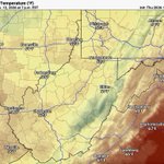


Some melting wet snowflakes and sleet pellets possible Friday night into Saturday morning across the lowlands. ❄️

2
73

⚠️ Tornado watch continues. Additional severe weather through Thursday evening for portions of the Mid-Atlantic region. There’s been flash flooding, severe thunderstorms and tornadoes.
118
Josh Fitzpatrick ❄️ retweeted

Thursday
Eagles Nest Rock
Dewey Lake
Jenny Wiley State Park 🍁
Prestonsburg,Ky.
#Kentucky
@YesTV
@Kentuckyweather
@JoshFitzWx @AmandaBarren
@TWCAlexWilson
@AlexWalkerTV @WSAZBrandon @JimCantore @weatherchannel @ChiliWX @SpencerWeather @JenCarfagno @tcavalierWSAZ @AdamBurnistonWX
@nwsjacksonky @meteojoe @JimCantore @WKYT @FeliciaCombsTWC @GaudetWeather @StephanieAbrams @WSAZTaylorEaton @floydcotimes @realalexwilson @WKYT @WYMT @wave3news @FOX56News @WSAZ @WCHS #Kentucky – at Prestonsburg, KY


A little wet snow accumulation for the higher mountains of West Virginia Friday into Saturday. No accumulation for the lowlands. A few melting sleet pellets and snowflakes possible Friday and Friday night. ⛷️

79

⚠️ Isolated Severe Thunderstorm Warning including Paintsville KY, Inez KY and Auxier KY until 12:30 AM Thursday. ⛈️🌬️
85

Harrisonburg and Charlottesville two separate markets for now. Surrounding bigger markets will absorb them sooner than later. I expect consolidation in Parkersburg, WV, Hazard, Kentucky, Lima, Ohio, etc. also.

149
Some wet snow accumulation for the higher mountains of West Virginia Friday into Saturday. No accumulation for the lowlands. A few melting sleet pellets and snowflakes possible Friday. ⛷️

80

🚨 A severe thunderstorm watch for possible severe weather issued for portions of Indiana and western Kentucky through Wednesday evening. ⛈️ 🌬️ 🌪️
68
Avoid the 31st Street Bridge in Huntington and Proctorville. There’s an accident closing the bridge. Traffic is a mess on both sides of the river Wednesday evening.


85
Wet snow accumulation likely for the higher mountains of West Virginia Friday into Saturday. No accumulation for the lowlands. A few melting snowflakes possible Friday. ⛷️

72
