

Meteorologist (CBM) 20+yrs TV, Baltimore, College Prof, weather geek,dad and outdoor lover. #FITF, Founder of The Maryland Trek, Just In Power Kids
Baltimore, MD
Joined January 2008
- Tweets38K
- Following1.3K
- Followers54.7K
- Likes18.4K




Pinned Tweet
Winner!
Crescent sunrise ☀️🌙🌎❤️
#PartialSolarEclipse
over Baltimore from my friend
Tim Shahan
#SolarEclipse

Tuesday October 27: 3 PM Smoke Map
🤔Have you noticed a haze in front of the sun today?
🔥 🌤️Light wildfire smoke is drifting into Maryland and the Mid-Atlantic today from fires across the Mississippi River Valley region.
🛰️Recent NOAA satellite analysis has confirmed smoke plumes from Arkansas, Missouri, Mississippi, and other parts of the Southeast, with light-density smoke covering much of the Mississippi Valley and drifting northeastward.
👉The maps show the general west-to-east / northwest-to-southeast flow carrying the smoke our way.
Thickest smoke ALOFT appears to be across metro Washington, Baltimore, Annapolis and through Southern Maryland to Delmarva.
🟢🟡Air quality remains mostly in the Good to Moderate range for now, but the haze is noticeable.
🌵Dry conditions continue to fuel fires across the region.
#Maryland #WildfireSmoke #AirQuality


I know it has been GREAT for many, but 9 days without rain and we may go another week...
Legitimate rainfall expectations near Zero through next Monday.
👻🎃 Halloween Still Looking Warm AND Dry!
🌥️ More Clouds Sunday as we turn the clocks back.
🌧️ Rain Chance On Monday is LOW for a few showers... but should increase after that.
🌡️ This WARM set up looks to dominate into the first Two Weeks of November. Remember we are watching for an unprecedented EARLY Polar Vortex weakening AND Potential Split. IF that happens, there is still a delay for cold air to reach us up to 3 weeks later.


Good Morning it’s TUESDAY OCTOBER 27
🧵1 of 2
🌡️ Slightly Cooler Today
☁️ Clouds Return Tonight And Tomorrow, But Dry!
🌵9 Days since the last rain AND the earliest I see anything may be Sunday or Monday
READ MORE 🔗 👉 Full Morning Report
justinweather.com/2026/10/27…

🧵2 of 2
🌵9 Days since the last rain AND the earliest I see anything may be Sunday or Monday
👻🎃 Halloween Looks Warm and Dry
⏰ 5 Days Until The Clock Change (back one hour) Sunday Morning
READ MORE 🔗 👉 Full Morning Report
justinweather.com/2026/10/27…


🌎 EL NIÑO 2026 VS. 1997: IT’S NOT JUST HOW STRONG, BUT WHERE!
We know this year’s El Niño is exceptionally strong. But there is something else that has caught my attention, and it may be important as we head toward winter.
The location of the unusually warm water could be just as interesting as the actual temperatures.
Take a look at these two ocean-height maps comparing October 1997 with October 2026.
🌡️ FIRST, THE NUMBERS
El Niño is measured using ocean temperature anomalies, or how much warmer the water is compared to average.
TWO REGIONS (marked on the globes) are particularly important:
🔸 Niño 3.4: The most commonly used region for measuring El Niño strength.
🔸 Niño 1+2: The easternmost region, just off the coast of South America.
Recent October 2026 weekly measurements show:
🔥 Niño 3.4: +3.3°C (+5.9°F)
🔥 Niño 1+2: +5.2°C (+9.4°F)
These are extraordinary anomalies, especially in the eastern Pacific.
The numbers are SST anomalies, while the accompanying maps show sea surface HEIGHT anomalies. The elevated ocean levels are associated with warmer water and changes in ocean circulation.
👀 🌎 NOW LOOK FARTHER NORTH!
‼️ This is the feature that really caught my attention.
Compare the two globes, especially the area west of Mexico and Baja California.
👉🏻Notice the extensive area of elevated sea levels extending farther north in 2026.
This feature is outside the traditional El Niño monitoring regions, but it could be relevant to the larger Pacific weather pattern.
🌀 REMEMBER THE EASTERN PACIFIC HURRICANES?
We’ve already experienced an unusually active eastern Pacific hurricane season.
Several tropical systems have affected Mexico, with tropical moisture reaching the southwestern United States.
Hurricane Polo was one example in September. It crossed Baja California, made another landfall in mainland Mexico, and helped transport tropical moisture into the Southwest.
This doesn’t mean the elevated ocean levels caused those storms. But the location of these ocean anomalies is something worth investigating alongside this season’s tropical activity.
🌧️ WHY THIS INTERESTS ME FOR WINTER
El Niño influences the tropical Pacific atmosphere, including where large clusters of thunderstorms develop.
That tropical convection can influence the jet stream thousands of miles away.
During many strong El Niño winters, the southern branch of the jet stream becomes more active, bringing Pacific storms across the southern United States.
But what if the strongest tropical convection develops farther east or north than during other major El Niño events?
Could that alter the position or strength of the southern storm track?
That is the question I’m exploring.
❄️ WHAT ABOUT SNOW IN MARYLAND?
A more active southern storm track can provide moisture for East Coast winter storms.
But moisture alone doesn’t produce snow.
We still need the right combination of cold air, storm timing, and atmospheric blocking.
That is why I’m also watching the polar vortex, the North Atlantic pattern, and other factors that can influence winter temperatures.
📌 MY TAKEAWAY
The extraordinary strength of this El Niño is getting plenty of attention.
But I’m particularly interested in WHERE the ocean anomalies are located and how the atmosphere responds.
The unusual feature farther north, near Mexico, adds another piece to the puzzle.
It doesn’t guarantee a particular winter outcome, but it gives us something important to investigate as I continue preparing my full Winter Outlook.
More to come!
❄️ Faith in the Flakes!
#ElNino
#weather
#winteroutlook
#FITF

Full Hunter’s Moon rising this evening.
🔭 This was the view with @nurse_jackie13’s new telescope Vs my iPhone 17 pro.
👀 Did you see it yet?
🌳 There may still be trees or other obstructions so some areas can have a delayed sunrise.
📝 It ‘looks’ larger simply because of perspective with the trees or buildings on the horizon. When it’s high in the sky it will be the same size, but not have the same ‘pop’.
🤔 Were the kids or pets a little crazy today? Might be in for a long night.
#fullmoon
#huntersmoon
#october
#eveningsky


Walking the dog and it truly went from
☀️ HOT in the sun
To
🥶 CHILLY in the shade.
🌕 The full moon rises at 6:11 PM
It could take up to 1/2 hour for it to rise over tree lines, hills, buildings for you to see if you don’t have a direct line east.
📷 Hope to get some nice pics.

PATTERN CHANGE IN NOVEMBER
☀️ This sunny and dry weather has made some happy, but its time will be coming to an end.
🌀 POLR VORTEX SPLIT?
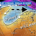
💻 This is a brief look at the European Model form last night which is doubling down with the most aggressive plot for what could be an unprecedentedly early weakening of the Polar Vortex.
👀 This looks like a break into 3 operate arctic vortices.
This is NOT a promise of a split or arctic air for us, but it is leaning that way.
💨 A true tell is the wind direction reversing to the East. This is briefly shown by the ECMWF.
👉I need to point out that this is the standout not the standard. But this model has been consistently showing the disruption with the most dramatic results.
📝 Note: We do not get immediate effects here in the Eastern US. That can be delayed by weeks.. meaning mid to late November to a signal to colder.
I have often seen suggestions like this show early and get pushed back... which is why I made that call for December 5th and our first potential snow. However, we may see colder and more active weather ahead of that.
🌧️💦The El Niño charged Pacific Storm Track is expected to flex its muscle and show more across the US in November..
🌡️ I still see November starting warm and may say warmer than average much of the month. Then colder air builds by Thanksgiving. More on that later.
So, yes! A Pattern Change Is Coming.
#WeatherUpdate
#polarvotex
#ElNino


Full Moon AND Fall Foliage this morning.
@nurse_jackie13 pulled over on her way to work to capture this gem.

Good Morning it’s MONDAY OCTOBER 26
🧵1 of 2
🌥️ Patchy Fog
☀️ Another Sunny and Warm Day
🌵8 Days since the last rain AND the earliest I see anything may be Sunday
READ MORE 🔗 👉 Full Morning Report
justinweather.com/2026/10/26…


🧵2 of 2
👻🎃 Halloween Looks Warm and Dry
⏰ Clocks Change (back one hour) Sunday Morning
READ MORE 🔗 👉 Full Morning Report
justinweather.com/2026/10/26…


⏰🍁 ONE WEEK UNTIL WE FALL BACK!
Are you ready for sunsets closer to 5 PM? 🌇
At least the sun will be rising before 7 AM again… for a few weeks! 🌅
Next Sunday, November 1, Daylight Saving Time ends, and we return to Eastern Standard Time. At 2 AM, clocks move BACK one hour. That means an extra hour of sleep for many of us!
☀️ Here’s how sunrise and sunset change in Baltimore:
📅 TODAY – Sunday, October 25
🌅 Sunrise: 7:27 AM
🌇 Sunset: 6:14 PM
☀️ Daylight: 10 hours, 47 minutes
📅 NEXT SUNDAY – November 1
🌅 Sunrise: 6:34 AM
🌇 Sunset: 5:06 PM
☀️ Daylight: 10 hours, 32 minutes
📉 That’s a sunset 68 minutes earlier on the clock in just one week!
But here’s something worth pointing out…
⏰ We don’t actually lose an hour of daylight when we change the clocks. We’re simply shifting that hour from the evening to the morning.
☀️ The REAL loss of daylight is about 15 minutes over the week as we continue toward the Winter Solstice on December 21.
And while we’ll enjoy sunrises before 7 AM again, that won’t last long. The sun will continue rising later each morning as we head toward winter.
🏛️ WHAT ABOUT THE SUNSHINE PROTECTION ACT?
You may remember the proposal to stop changing our clocks twice a year.
The U.S. House of Representatives passed the Sunshine Protection Act in July by a vote of 308–117.
However, the Senate has STILL not voted on it.
If approved and signed into law, the bill would make Daylight Saving Time permanent, keeping sunsets an hour later during the winter months. The trade-off would be much darker winter mornings.
For now, we’re still changing our clocks!
🍂 NOW THE BIG QUESTION:
Would you rather have…
🌅 More daylight in the MORNING?
🌇 More daylight in the EVENING?
⏰ Or would you simply prefer to stop changing the clocks twice a year?
I’m curious where everyone stands on this!
#clockchange
#DaylightSavingTime
#daylightsavings
#standardtime

🍁 Eye Candy
Looks like York County will be at Peak Foliage this week.
Here’s today’s view at Lake Redman and Lake Williams.
📷 Jackie Diamond
#October
#fallfoliage
#Pennsylvania


Good Morning it’s SUNDAY OCTOBER 25
🧵1 of 2
⚠️🧊Frost AND Freeze In More Areas To Start The Day
🌥️ Patchy Fog
☀️🏈🐦⬛ Ravens Game Weather Looks GREAT!
READ MORE 🔗 👉 Full Morning Report
justinweather.com/2026/10/24…


🧵2 of 2
☁️ Fog Likely To Develop Again Overnight and Monday Morning
🌡️ Monday: A Little Warmer And A Few More Clouds
🌵No Rain In Sight Through Halloween!
READ MORE 🔗 👉 Full Morning Report
justinweather.com/2026/10/24…


☀️ NOTHING FOR ANOTHER WEEK!
👀 Looking Ahead To A Dry End To October!
🌵 No Rain In Sight Into Next Weekend! Although we may get more clouds at times...
📏💦 This will put us back into the 6 inch Annual Rainfall Deficit By Then.
🍁 This may be good for leaf peeping as we approach Peak Fall Foliage...
‼️It will ALSO get Mighty Crispy!
🔥 Fire Danger may be something to start considering.
Just want to put this out there as we enjoy this sunny Saturday.


Good Morning it’s SATURDAY OCTOBER 24
🧵1 of 2
⚠️🧊 Got Frost? More in NE MD and Delmarva have it today.
🌥️ Fog Has Been Developing And More Expected Sunday Morning
☀️↕️🌤️ Today Brings More Clouds On Our South Side
☁️ Fog Likely To Develop Again Overnight and Sunday Morning
🏈🐦⬛ Ravens Game Weather Looks GREAT!
READ MORE 🔗 👉 Full Morning Report
justinweather.com/2026/10/24…


🧵2 of 2
🌵No Rain In Sight Through Next Week!
READ MORE 🔗 👉 Full Morning Report
justinweather.com/2026/10/24…

