

Wildfire reporter from Bakersfield, reporting on fires in the United States. Less frequent to focus on other things, still reporting though
Bakersfield
Joined October 2022
- Tweets8.4K
- Following361
- Followers1.7K
- Likes23.9K


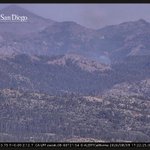


#BrandywineFire the fire is half an acre per the NIFC. The nearby #CreekFire to the southwest is 2 acres.

Air Attack 52, Helitanker 0HX, VCFD Copter 4 is Assigned to the #BrandywineFire located near Sawmill Mountain, South of Pine Mountain Club, Ventura County.
This Fire was detected by Air Attack 51 over Los Padres National Forest.
KernFireGraph retweeted

#TalbotFire Additional Air Resources enroute Jumper 10 and Copter 613, with 1 Lead and Two (MAFFS) on Order.
OES Intel 12 mapped the Fire at 16 acres with multiple spots out ahead.


#TalbotFire The Fire is 10-12 acres with multiple spot fires out ahead, AA230 accepted the offer of Smoke Jumpers for the Fire unknown ETA.

#TalbotFire Tahoe NF, near Talbot Campground.
2-3 acres in timber understory with a dangerous rate of spread with isolated torching and short range spotting.
Additional aircraft have been requested.

KernFireGraph retweeted
Air Attack 52, Helitanker 0HX, VCFD Copter 4 is Assigned to the #BrandywineFire located near Sawmill Mountain, South of Pine Mountain Club, Ventura County.
This Fire was detected by Air Attack 51 over Los Padres National Forest.

#AvalancheFire 1 acre in Yosemite National Park, about a mile and a half S of Wawona Tunnel.

#TeagleFire fire glow is visible on the mountains in the image below.


#TeagleFire
A brush fire is currently burning deep in the China Lake base in Inyo County with visible heat signatures on satellite.
Little available information at the moment

#DennisFire burning in the Caldor Fire byrn scar, near Mormon Emigrant Trail & Light Canyon Rd in El Dorado County

#DennisFire the fire is 15 acres and has spotted to the north side of Mormon Emigrant Trail.
#TeagleFire
A brush fire is currently burning deep in the China Lake base in Inyo County with visible heat signatures on satellite.
Little available information at the moment
#WoodsFire the fire has now grown to 15 acres per wildcad

#WoodsFire the fire is now 1 acre. There is no additional information for the #RockyFire at the moment.

#BugFire the fire has once again increased in activity this afternoon. It is 7,500 acres, per CalFire.

#RockyFire the fire is now 1.2 acres
#WoodsFire the fire is now 1 acre. There is no additional information for the #RockyFire at the moment.


#WoodsFire the fire is now 1 acre. There is no additional information for the #RockyFire at the moment.

This is now the #RubyFire and is 300 acres. The nearby #DoubleSpringFire is now 80 acres.
