

Chemical Engineering major-Montana State University/Photographer of extreme weather....whatever i'm doing i'd probably rather be skiing.
Bozeman, MT
Joined August 2010
- Tweets2.6K
- Following567
- Followers3.4K
- Likes1.8K



Chris Streeks retweeted

"The Great Wall"
The horizontal banding you see along the underside of the shelf reflects the sequential lift of multiple humid air parcels along the outflow boundary, each producing its own thin layer of conden...
EXIF @tamron_europe 17-28mm f/2.8 17mm f/8 ISO100 HDR + ND0.9*


Chris Streeks retweeted

Today will go down as the craziest weather day I have ever covered in my home state. Gambled east in the open warm sector / modifying outflow regime ahead of the PFT/cold front and it paid off in the form of numerous large, damaging, but photogenic tornadoes in central Illinois.


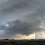
Energetic supercell from Miniota to Oakburn, MB, numerous funnels, thought it was going to produce 2-3 times but never more than brief circulations #mbstorm


Saw a somewhat suspicious lowering back in the rain nW of miniota, MB about 10mins ago, rain bands seemed to be wrapping


1
188


That looks scary and hard to see anything on 😳 west side of Holland, KS a bit close for comfort
1
200
Low level lapse rates leave a bit to be desired but think tomorrow def improves on the some of the issues Sunday had in SK/MB

21
1,165


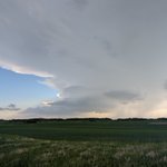
Cu bubbling east of Carlyle, Sk
learned my lesson and have adorned a coating of mosquito spray for the evening

Sig tor values on the rise in SE Saskatchewan, this family of red foxes (I think) weren't straying far from their burrowed tornado shelter #skstorm


Plan today is catch the first 2-3 hrs of supercell activity in Moosamin, SK vicinity.....Then drop south into ND for sunset MCS/derecho


