MU Weather Center (@MUweather) header
MU Weather Center (@MUweather) profile picture

Millersville University Weather Information Center. Tweets by Meteorologist & Director Kyle Elliott. Expert Forecasts & Storm Analyses for southeastern PA.

Millersville, PA
Joined October 2020
Photo by MU Weather Center (@MUweather)Photo by MU Weather Center (@MUweather)Photo by MU Weather Center (@MUweather)Photo by MU Weather Center (@MUweather)Photo by MU Weather Center (@MUweather)Photo by MU Weather Center (@MUweather)Photo by MU Weather Center (@MUweather)Photo by MU Weather Center (@MUweather)Photo by MU Weather Center (@MUweather)Photo by MU Weather Center (@MUweather)
(1/4) Alright, snow fans! The moment you've all been waiting for has arrived: my 2026-2027 Winter Outlook! Two primary winter-season influences will be our Super, east-based El Niño and slightly-negative Pacific Decadal Oscillation (PDO)..
5
12
114
36,752
In today's SWD update, I explain why numerical computer models still vary drastically with regard to the coastal storm system's track and intensity this weekend. I also highlight the transition into a colder weather pattern just in time for #Thanksgiving. millersville.edu/weathercent…
2
311
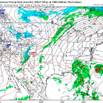
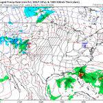
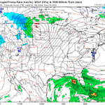
There are still striking and astounding differences between the various computer models regarding the strength and track of this weekend's coastal storm.. and which center of low pressure (the one over FL or the one NE of the Bahamas) becomes the primary one. What a mess!
6
425
The high pressure system will shift off the New England coastline tomorrow, but the weekend is still going to kick off on a gorgeous note! High clouds may dim the sun, especially Saturday afternoon, but winds will remain light with high temps in the mid 60s. #GetOutside & #Enjoy!
1
4
325
The sprawling high pressure system over the mid-Atlantic States is still in place, so we'll be graced with another sunny, dry, tranquil and pleasantly warm day with high temps in the mid-to-upper 60s. It doesn't get nicer than this in late #November!
5
381
MU Weather Center retweeted
😲+40°F differences between high & low temperatures are about as large as we get around here! 🌡️Data Source: RTMA #PAwx
2
4
29
1,642
Heads up, Pennsylvania: Continued dry conditions are raising wildfire risks. Please avoid starting outdoor fires for now. Be safe, PA!
5
12
493
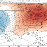
In today's medium-range video, @wxwithmatt and I discuss uncertainty in the track and intensity of this weekend's coastal storm, as well as the plunge of much chillier air during the middle of next week. Another storm bears watching around #Thanksgiving. millersville.edu/weathercent…
4
407
A sprawling high pressure system over the southern mid-Atlantic States will promote sunny skies, light winds and pleasantly mild conditions across northern MD, southeastern PA and the LSV today. Despite another cold start, temps will peak in the mid-to-upper 60s this afternoon!
3
348
A sprawling high pressure system over the mid-Atlantic States will promote sunny skies, light winds and milder conditions across northern MD, southeastern PA and the LSV today. Despite another cold start, temps will peak in the low 60s this afternoon. #GetOutside and #Enjoy!
5
438
In today's SWD, I highlight the stretch of sunny, dry and pleasant weather through Saturday, uncertainty in the forecast from Sunday into Monday, and return of much cooler air just before #Thanksgiving. millersville.edu/weathercent…
2
384
A sprawling high pressure system upper-level, #jetstream ridge over the Northeast and mid-Atlantic States will promote sunny, dry, tranquil and pleasantly mild weather through the start of the weekend. High temps top out in the 60s in northern MD and southeastern PA from Wed-Sat.
2
9
567
A sprawling high pressure system over OH and western PA will promote sunny skies, lighter winds and milder conditions across the LSV today. After a cold start with lows of 25°F at York Apt and 29°F at @millersvilleu, high temps will reach the mid-to-upper 50s this afternoon.
5
395
A Canadian high pressure system over the Ohio Valley will promote partly-to-mostly sunny and seasonably cool conditions across northern MD, southeastern PA and the LSV today. NNW winds of 10-20 mph will accompany high temps in the low-to-mid 50s.
3
434
MU Weather Center retweeted
What's the story this workweek? Dry with warming temperatures! High pressure setting in over the eastern US will allow for calmer, warmer conditions to build during the week after our taste of winter this past weekend! #PAwx
2
12
1,479
In today's brief SWD update, I highlight the brisk and unseasonably chilly weekend ahead and gradual moderating trend in temps next week. By Wednesday, highs should be back up around 60°F. millersville.edu/weathercent…
3
524
A deep trough, or dip in the #jetstream, over the eastern U.S. will plague northern MD, southeastern PA & the LSV with brisk & chilly weather this weekend. Any AM sun will be of the "self-destruct" variety, & NW winds may gust up to 35 mph each afternoon w/highs between 45-50°F.
7
749
In the wake of yesterday's storm system, NNW winds of 12-25 mph will usher much colder air into the Commonwealth today. High temps will be around 10°F below normal, or in the low-to-mid 40s, this afternoon under mostly cloudy skies. Wind chills hover in the 30s. Yuck!
6
491
As expected, rainfall amounts increased dramatically from SW-to-NE across southeastern PA and the LSV since Thurs AM. Less than 0.10" of rain fell in most of Franklin Co, while eastern Lancaster Co. and areas near Philadelphia received 0.75-1.25". @millersvilleu picked up 0.33".
2
14
1,126
MU Weather Center retweeted
Severe Thunderstorm Warning including Pottstown PA, Phoenixville PA and Collegeville PA until 2:30 PM EST
6
16
5,637
Showers and storms have essentially exited the LSV, but severe thunderstorms will rumble through SE PA over the next 2-3 hours. The main threats will be damaging wind gusts up to 60 mph, hail, frequent lightning and even an isolated tornado.
2
1
7
670