

Distruptive mobile #GIS app. With offline capability and smart features, we're not just a pretty interface. Product of @TakorGroup
Perth
Joined December 2013
- Tweets1.1K
- Following0
- Followers452
- Likes471





⚠️MAPPT BLOG ALERT⚠️
Ask yourself if your baselayer imagery up to date? Learn how to access updated high resolution baselayer images from Soar. bit.ly/2CwpiCY
#android #mapping #ILoveToSoar #FoundOnSoar #SkyMap50 #satellite #remotesensing #maps #mapping
Struggling to achieve positional accuracy with your tablet's GPS?
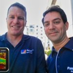
We just received an EOS Arrow 100 in the post courtesy of 4DGlobal to utilise with Mappt and #Android!
Follow our blog posts for an update on how it went mappt.com.au/news/
@4Dglobal @EosGNSS

2
Mappt is FREE for all Emergency and Bushfire Relief Agencies in Australia - Contact us
Watch the evolution of a MEGA-BLAZE Nowra, NSW
Satellite images on Soar: bit.ly/3aNYRFw
#firesNSW #AustralianFires #AustraliaOnFire #AustraliaBurning #AustraliaBurns

GIS by Bike: Why not capture some data while staying fit?
What's not to like about capturing geospatial data and helping the planet? Our local shire of @BelmontCouncilWA captures asset-related data. According to the rider, 'data capture by bike is more efficient than by car!'

@LadyElliotGBR getting some national attention for their restoration activities! @Mappt is a proud partner and GIS provider for re-vegetation management at LEI. abc.net.au/news/2019-09-29/l…
Quadrat surveys with Mappt? Mangrove forests in Borneo? Read on to see how the two come together in one simple approach to quadrat data collection! buff.ly/306dzVz

1
How's your mobile hardware? Mappt just kicked off field testing for the new Panasonic Toughbook FZ-L1 Android Tablet.
Specs shortlist: Android 8.1, 7" HD display, Qualcomm Snapdragon CPU, 4G Data capability, & 3yrs std warranty. #Panasonic #Android #Mapping #GIS #Ruggedized

The Mappt Air collaboration and project synchronisation tool seems to be a hit with @CityofMandurah's Environmental Services Team. #GIS #geospatial #mapping #envieonmental #westernaustralia #westcoasteagles

1

Did you know that Mappt Air allows your whole field team to add survey data to a single cloud-based collaborative project? buff.ly/30nJ5eE

Mappt's mid-year update: Tutorials, Top 5 Tablets Guide & New features! - mailchi.mp/takor/mappts-mid-…
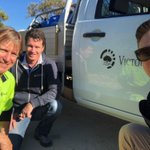
Was nice to catch up with Stephen from the Town of Vic Park during our drone mapping survey! See more about the project here: buff.ly/2JZ4q9T

We love it when a client reaches out to us forst thing in the AM requesting a software renewal. Thanks Hancock Exploration!
Using Drone Imagery to Enrich Field Surveys: A workflow using Mappt, DJI & QGIS #drones #GIS #mobile #fieldmapping buff.ly/2JZ4q9T


How tablets are simplifying field work - a Senior Geologist's story! #Mappt #testimonial #easyGIS #strikeanddip buff.ly/2wdTKv0

Do your non-GIS savvy team members need an intuitive mobile mapping tool? mappt.com.au/2019/03/08/mapp…