

Co-director @TheWaterDesk at the University of Colorado Boulder and author of https://nitter.gq/t.co/IOhQIGYGpl @snownewsnow, a free newsletter on snow, climate, and water.
Durango, Colorado
Joined December 2008
- Tweets1.8K
- Following814
- Followers851
- Likes259





Pinned Tweet
This is normally a dry gully and meadow near my home north of Durango. It became a raging torrent this afternoon.
Severe flooding has prompted evacuations and road closures across southwest Colorado. #cowx
The worst flooding in my neighborhood near Durango was downstream of the burn scar from the 416 Fire.
After the 2018 blaze, some ground cover, scrub oak, aspen, and other vegetation returned, but the runoff and erosion during the flood were remarkable.


1
1
66
Navajo Reservoir, along the San Juan River and the Colorado-New Mexico border, saw its water level rise nearly 60 feet from Sept. 20 to Nov. 7.
Satellite imagery shows the dramatic change:
science.nasa.gov/earth/earth… #cowx #nmwx

105
I’ve been photographing the flood damage in and around Durango.
It’s shocking to see what all that water and mud has done to our community.
Here are some views from yesterday in the Trimble area, north of town.
waterdesk.photos/Colorado/Du… #cowx


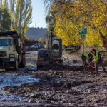
In Durango, I watched crews and heavy machinery scrape, shovel, scoop, and otherwise try to clear a neighborhood of the thick muck left behind by floodwaters.


1
2
78

Southwest Colorado, including my neighborhood, has suffered devastating flooding after an extraordinarily wet fall. Thankfully, our family is safe.
My latest post explores the remarkable weather whiplash we've experienced.
snow.news/p/four-corners-flo… #cowx

Flew my drone above our neighborhood north of Durango this afternoon to assess the flood damage and take photos for Colorado Public Radio.
The amount of mud and debris left behind is mind-boggling. I sank up to my waist in the muck a few times.
cpr.org/2026/11/02/southwest… #cowx


3
215
A few months ago, SW Colorado was gripped by severe drought following the worst winter snowpack in generations, a record-breaking spring heat wave, and a lackluster summer monsoon.
Now the region is experiencing historic flooding after extraordinary rainfall this fall. #cowx
The La Plata County Sheriff in SW Colorado has temporarily closed all county roads due to dangerous flooding and debris flows.
We’ve already picked up 2.86” of rain since midnight at my house north of Durango, after an incredible 8.02” in September and 8.86” in October. #cowx

2
562
Scenes from yesterday's flooding along the San Juan River, between Farmington, New Mexico, and Aneth, Utah.
More images in The Water Desk’s multimedia library:
waterdesk.org/photos-san-jua…


1
234
Disastrous flooding along the San Juan River in the Four Corners region. Here’s some of what I saw today in Shiprock, on the Navajo Nation in northwest New Mexico.


1
139
🎉 Happy New Water Year! 💧
New post explains why water wonks hit reset on October 1 and uses maps to visualize water year 2026.
I didn't stay up late last night to party, but I do toast to wiping the slate clean after 2026’s historic snow drought.
snow.news/p/welcome-to-water…

Low water levels in the Dolores River and McPhee Reservoir in southwest Colorado.
The Dolores begins high in the San Juan Mountains and flows through canyon country before joining the Colorado River northeast of Moab.
waterdesk.org/photos-dolores…


Mitch Tobin retweeted

Excited to join The High Route podcast to discuss last season’s historic snow drought and what it means for the West.
The show focuses on backcountry snow sports, so I was glad to share my perspective as both a skier and journalist covering the snowpack.
the-high-route.com/the-high-…

Climate change made the West’s snow drought 4.4 times more likely, according to a new study. But it was still a rare event—not the new normal.
My Q&A with the lead author explores how scientists measured warming’s influence and what the future may hold.
snow.news/p/climate-change-w…

The effects of last winter’s historic snow drought were easy to see—and feel—during my recent summer road trip through Colorado: smoky skies, depleted reservoirs, and virtually no snow left on a 14er.
New photo essay at snow.news:
snow.news/p/photo-essay-summ… #cowx

Mitch Tobin retweeted
Late-season storms brought much-needed moisture to parts of the West, but they didn’t come close to erasing the deficit.
New at snow.news: update on snow drought and remembering my dad, who helped inspire my love of journalism and weather.
snow.news/p/snow-drought-upd…

April 1 is a key milestone for the West’s snowpack.
This year’s data paint a disturbing portrait of the historic snow drought.
Eight states are at record lows for snow water equivalent.
My latest post at snow.news:
snow.news/p/snowpack-april-1…