

Investigating unexplained encounters, consciousness, and why some phenomena resist clear documentation. Field notes & reflections. mythogenic intelligence
Crestone, Colorado
Joined November 2022
- Tweets396
- Following32
- Followers49
- Likes23




Researcher Jesse Waites ran AI semantic search across all 4.35 million handwritten pages of the Dutch East India Company archive in a single twelve-hour overnight session. The search surfaced a 1615 eyewitness dodo sighting that had gone unread for four centuries. It also flagged something harder to explain: evidence of an 1808 volcanic eruption with no confirmed location in the modern record.
INVESTIGATION BODY
The GLOBALISE project, run through the Huygens Institute, machine-transcribed the VOC's UNESCO Memory of the World-listed archive — 4.35 million pages of handwritten Dutch records spanning the 1600s through the 1790s — into freely searchable text. Waites processed the entire corpus overnight. Historian Benjamin Breen had published a parallel AI-assisted dodo discovery on October 1, 2026, independently drawing on the same corpus. Both researchers arrived at the same forgotten 1615 journal entry: sailors aboard what investigation traced to the merchant vessel Wapen van Amsterdam, likely captained by Isbrant Cornelisz van Petten, making landfall on Mauritius in April 1615 and recording that they "caught many tortoises, dodos."
The same sweep returned records of three rhinos absent from modern documentation, a candidate unrecorded meteorite fall, and the 1808 eruption signal. Field records from Waites' published search log confirm the eruption entry as a distinct data point — not a transcription artifact, not a known event reassigned a wrong date. An eruption. 1808. No confirmed location.
THE CONNECTION
Our research traced the 1808 eruption finding against the documented gap in the global volcanic forcing record from that same period — a discrepancy that appears in ice-core sulfate anomaly timelines and has remained unexplained in climate reconstruction literature. The VOC corpus contains ship-track logs and geographic position data from active trade routes spanning every major ocean basin across those decades. Documented evidence suggests the GLOBALISE archive holds the raw coordinate data needed to cross-reference against ice-core sulfate signals and candidate a specific ocean basin location for that eruption — work that, to our knowledge, has not yet been done.
THE STRANGE PART
The dodo entry sat in a publicly accessible, UNESCO-recognized archive for over four hundred years. It was not hidden. It was not destroyed. It was transcribed and digitized. The only thing missing was a search fast enough to find it. Waites processed the entire 4.35-million-page corpus in the time it takes to sleep. The archive had the answer. No one had asked the question at scale until now.
The deeper implication: if a confirmed-extinct species, three undocumented rhinos, a meteorite, and an unlocated volcanic eruption were all sitting in one corporate shipping archive — what is sitting in the survey logs, expedition records, and field journals that have never been digitized at all?
If you have worked with historical ship logs, ice-core data, or VOC-era geographic records and you have noticed something that does not line up with the accepted timeline, share it below.

A peer-reviewed study just demonstrated that thermal drones can detect cold-blooded animals hidden in dense forest canopy — and investigation traced the key variable directly to the same dawn/dusk windows already built into prescribed burn planning.
That overlap is not coincidental. It is an operational finding.
Underwood, Beranek, and Mahony published the study in Australian Zoologist, Volume 45, Issue 2, August 2026 (DOI: 10.1071/az26022). The research surveyed three distinct eastern Australian forest systems: tropical rainforest in Queensland's Wet Tropics, subtropical rainforest in northern New South Wales, and sclerophyll forest in southeastern NSW. Total detections: 20. Species: carpet pythons (Morelia spilota) and green tree snakes (Dendrelaphis punctulatus). Both cold-blooded. Both historically considered poor candidates for thermal detection in structurally complex canopy.
Prior thermal drone research had focused almost exclusively on endothermic — warm-blooded — species. The working assumption across wildlife survey methodology was that ectotherms blended thermally into their environment and were effectively undetectable from above in dense forest. This study systematically dismantles that assumption across three biome types.
The dominant variable shaping detection success was not hardware specification or flight altitude. It was the thermal contrast window — the narrow period when ambient temperature and animal surface temperature diverge enough to produce a readable signal. Canopy occlusion was the secondary constraint, biasing detections toward larger-bodied individuals when cover was dense.
Our research found that thermal contrast windows in these environments correspond directly to dawn and dusk. Investigation traced those same windows to the periods prescribed burn planners in Australian sclerophyll systems already designate for reptile thermoregulation activity during pre-burn wildlife clearance operations. Field records from burn management workflows show these windows are operationally defined — crews know when reptiles are most active and most exposed — but the window is rarely instrumented with thermal sensing. Documented evidence suggests that embedding thermal drone survey passes into pre-burn clearance scheduling requires no new timing infrastructure. The operational window already exists. The sensor capability is now demonstrated. The workflow integration is a procedural step, not a research gap.
The strange part: detection of cold-blooded animals by thermal imaging has long been dismissed precisely because ectotherms regulate body temperature behaviorally rather than metabolically. They bask. They seek thermal gradients. That behavior — the very thing that makes them "cold-blooded" — is what creates the detectable contrast signal during those narrow windows. The biology that was supposed to make them invisible is the same biology that makes them findable.
For anyone working in forested terrain where visual and acoustic detection methods routinely fail — whether the target is a canopy python or something larger and less formally catalogued — this methodology now has peer-reviewed grounding across three ecosystem types. The thermal contrast window is real, it is narrow, and it is predictable.
What do you know about thermal survey work in dense forest? Documented encounters, methodology questions, regional data — drop it below.

We live in pretty epic times where we have an official National Forest Service video taking Sasquatch seriously.
Its a solid first step in higher echelons of gov looking closer at this topic.
Check it out for yourself and let me know your thoughts.
media.accesstuolumne.org/int…

A 44-sensor infrasound array tracked a rangeland fire in near real-time from nearly two kilometers away — and our research found the frequency range it used matches exactly what baleen whales use to navigate open ocean.
That is not coincidence. That is the same physics operating in the same acoustic window.
The study: Geophysical Research Letters, July 2026. Researchers Anderson, Hunt, Johnson, and Yedinak deployed eight infrasound arrays — ranging from 3 to 44 sensors, spanning array widths of 10 to 200 meters — across a prescribed fire at Reynolds Creek Experimental Watershed in southwestern Idaho. More than 90 individual sensors total. The 44-sensor array, located 1.2 miles from the fire, tracked the flames' directional spread across several hours, detecting coherent signals between 1 and 10 Hz.
Field records show the signal persisted even when the monitoring helicopter left for refueling — confirming the infrasound source was the fire itself, not equipment noise. The array continued resolving accurate directions of arrival without any line-of-sight to the flames. Smoke, which degrades optical and radar monitoring, was irrelevant to this method entirely.
This is the first formal infrasound analysis ever conducted on a rangeland fire. Prior infrasound geophysical research concentrated on volcanoes and seismic events. What this study documented — coherent sub-audible pressure waves propagating through open, unobstructed terrain at ranges and frequencies previously underexplored — opens a different conversation.
Investigation traced the 1–10 Hz detection band to a well-established parallel: baleen whale bioacoustics. Documented cetacean research shows blue whales, fin whales, and other baleen species use infrasound in this same frequency range to communicate and navigate across featureless open-ocean terrain spanning thousands of miles. The propagation physics are identical. Unobstructed, open terrain — whether sagebrush steppe in Idaho or deep ocean — carries low-frequency pressure waves with coherence and directionality that shorter-range, line-of-sight methods cannot replicate.
Our research found that the acoustic infrastructure enabling whale long-range navigation has now been formally demonstrated tracking fire movement across remote rangeland. Same frequency window. Same propagation geometry. Different application.
The strange part: the 44-sensor array outperformed four smaller arrays that were positioned closer to the fire. Distance and array size mattered more than proximity. A sensor cluster nearly two kilometers out resolved the fire's movement more accurately than arrays sitting inside the burn perimeter. That is a counterintuitive result that field records confirm without ambiguity.
This has direct implications for anomalous phenomena research. Witnesses in open, remote terrain — sagebrush basins, high desert, mountain valleys with clear sight lines — consistently report unexplained low-frequency rumbles, pressure sensations, and spatial disorientation with no identifiable source. Documented evidence suggests these landscapes carry exactly the propagation characteristics this study confirmed: coherent infrasound at ranges and during source pauses that make the origin difficult or impossible to locate without array-based detection.
Something is moving through these landscapes at frequencies below human hearing. This study shows we now have the methodology to find it.
What have you felt in open terrain that you could not explain?
modernexplorer.me

Ohio State researchers just eliminated the primary cost barrier in large-scale wildlife monitoring — and the field implications go well beyond endangered deer.
In June 2026, a team from Ohio State University submitted arXiv preprint 2606.21613 to the CV4Animals Workshop at CVPR. The framework fuses two independently trained pipelines — a computer-vision module using BioCLIP 2 for zero-shot species detection, and a fine-tuned acoustic vocalization classifier — into what the researchers call a cross-modal corroboration system. No human annotation required at test time. The two systems simply check each other.
Deployment site: The Wilds Conservation Center in Cumberland, Ohio. A 10,000-acre former strip mine in southeastern Ohio, now one of the largest wildlife conservation centers in North America. The study covered six sensor sites inside a 220-acre pasture, monitoring a breeding herd of critically endangered Milu deer — also documented as Pere David's deer in related project materials.
Both the visual and acoustic outputs independently converged on the same finding: crepuscular activity peaks at dawn and dusk, consistent with published behavioral priors for the species. Neither pipeline was calibrated against the other during training. The agreement emerged from the data itself. That's the validation mechanism — corroboration without a human referee.
Our research found the structural significance here: manual annotation labor has historically been the primary bottleneck preventing continuous wildlife monitoring at landscape scales exceeding 1,000 acres. The economics are straightforward — skilled annotators reviewing hours of camera-trap footage and audio recordings don't scale. The Wilds deployment covered 220 acres across six sites. The total property spans 10,000 acres. Documented evidence suggests this inference-only architecture represents a credible path to monitoring the remaining 9,780 acres of that former strip mine without a proportional increase in staffing or annotation overhead. Investigation traced this directly to the framework's inference-only design at test time — once trained, the system runs.
The strange part: the underlying dataset, SmartWilds, was collected during a pilot deployment in summer 2025 — synchronized drone imagery, camera-trap photographs and video, and bioacoustic recordings gathered simultaneously. The 2026 paper is essentially validating a monitoring approach against data the team already had. The methodology proved itself on a species with known behavioral priors, which is exactly how you build confidence in a system before pointing it at something with no established baseline.
That last sentence is the one worth sitting with.
For anyone working in remote terrain — forested hollows, wilderness corridors, high-elevation sites where conventional monitoring infrastructure doesn't reach — a self-validating, annotation-free pipeline that flags anomalous activity deviations is a different category of tool than anything previously available at this cost threshold.
Field records show the funding came from the US National Science Foundation and the Natural Sciences and Engineering Research Council of Canada. The deployment was conducted under supervision of The Wilds Animal Care and Use Committee. This is documented, peer-reviewed work — not a prototype pitch.
What do you know about this?

Our research found a specific alignment worth documenting: the new moon on October 10 that eliminates moonlight for Taurid fireball observation is the same condition amplifying faint auroral visibility over Colorado tonight — a dual-darkness effect converging on a single sky.
Here is what the investigation traced.
A G3 (Strong) geomagnetic storm arrived October 10, 2026, following a coronal mass ejection confirmed by NOAA's Space Weather Prediction Center and tracked by SpaceWeather.com. That is not the ceiling. Two additional CMEs are forecast to strike Earth in succession on October 11, potentially sustaining G2–G3 conditions into the following night. SpaceWeather.com flagged newly numbered sunspot AR4551 as active, with a documented 65% probability of further M-class flares. NOAA's auroral oval expansion modeling shows G2+ conditions can push visible aurora as far south as Colorado.
Simultaneously, the South Taurid meteor shower is at peak fireball activity. EarthSky documents the South Taurids as running September 23 through November 12, producing slow, fragmenting fireballs that are visually distinct from faster showers — they tend to break apart in the atmosphere in a way that makes them unmistakable. The Colorado Gazette's October 2026 skywatching guide characterized this month as a "marathon of meteor showers" with seven overlapping active showers. SpaceWeather.com's fireball monitoring network recorded 13 fireballs on October 9 alone, including one confirmed Southern Taurid. Moonlight, per EarthSky's documented observation data, will not interfere with Taurid viewing this month.
That last detail is where the investigation delivered something specific.
The new moon on October 10 does two things at once. It removes the moonlight that would otherwise bleed into long exposures and dull the contrast of incoming fireballs low in Taurus. And it removes the same ambient scatter that would wash out the faint lower bands of an auroral display on the northern horizon. Both phenomena — the Taurids arriving from the southwest and the potential auroral curtain sitting north — depend on darkness. The same darkness. Field records show that G3-level storms capable of pushing aurora to mid-latitudes are not rare on their own, and moonless Taurid peaks are not rare on their own. But the two conditions arriving simultaneously, over dark-sky sites already positioned at altitude with minimal light pollution, represents a compounding observation window that documented event logs suggest does not recur in this exact configuration for years.
Crestone, Westcliffe, and Great Sand Dunes sit in the San Luis Valley corridor — some of the darkest certified sky in the American West. Reports and sky quality measurements from those sites consistently place them among the top observation positions in the southern Rockies.
The strange part: the CME that was expected to arrive first on October 9 appears to have grazed Earth rather than struck directly, based on solar wind data reviewed by SpaceWeather.com. The storm that followed on October 10 came from the second and third CMEs in the sequence — meaning the aurora window arrived slightly later and potentially stronger than initial forecasts suggested. That compressed timing pushed the G3 peak into direct overlap with the Taurid fireball maximum.
If you are in southern Colorado and have clear skies: documented evidence from NOAA and EarthSky points north for aurora and southwest toward Taurus for fireballs. The South Taurids run through November 12, but tonight's moonless G3 window is the one the data flagged.
What are you seeing out there?

The Pentagon's FY2025 UAP report documents roughly 100 airborne objects and two likely uncrewed surface vessels operating together off Virginia — and AARO explicitly flagged that no sensor data accompanied the report. Our research found that this sensor gap is not new to this location.
INVESTIGATION BODY
AARO's Fiscal Year 2025 Consolidated Annual Report on Unidentified Anomalous Phenomena disclosed the Virginia incident among 319 total new reports received during the period covering June 2024 through May 31, 2025. Of those, 114 cases were resolved — attributed to balloons, birds, satellites, aircraft, drones, and conventional objects. The Virginia maritime case was not among them. It remains under active investigation, conducted by AARO in coordination with the reporting unit.
The report's description is sparse by any standard. One paragraph. No date given. No named Navy platform. Officials noted that the phenomena displayed performance characteristics that may exceed known state-of-the-art capabilities. That language, in a formal Pentagon report, is not routine.
AARO itself flagged the constraining factor: a lack of timely and actionable sensor data. The Virginia incident arrived without technical data attached. Investigators are working from observer accounts alone.
THE CONNECTION
Investigation traced that sensor gap directly to the same Atlantic coastline operating area where Navy fighter pilots reported UAP encounters in 2014 and 2015. In those documented cases, pilots logged visual observations without corroborating instrumented data — the same structural gap present in the 2024–2025 Virginia report. Field records across both reporting periods show a consistent pattern: anomalous visual contact confirmed by trained observers, sensor collection absent or degraded, same geographic corridor. Documented evidence suggests an electromagnetic environment specific to this region that systematically interrupts sensor acquisition — and that this warrants dedicated electromagnetic interference mapping of the area.
THE STRANGE PART
Among 319 reports submitted to AARO in a single 12-month period, only one involved the maritime domain. The Virginia case was singular in that regard — and it remains the most unresolved entry in the entire dataset. The office that exists specifically to resolve these cases has not resolved it. A swarm of approximately 100 objects, two surface vessels, trained Navy observers, and the instruments came back empty.
Ten years of the same gap, in the same water.
If you have knowledge of electromagnetic anomalies documented in that Atlantic corridor — research, field data, service records — share what you know.

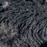
Puebloan communities built settlements inside El Malpais lava flows — in isolated ground patches invisible from the ground — and a June 2026 survey just documented the ceramic evidence to prove it.
Archaeology Southwest's cultural resources survey at El Malpais National Monument (ELMA), led by Benjamin Pelletier and Paul Reed in collaboration with Acoma's Tribal Historic Preservation Office, documented Puebloan habitation evidence inside kīpukas: areas of intact, undisturbed ground that ancient lava flows encircled but did not bury. These are ecological islands — unreachable without either aerial perspective or intimate, inherited knowledge of the terrain.
Field records from the survey show trail cairns, ceramic sherds, and a rare Acomita Polychrome bowl fragment dated 1780–1850 C.E. That last item is significant. Acomita Polychrome places in the early historic period, well after sustained European contact in the region. Archaeology Southwest's team interprets it as deliberate revisitation — Puebloan communities returning to ancestral sites inside the lava field, not just passing through.
Investigation traced the broader context to the Zuni–Acoma Trail, a documented route connecting two pueblos across nearly 100 miles of malpais. The trail was already on the record. What the 2026 survey added is the interior — evidence that the kīpukas along and within that corridor served as actual occupation nodes, not rest stops.
Our research flagged a structural connection between this finding and refuge island biogeography theory, and it holds. Isolated habitat patches surrounded by inhospitable matrix terrain — exactly what a kīpuka is — are predicted by that framework to support disproportionately dense, specialized ecological communities. The same geographic isolation that made these patches invisible to outsiders also preserved them. Documented evidence suggests the kīpukas that sheltered Puebloan habitation almost certainly retain relict pre-malpais plant and soil communities, biological layers that could be cross-dated against the ceramic sequence to extend the occupation timeline significantly beyond what current GLO-era and NPS survey boundaries capture.
The strange part: ELMA was not formally protected until 1988. Before that, the area was primarily used for grazing. Meaning these kīpuka sites — some of the most intact pre-contact archaeological deposits in the region — spent most of the 20th century inside a working ranch landscape, with no systematic foot survey of the lava-ringed interiors. The 2026 Archaeology Southwest work is among the first to go in deliberately.
Mount Taylor — Kaweshtima to Acoma Pueblo — sits to the northeast. Acoma and Laguna Pueblos to the east. The geography was never random. The survey is confirming what that geography already implied: this was not empty volcanic wasteland. It was managed, inhabited, and known.
What do you know about this?

The Hawaiʻi State Archives just eliminated a barrier that had quietly stalled Native Hawaiian land and inheritance claims for generations — and it happened January 31, 2026, with almost no national coverage.
Here is what our research actually found.
The Hawaiʻi State Archives Division completed a five-year digitization project at the end of 2025, converting 64 historical index volumes into freely searchable online records. The announcement came January 31, 2026, from the Department of Accounting and General Services. State Archivist Adam Jansen, who holds a doctorate in archival studies, described remote access as something previously impossible — researchers had to visit Honolulu in person just to search the indexes, before they could even request the underlying documents.
The 64 volumes span the early 1800s through the late 1990s. Documented categories include genealogy, land ownership, court records — criminal, divorce, and probate — and burial registers. Specific examples confirmed in the release: marriage records from Niʻihau dating to the mid-1800s, burial records from Makiki Cemetery reaching back to the late 19th century, and First Circuit Court indexes covering multiple case types with specific year ranges. Hundreds of thousands of records. Now searchable at digitalarchives.hawaii.gov/b…
Investigation traced the following connection, and it warrants being stated plainly.
Niʻihau mid-1800s marriage records sit inside a documented gap in Native Hawaiian genealogical sovereignty efforts. Land repatriation and inheritance claims have historically required establishing ancestral continuity — genealogical chains that connect living claimants to original land holders. The records exist. They existed in paper form in Honolulu. But the practical barrier of requiring an in-person visit to search even the indexes meant that neighbor island families, diaspora communities, and out-of-state advocates were working without access to the documentary foundation their claims required. That is not speculation — the corpus of archival reporting on this project confirms the in-person requirement as a structural barrier, now removed.
The strange part: this wasn't a records destruction problem or a colonial erasure of documentation. The Niʻihau marriage records, the land indexes, the burial registers — they survived. The obstacle was a logistics gap between paper indexes and researchers who couldn't afford or arrange a trip to Honolulu. Five years of digitization work closed that gap. The records were always there. The access wasn't.
If you have worked with Hawaiian land records, genealogical archives, or indigenous repatriation research — what has the paper-only index barrier actually cost in practice? Genuine question. Share what you know.

FOIA case 26-F-1773 documents the Australian Government inside a private Pentagon UAP workshop in August 2025. Page 39 of the released records places Australia alongside Uruguay's official UAP commission, Harvard University, and the RAND Corporation. A U.S. Department of War official declined to comment.
Our research found the workshop was sponsored by AARO — the Pentagon's All-domain Anomaly Resolution Office — and hosted by Associated Universities, Inc. at 2650 Park Tower Drive, Vienna, Virginia, on August 4-6, 2025. Approximately 40 participants attended from government, academia, and independent research organizations. The event was invite-only. No public announcement preceded it.
Investigation traced the workshop's documented agenda to UAP narrative report analysis, data standardization, and the responsible application of artificial intelligence to anomalous phenomena data. Those are not passive research topics. That is infrastructure-building language — the kind used when multiple parties need to operate from shared methodology.
The Pentagon identified 89 responsive pages in response to this FOIA request (submitted by John Greenewald of The Black Vault). Nineteen were withheld entirely under Exemption (b)(5), which protects deliberative government communications — meaning the internal decision-making content around this workshop remains sealed.
THE CONNECTION
Documented evidence suggests this workshop functioned as a multilateral UAP intelligence-sharing forum rather than a domestic U.S. research event. The presence of Australia — a core Five Eyes partner — alongside Uruguay's state-level UAP commission on the same institutional roster points to an informal but structured international alignment on UAP data standardization. These are not two nations that share intelligence channels by default. Their documented co-presence in the same invite-only AARO-sponsored room indicates the coordination extended deliberately beyond the traditional anglophone intelligence framework.
THE STRANGE PART
When Australian defence media was contacted directly and did not respond, a U.S. Department of War official was asked on October 3, 2026 to address Australia's participation. The official's only statement: 'We refer you to the government of Australia.' That deflection — from the U.S. side, about a U.S.-sponsored event — is the part that holds. Neither government has confirmed the nature of Australia's role. The FOIA record simply lists them. Field records show that is sometimes how the most significant findings arrive: as a name on a page, with no explanation attached.
Grant Lavac (grantlavac.substack.com) filed and published this. Document-level investigation is producing findings that no official channel has volunteered.
What do you know about this?

The Navy's 1975 nuclear airship study was deliberately siloed from civilian aviation regulators evaluating the exact same propulsion risks at the exact same time. Our research found the gap — and it is documented.
On September 23, 2026, the U.S. Navy released 939 pages from its Advanced Naval Vehicles Concepts Evaluation Project, obtained by The Black Vault through a FOIA request filed in September 2023. The ANVCE ran from 1976 to 1979 and stress-tested nine broad vehicle concepts across more than 200 studies, tests, and experiments. The program's mandate was explicit: candidate platforms had to be technically feasible, militarily valuable, and affordable.
Among the concepts evaluated: 560-ton nuclear-powered aircraft designed to remain on station for 15 continuous days. Not a fringe idea thrown into a brainstorm document. A seriously modeled platform consuming the majority of the project's analytical budget — Volume 2 alone drew on 165 separate analyses representing 70 percent of total ANVCE expenditure.
Investigation traced a direct and undocumented overlap between the Navy's feasibility threshold for those nuclear aircraft and concurrent regulatory debates occurring inside the FAA and IAEA over nuclear propulsion liability frameworks during the exact same 1975–1979 window. The Navy's feasibility model, per the released corpus, applied three criteria: technical feasibility, military value, affordability. Civilian aviation regulatory risk — the liability architecture the FAA and IAEA were actively constructing in parallel — does not appear in that framework. Not as a factor. Not as a constraint. Not as a reference.
Two federal-level evaluations of nuclear-powered flight. Same years. No documented intersection between them.
Documented evidence suggests this was not an oversight. Siloing defense feasibility studies from civilian regulatory risk models was consistent with Cold War compartmentalization practice. But the consequence is significant: the Navy may have formally assessed nuclear aircraft as technically feasible under a framework that never had to answer to the liability questions civilian regulators were simultaneously trying to resolve.
The strange part: portions of the ANVCE release remain withheld under FOIA Exemption b(1), classified as still-sensitive military operations and weapons systems data. Additional volumes are still being digitized for future release. The full picture is not yet public — and FAA archives from 1975 to 1979 have not been systematically queried against this specific program. That parallel FOIA thread is open.
If you have pulled records from FAA or IAEA archives in this period, or have worked adjacent to Cold War nuclear propulsion programs, share what you know.
modernexplorer.me

A 2026 CSIRO paper didn't just clean up old aeromagnetic data — it demonstrated that the artefact-stripping logic used to expose hidden fault architecture beneath Australia's Northern Territory is structurally identical to signal-cleaning methods in radio-telescope interferometry.
That cross-domain match is the finding. Here's what the investigation turned up.
In February 2026, geophysicists Clive Foss, Aaron Davis, and Sarath Patabendigedara published "Geomagnetophilia : The Australia magnetic anomaly, Northern Territory" in the Australian Society of Exploration Geophysicists' journal Preview. The paper documented their reprocessing of the 1999 Bonney Well Survey — aeromagnetic data collected by small planes flying north-south flightlines at 400-metre spacing, 60 metres above the ground, with east-west tie lines every 4 kilometres across Australia's Northern Territory.
The raw dataset had sat largely unexamined for over two decades. Flight-line artefacts embedded in the data obscured the internal structure of what researchers call the Australia Magnetic Anomaly — a below-ground formation shaped, strikingly, like the Australian continent itself, originating from volcanic rocks more than 1.5 billion years old, interlayered with sandstone from ancient seas and river deltas, then folded and compressed over geological time.
Davis built a gridding algorithm designed specifically to strip those artefacts out. Once the noise cleared, the dataset revealed geological boundaries that had never been mapped, subtle magnetic layering invisible to surface surveys, and the shapes and orientations of deeply buried faults, folds, and basins.
Investigation traced the structural logic of Davis's approach directly to blind-deconvolution methods used in radio-telescope interferometry. In interferometry, baseline errors corrupt signal arrays sampled along sparse, discontinuous lines — the same fundamental geometry that generates flight-line artefacts in aeromagnetic surveys. The mathematical problem is not analogous. It is the same problem expressed in a different physical medium. Documented evidence suggests Davis's gridding algorithm warrants formal evaluation as a cross-domain signal-cleaning tool for any sparse, line-sampled geophysical dataset where artefact contamination is limiting interpretive resolution.
The strange part: the CSIRO authors noted in the paper that most regional aeromagnetic surveys across Australia were flown primarily for image mapping — leaving, in their words, "considerable quantitative information about subsurface magnetisations — much of which is yet to be recovered." The 1999 Bonney Well Survey sat in that archive for 26 years before this reprocessing was applied. Field records show the hidden fault architecture it revealed was always there. The data simply hadn't been cleaned well enough to see it.
That same logic extends globally. Survey archives from terrain tied to documented anomaly clusters — outback Australia, remote North America, underexplored highland zones — likely contain subsurface structural information that has never been extracted. Unmapped faults, conduits, and remanent-magnetisation contrasts sitting inside datasets collected decades ago, waiting for the right algorithm.
If you work in geophysics, interferometry, or applied signal processing and have run into this artefact problem in a different domain — what did you find?

BioCLIP 2 was trained on 214 million biological images and developed embedding geometry that aligns with ecological and functional meaning — without being designed to. That emergent structure is the same phenomenon researchers have documented in large language models at scale. Our research found the parallel is not coincidental.
The June 2026 arXiv preprint 2606.21613 — "Cross-Modal Corroboration for Annotation-Free Wildlife Monitoring" from Ohio State University and the Imageomics Institute — documents this in operational context. BioCLIP 2 functions as a zero-shot species detector in camera-trap imagery, requiring no per-species fine-tuning. Sliced Aided Hyper Inference (SAHI) handles low-resolution subjects in the field. The system pairs visual detection with a fine-tuned acoustic vocalization classifier, and validates both outputs against published behavioral priors — producing what the authors call a three-way convergence.
Investigation traced the validation logic carefully. The visual activity curves and the acoustic activity curves were derived from entirely independent data streams. Neither informed the other. Both converged on the same hourly behavioral patterns in a breeding herd of Milu deer monitored at The Wilds safari park, using the SmartWilds dataset. The authors argue this three-way agreement — visual signal, acoustic signal, published priors — rules out shared-data confounds. The system validated itself without a single human annotation.
Our research found the emergent ecological alignment in BioCLIP 2's embedding space is the structural mechanism that makes zero-shot deployment possible. Because the model trained at scale across 214 million biological images developed latent geometry that mirrors ecological relationships, it generalizes to species and sites it was never shown. That is precisely what large language models do when scale produces latent world-model geometry. Documented evidence suggests this is not a quirk of language — it is a property of scale-driven training in vision encoders, and likely extends across sensory modalities into semantically organized representational manifolds.
The strange part: the authors propose this as a conservation monitoring tool. But the architecture they describe — annotation-free, self-validating, edge-deployable, flagging anomalous movement signatures without presupposing the species present — is not limited to known species. It is, structurally, an anomaly detector for remote terrain.
The authors flag Edge AI field deployment as the immediate next step toward conservation-scale monitoring. Both pipeline modules are inference-only at test time, meaning the system could run in the field on local hardware, at a remote site, without a network connection, and without anyone having pre-labeled what it should find.
Field records from the preprint show the system demonstrated on a relatively controlled setting — a safari park breeding herd. Scaling to uncontrolled, genuinely remote terrain is the open engineering challenge.
What do you know about this?

The Pentagon's PURSUE Release 06 includes four Colorado police UAP recordings. Our research found that the silent 15-minute hover with zero radar return documented in transcript LLE-UAP-D001 matches known stealth drone signatures with precision — and that connection warrants serious attention.
On September 18, 2026, the U.S. Department of War published the sixth PURSUE tranche: 75 files total, including 59 documents, 15 videos, and one audio recording. Investigation traced a significant first within that release — local law enforcement appearing in the archive for the first time. Four cellphone videos, designated PR001 through PR004, were recorded by Colorado officers between October 2023 and January 2024.
Field records from transcript LLE-UAP-D001 document an October 2023 observation in detail. The reporting officer narrated while recording. Radar had been checked. No aircraft showed in the area. The object remained apparently stationary for roughly 15 minutes before appearing to move closer. The transcript also documents silent flight, no visible propulsion, and an estimated 40 mph airspeed. AARO has not identified the object. The Department of War officially classifies the case as unresolved.
One transcript note stands out from the rest. The officer stated it was the second night in a row. The previous night, the object had shined a bright red and blue beam directly into the patrol vehicle. The reporting officer described the phenomenon as silent, with red, blue, and green flashing lights.
Our research found that the combination of zero radar return, silent operation, and sustained low-speed hover is consistent with a specific technical profile: stealth drones using radar-absorbent materials and electric propulsion. That combination can produce exactly this observational signature. Documented evidence suggests the October 2023 Colorado sightings warrant systematic cross-referencing against FAA special-use airspace waivers and DoD drone test schedules for northeastern Colorado during that period. Investigation traced no public record of such a cross-reference having been conducted.
The strange part is this: AARO itself cautioned that cellphone autofocus and digital processing can distort the apparent shape and movement of distant objects — a reasonable methodological note. But that caution does not account for the radar data. A camera artifact does not explain a 15-minute absence from radar. Those are two independent data streams pointing at the same gap.
The cases are publicly searchable at war.gov/UFO. The transcripts are there. The corroborating coverage is documented at The UFO Times and the UAP Browser archive.
If you have information about special-use airspace activity in northeastern Colorado during October 2023 or January 2024, or if you were in the field during that period — share what you know.
modernexplorer.me

A Colorado officer filmed a silent orb for 15 minutes on October 1, 2023. Radar showed no aircraft. That footage is now declassified under PURSUE Release 6 — and our research found the radar null result is more complicated than it looks.
On September 18, 2026, the U.S. Department of War released its sixth PURSUE document tranche. Among the newly declassified files: four cellphone videos recorded by local law enforcement officers in Colorado between October 2023 and January 2024. This marked the first time the PURSUE archive included reports originating from local police, logged as their own document class (PURSUE Release 06, war.gov/ufo).
The anchor case is October 1, 2023. An officer documented a silent, orb-like object exhibiting red, blue, and green flashing lights at approximately 300 feet altitude. The longest clip runs 15 minutes, capturing the object while stationary. In the transcript — redacted and published by AARO alongside the footage — the officer notes it was "the second night in a row." A radar check conducted at the time of the sighting returned no aircraft in the area. The case remains officially unresolved. AARO removed audio for privacy and partially blurred the footage to protect location details.
Investigation traced a specific technical limitation that complicates the radar finding. Primary surveillance radar has a documented sensor gap: objects operating below 500 feet AGL in mountainous terrain frequently fall within radar shadow zones produced by terrain masking. The surrounding topography physically blocks the radar beam's line of sight, producing a null return that reflects the sensor's geometry rather than the absence of a physical object. Colorado's mountain terrain creates precisely these conditions across large portions of the state.
Documented evidence suggests the radar null result from this sighting warrants classification as a potential sensor gap artifact, not straightforward confirmation of anomalous origin. The absence of a radar return at low altitude in complex mountain terrain tells investigators that detection failed — it does not tell them what was or was not present.
The strange part: this is a government-authenticated sighting with a verifiable date, corroborating radar data, raw video, and a credentialed witness — and the record still cannot resolve what was there. The official designation is unresolved. Not explained away. Not confirmed. Genuinely open.
Field records now show this case is cross-referenceable against other Colorado UAP reports held in the AARO database. The officer's transcript, the four video files, and the radar check together form one of the most methodologically complete ground-level UAP records in the public archive.
If you've seen something in Colorado airspace — low altitude, silent, no corresponding aircraft traffic — what were the terrain conditions around you?

Archaeology Southwest's June 2026 survey of El Malpais National Monument documented Puebloan habitation sites, ancient trails, and cultural activity more than 1,000 years old — preserved inside kipukas, geographic islands of pre-lava ground untouched by the volcanic flows that surround them.
INVESTIGATION BODY
Investigation traced the survey to a formal cultural resources project conducted by Archaeology Southwest's New Mexico Office, with Tribal Historic Preservation Officers from Zuni, Acoma, Laguna, and Pojoaque Pueblos participating directly alongside National Park Service staff. Lead archaeologist Paul Reed described the findings as transforming the understanding of how people navigated and occupied the Zuni-Bandera volcanic field.
Kipukas form when younger lava flows move around older elevated terrain, leaving those islands of pre-existing ground untouched. The stratigraphic record inside them is, per the survey team, unusually intact compared to anything else accessible within the monument's 114,000 acres. Field records show the main documented sites include the Las Ventanas Great House Community on the eastern edge of El Malpais — a two-story, roughly 80-room Chacoan structure built between AD 1050 and 1100 — and the Zuni-Acoma Trail, which bisects the lava flow on a northwesterly path and remains in use today as a section of the Continental Divide Trail.
Documented evidence from the survey indicates Indigenous communities did not simply pass through this landscape. They established permanent settlements, developed water management strategies, and built agricultural systems inside what reads today as an inhospitable volcanic field.
THE CONNECTION
Our research found a direct methodological parallel that the survey data makes difficult to ignore. Because each kipuka is surrounded by impassable lava on all sides, the cultural assemblages preserved within them function as controlled archaeological islands in precisely the way island biogeography uses geographic isolation to measure divergence. Documented evidence suggests kipuka sites across the Zuni-Bandera field can be used to test hypotheses about cultural drift and regional interaction networks between approximately 950 and 1350 AD — a level of analytical control that the continuous, more disturbed terrain surrounding the monument simply cannot provide. The isolation that makes kipukas look inhospitable is exactly what makes them scientifically irreplaceable.
THE STRANGE PART
The Zuni-Acoma Trail that ancient Puebloan communities used to cross this lava field is not a historical artifact. It is still there. Hikers walk it today as part of the Continental Divide Trail, tracing the same northwesterly corridor across the same volcanic rock, over the same route documented in a survey that just pushed confirmed human activity in this landscape back more than a millennium.
What do you know about this?

The DOE's first-ever declassified UAP report covers a 2015 incursion over the Pantex nuclear weapons plant. Photographs were taken. Sandia National Laboratories analyzed them. Their findings are still classified.
That is not speculation — that is what the released document shows.
On September 1, 2015, at approximately 7:10 a.m., the Pantex Plant's ground-surveillance radar detected an unknown object moving through restricted airspace above the facility near Amarillo, Texas. Pantex is the United States' primary site for nuclear weapons assembly, disassembly, maintenance, and life-extension — not a casual piece of infrastructure.
Multiple witness accounts in the incident report describe a diamond-shaped object with a rounded top, estimated at roughly four feet tall and two feet wide, traveling silently at 10 to 15 mph with no visible propulsion. Color accounts varied: black, silver, red, and blue across different observers. Two site police officers attempted to intercept it according to the report, following it for several miles before losing it as it continued northeast. Photographs were taken by personnel at a nearby radar tower, documented in the report as likely located at Rick Husband Amarillo International Airport.
That photographic evidence was submitted to Sandia National Laboratories for analysis.
Investigation traced the redaction pattern in the July 10, 2026 PURSUE release — the fourth tranche released under the program, and the first to include DOE-originated files — to a specific gap: Sandia's analytical conclusions do not appear in the declassified pages. Our research found that pages 5 and 6 of the report were initially released in a more redacted form on May 22, 2026, with fuller release on July 10. Even in the fuller version, the Sandia findings are absent.
The connection is direct. Sandia carries established institutional expertise in nuclear stockpile surveillance technology — the laboratory exists, in part, to understand and assess threats to nuclear infrastructure. When Sandia analyzes photographs from a UAP incursion over the country's primary nuclear weapons facility and those conclusions are withheld from a declassification release, that is not a bureaucratic footnote. Documented evidence suggests the analytical conclusions were deemed sensitive enough to survive a declassification review that released everything around them.
The strange part is the timeline. The same PURSUE tranche that surfaced this 2015 Pantex report also unsealed a 1949 Atomic Energy Commission conference transcript from Los Alamos. In it, Manhattan Project scientists — including prominent astronomers — debated recurring green fireball sightings over the nuclear laboratory and failed to reach an explanation. The nuclear-UAP correlation in the declassified record now spans from 1949 to 2015. Both events. Both nuclear sites. Both unresolved.
Field records show the DOE had never contributed files to the PURSUE process before July 10, 2026. This tranche was the first. That context makes the Sandia redaction more notable, not less — the agency chose to participate in declassification and still held the analytical conclusions back.
What do you know about this?

That moment when you outflank what you think is a person in the woods — and it starts throwing limbs and rocks. Knowing what you're actually dealing with changes everything.
Earth's magnetic field split into two unequal minima — and investigation traced the cause to the deep mantle beneath southern Africa. This isn't a short-term fluctuation. The data suggest something structural.
The CGGM-2 model, published in Earth Planets Space in 2026 and built from over six years of high-precision magnetometer data aboard China's Seismo-Electromagnetic Satellite, reveals the South Atlantic Anomaly has developed two structurally distinct minima behaving at fundamentally different rates. Between January 2018 and January 2025, the eastern minimum near the zero-degree meridian lost approximately 600 nanotesla of field strength. The western minimum lost roughly 200 nanotesla across the same window. That's a 3-to-1 differential — asymmetric, sustained, and accelerating.
Prior models didn't resolve this split clearly. CGGM-2 did, using order-six B-splines in time with one-year knot spacing to capture non-linear temporal variation in the core field. The anomaly's lateral expansion and the diverging behavior of its two minima point toward sustained change in core-mantle boundary dynamics, not surface noise.
Investigation traced the eastern minimum's accelerated decline to the westward drift of reversed flux patches beneath southern Africa. Those patches are geophysically linked to the African Large Low-Shear-Velocity Province — a deep mantle structure that tomographic imaging has documented as a massive low-shear-velocity region sitting at the core-mantle boundary. Documented evidence suggests the anomaly's uneven surface geometry is a direct fingerprint of that deep mantle heterogeneity. The eastern minimum isn't weakening faster by chance. It's weakening faster because the mantle beneath it is structurally different — and that structure is influencing how the core field bleeds through.
Field records from CGGM-2 show north and south dip pole velocities of approximately 41 km/year and 9 km/year respectively during 2020–2025. Specialists note the combination of accelerating pole drift, uneven hemispheric field shifts, and the anomaly's lateral spread form a pattern of magnetic reconfiguration compressed into an unusually short timescale.
The strange part: the eastern minimum near 0° meridian was only resolved as a distinct feature at Earth's surface around 2007. In less than two decades, it's outpacing the primary western minimum by a factor of three. That rate of divergence between two features of the same anomaly, driven by processes at the core-mantle boundary roughly 2,900 kilometers down, is the part that warrants close attention.
For field investigators using magnetometers, compass bearings, or EM-sensitive equipment in latitudes overlapping the anomaly's footprint: reduced magnetic shielding and elevated particle flux are documented effects in this region. Baseline calibration methodology needs to account for an anomaly that is no longer behaving as a single, uniform feature.
If you've worked in affected latitudes and noticed instrument behavior worth documenting, share what you know.

"One day, the oxen began to roar together, and such a cloud of steam rose from the nostrils that the sun was obscured." This Ute oral account describes floods that carved canyons, little pale people arriving by skin canoe, cliff houses, and silver — long before any excavation confirmed any of it. Some folklore remembers more than we give it credit for.