

Official operational X account of the National Hurricane Center for the Atlantic basin. More details: https://xitter.cf/t.co/zaFMQs6z7j
- Tweets15.9K
- Following82
- Followers1.4M
- Likes25





ALT Infrared Satellite Image of non-tropica low pressure system that has a medium chance of development.

ALT 7 day outlook area of the system off the East U.S. coastline that has a medium chance of formation.

ALT 7 day Tropical Weather Outlook Graphic depicting the the system off the SE U.S. coastline.

ALT Tropical Weather Outlook NWS National Hurricane Center Miami FL 200 PM EDT Sat Oct 17 2026 For the North Atlantic...Caribbean Sea and the Gulf of America: 1. Off the East Coast of the United States: A strong non-tropical low pressure area is expected to form during the next day or two off of the eastern coast of the United States. This low is likely to move slowly and erratically through the middle of next week, and some subtropical development is possible during this time. Regardless of whether subtropical development occurs, this system will cause high winds, coastal flooding, and dangerous surf along portions of the U.S. East Coast. Please consult statements and warnings from local National Weather Service offices and the Weather Prediction Center for more information, along with High Seas Forecasts issued by the National Weather Service. * Formation chance through 48 hours...low...near 0 percent. * Formation chance through 7 days...low...20 percent.

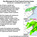
ALT Key Messages: 1. Areas of heavy rainfall will continue across portions of the Central Appalachians and Mid-Atlantic today, with localized flash and urban flooding possible. River flooding continues in western North Carolina. 2. Swells from Isaias will continue to affect much of the Gulf and Southeastern Atlantic coasts of the United States today. These swells are likely to cause life-threatening surf and rip current conditions. Please consult products from your local weather office. 3. A couple of tornadoes are possible today across the Piedmont and Coastal Plain of Virginia and North Carolina.

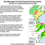
ALT Key Messages: 1. Heavy rainfall associated with Post-Tropical Cyclone Isaias will spread into the Central Appalachians and Mid-Atlantic on Sunday. Isolated flash and urban flooding will be possible. 2. Strong wind gusts continue to pose a threat across the southeastern United States today, particularly near the southern Appalachians. Scattered power outages and downed trees and power-lines may occur, with the risk highest in elevated terrain. 3. Swells from Isaias will continue to affect much of the Gulf and Southeastern Atlantic coasts of the United States, Mexico, and western Cuba this weekend. These swells are likely to cause life-threatening surf and rip current conditions. Please consult products from your local weather office. 4. A couple of tornadoes are possible today across the Piedmont and Coastal Plain of Virginia and North Carolina.

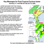
ALT Key Messages: 1. Heavy rainfall associated with Post-Tropical Cyclone Isaias will continue across the Southern Appalachians and Southeast tonight. Considerable flash and urban flooding will be possible. Landslides are also possible across the Southern Appalachians. 2. Strong wind gusts continue to pose a threat across the southeastern United States today, particularly near the southern Appalachians. Scattered power outages and downed trees and powerlines may occur, with the risk highest in elevated terrain. 3. Swells from Isaias will continue to affect much of the Gulf coasts of the United States, Mexico, and western Cuba this weekend. These swells are likely to cause life-threatening surf and rip current conditions. Please consult products from your local weather office. 4. A couple of tornadoes are possible tonight across eastern Georgia and the Carolinas.

ALT Key Messages: 1. Heavy rainfall associated with Post-Tropical Cyclone Isaias will continue across the Southern Appalachians and Southeast today. Considerable flash and urban flooding will be possible. Landslides are also possible across the Southern Appalachians. 2. Strong wind gusts continue to pose a threat across the southeastern United States today, particularly near the southern Appalachians. Scattered power outages and downed trees and powerlines may occur, with the risk highest in elevated terrain. 3. Swells from Isaias will continue to affect much of the Gulf coasts of the United States, Mexico, and western Cuba this weekend. These swells are likely to cause life-threatening surf and rip current conditions. Please consult products from your local weather office. 4. A couple of tornadoes are possible today across eastern Georgia and the Carolinas.

ALT Key Messages: 1. Heavy rainfall associated with post-tropical cyclone Isaias will continue across the Southern Appalachians and Southeast today. Considerable flash and urban flooding will be possible. Landslides are also possible across the Southern Appalachians. 2. Strong wind gusts continue to pose a threat across the southeastern United States today, including Georgia, the southern Appalachians, and extending west through much of central and northern Alabama, Mississippi, and Tennessee. Scattered power outages and downed trees and powerlines may occur, with the risk highest in elevated terrain. 3. Swells from Isaias will continue to affect much of the Gulf coasts of the United States, Mexico, and western Cuba this weekend. These swells are likely to cause life-threatening surf and rip current conditions. Please consult products from your local weather office. 4. A couple of tornadoes are possible today across eastern Georgia and the Carolinas.

ALT Key Messages: 1. Heavy rainfall associated with the post-tropical remnants of Isaias will be spreading quickly northward into the Tennessee Valley, Southern Appalachians and Southeast today. Considerable flash and urban flooding will be possible. Landslides are also possible across the Southern Appalachians. Additional heavy rains are possible across portions of Northwest Florida and heavy rains are also possible across coastal Southwest Florida, resulting in flash and urban flooding. 2. Post-storm safety: Follow advice of local officials and avoid areas of downed power lines and flooding. Ensure generators are properly ventilated and placed outside at least 20 feet away from dwellings and garages to avoid carbon monoxide poisoning. During clean up, be careful when using chainsaws and power tools. Drink plenty of water to avoid heat exhaustion.

ALT Mensajes clave: 1. Las fuertes lluvias asociadas con los remanentes postropicales de Isaias se propagarán rápidamente hacia el norte hacia el Valle de Tennessee, el sur de los Appalaches y el sureste hoy. Será posible que se produzcan inundaciones repentinas y urbanas. También es posible que se produzcan deslizamientos de tierra en el sur de los Appalaches. Es posible que lluvias fuertes adicionales se produzcan en partes del noroeste de Florida, así como en toda la costa del suroeste de Florida, lo que podría resultar en inundaciones repentinas y urbanas.