





Pinned Tweet
#Fiji is more than just #BeachIslands. It's also #Highlands.
Exactly a year ago, I began a #13days #GeoScience #trek through the #mountains of #Nadarivatu and #Ba starting at the #headwaters to study #rivers and #rocks. I worked with #villages and @ItaukeiAffairs @UNDP_Pacific


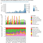
How the carbon footprint of air travel to UN climate conferences has increased 25-fold over three decades - emissions totalled 710,282 tonnes of CO2e-
This article quantifies the irony: nature.com/articles/s44458-0…
An increase of 2500% from the first conference. #PreCOP #COP #UNFCCC


“For the Pacific, 1.5°C to stay alive is not just a slogan… it is a lifeline”
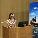
- Christina Stege, Climate Envoy of the Marshall Islands ahead of #preCOP
Christina Stege Climate Envoy of the Marshall Islands’ opening keynote at the @UniSouthPacific in the lead up to #preCOP #COP
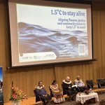
1.5°C to stay alive: Aligning finance, justice and community voices to keep 1.5°C in reach
Link to join and listen in here : events.humanitix.com/1-5-c-t…


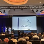
Recently presented our work on bridging environmental science into #EarthObservation and space technology at #IGARSS2026 in Washington DC and our visit to the #NASA Goddard Space Flight Center. Will use this learning experience to incorporate new satellite sensors into our work.


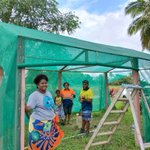
Our completed nursery construction in Nakaile Village, Tailevu working with the team from #YadravaNaVanua and Grandprize winners of the Space for Planet Earth Challenge from @SpaceBaseNZ


NicholasMetherall🏞🌌🛰️🌏🌳🚣🇦🇺🇲🇾🇹🇱🇵🇬🇫🇯 retweeted

🌊 Applications for the Floating University 2027 voyage are officially open!
🔬 Implemented by Earth Sciences New Zealand, the programme provides Pacific ECOP with hands-on experience in ocean science at sea.
👉 Apply here: bit.ly/4y8xnEP

NicholasMetherall🏞🌌🛰️🌏🌳🚣🇦🇺🇲🇾🇹🇱🇵🇬🇫🇯 retweeted
🌊 We’re taking the classroom to the ocean and inviting Pacific Early Career Ocean Professionals (ECOP) to come aboard! 🚢 You’ll join an important voyage into the Pacific aboard New Zealand’s flagship research vessel, Tangaroa.
▶️ bit.ly/4y8xnEP

Work and studies have gotten particularly these past years… It can be good to take a few days away from work to do your own projects. This was a mini carpentry project I did over a couple days recently to protect our storage from condensation and mold.
🪵🪓 🪚🔨🪛🪜⚒️
NicholasMetherall🏞🌌🛰️🌏🌳🚣🇦🇺🇲🇾🇹🇱🇵🇬🇫🇯 retweeted
SPC's DE Pacific team won 3rd place in the EO4SDG Mini-projects and the Earth at Risk image contest organised by the #IEEE Geoscience nd Remote Sensing Society by presenting a poster on the Mineral Resources Extraction Detection (MRED) Tool.
Read more: bit.ly/473Z2fw

NicholasMetherall🏞🌌🛰️🌏🌳🚣🇦🇺🇲🇾🇹🇱🇵🇬🇫🇯 retweeted

The @DEarthPacific is using LiDAR-trained deep-learning on Sentinel-2 to detect vegetation height/cover up to 30m height, 10m/pixel, scalable across all PICTS, for change monitoring, and unprecedented deforestation tracking, above-ground biomass, habitat/restoration planning.

NicholasMetherall🏞🌌🛰️🌏🌳🚣🇦🇺🇲🇾🇹🇱🇵🇬🇫🇯 retweeted
Want to know more about the MACBLUE GIS Workshop?
Hear from the participants who were out in the field & onsite during the workshop, which brought together participants from across Fiji for a week of hands-on training in mapping seagrass and mangrove ecosystems. #DEPacific
NicholasMetherall🏞🌌🛰️🌏🌳🚣🇦🇺🇲🇾🇹🇱🇵🇬🇫🇯 retweeted

Big thanks @nicholasmetherall for the love and support🙌
Super cool to see #QField, #QFieldCloud & #QGIS helping out in the field like this!
#Opensource only works because of awesome folks like you — if you use these tools, consider giving back too 💚
👉 github.com/sponsors/opengisc…

Working with communities and government partners in collecting GPS field data, we deeply appreciate and depend upon free and open-source software (@QFieldForQGIS @QFieldCloud @qgis) 🌏
I just sponsored opengisch. Go sponsor your open source dependencies! github.com/sponsors/opengisc…


Working with communities and government partners in collecting GPS field data, we deeply appreciate and depend upon free and open-source software (@QFieldForQGIS @QFieldCloud @qgis) 🌏
I just sponsored opengisch. Go sponsor your open source dependencies! github.com/sponsors/opengisc…
Upcoming #riparian #vegetation and #fluvial #geomorphology field survey coming up this October. Will be documenting the four day Fiji highland rivers trek for #ForestInventories, #biodiversity and #erosion #RiskAssessments and sharing results with villages.
Raica na veikau🌳⛰️

Sharing research results including #landcover, #deforestation and #mining maps and posters with communities who helped build them in Votua Village in Ba, Fiji.
These posters and resources will be used by the village community for land use and #NaturalResourceManagement planning.


NicholasMetherall🏞🌌🛰️🌏🌳🚣🇦🇺🇲🇾🇹🇱🇵🇬🇫🇯 retweeted
⏩ Read about how the Digital Earth Pacific (DEP) and MACBLUE projects, in collaboration with Pacific country and territory partners, are developing decision-ready DEP products to help map valuable coastal ecosystems: bit.ly/3WHRZCn
📖 Latest FNL: bit.ly/3Yz4y5d

NicholasMetherall🏞🌌🛰️🌏🌳🚣🇦🇺🇲🇾🇹🇱🇵🇬🇫🇯 retweeted
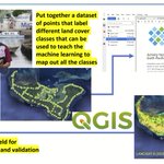
Part of Managing Coastal Aquifer Project, SPC facilitated a @DEarthPacific Land Cover Assessment and Skills Transfer in #Majuro supporting #RMI, #Palau and #Tuvalu through new capacity in applying machine learning techniques using field collected data for Earth Observations #EO


Majuro sunset - in front of the Waan Aelõñ in Majel (WAM) Sail Centre. Their program is committed to empowering young Marshallese by giving them the skills they need to move forward into a sustainable future. ⛵️ canoesmarshallislands.com/
@RmiR2r @MarshallIslandD @marshalleseB