
AK/ID/MT/ND #Wildfire🔥 data. NOT FOR SAFETY/EMERGENCY/EVACUATION PURPOSES; not affiliated with govt. RT/fav/follow!=endorse. Open source. See @FireUnofficial
Northern Rockies, USA
Joined September 2018
- Tweets1.2K
- Following2
- Followers101
- Likes0

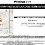
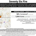

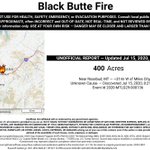


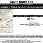
Wildfire Bot (AK/ID/MT/ND)-Unofficial 🔥🤖 retweeted

64% wanted navigational/road views, 36% for satellite. Therefore, the bots have been updated to show navigational/road views in the detailed maps in v3.7.0. Thanks for your input!

Do you prefer fire maps with a navigational view, or a satellite imagery view? Navigational views are clearer, but imagery views show where vegetation is. #gis #wildfires
64%Navigational/road view
36%Satellite/imagery view
47 votes • Final results Wildfire Bot (AK/ID/MT/ND)-Unofficial 🔥🤖 retweeted
Do you prefer fire maps with a navigational view, or a satellite imagery view? Navigational views are clearer, but imagery views show where vegetation is. #gis #wildfires
64%Navigational/road view
36%Satellite/imagery view
47 votes • Final results Wildfire Bot (AK/ID/MT/ND)-Unofficial 🔥🤖 retweeted
A request to fire agencies and media: Please put a Google Maps link, a lat/long, or similar when posting photos or news from a fire. It greatly helps people quickly understand where the fire is, especially for smaller fires that aren't in the nat'l databases.
Wildfire Bot (AK/ID/MT/ND)-Unofficial 🔥🤖 retweeted
The @USGS GeoMAC servers that the firebots rely on appear to be going down intermittently for the last ~half hour. When the govt data returns, the bots will automatically start posting again. Sorry - not much we can do.
Wildfire Bot (AK/ID/MT/ND)-Unofficial 🔥🤖 retweeted
The bots will be down for a day or two for some upgrades.
Wildfire Bot (AK/ID/MT/ND)-Unofficial 🔥🤖 retweeted
PSA: In general, satellite readings and perimeter data are not real-time. They are often at least 12 hours and sometimes many days old. Do not use them as an excuse not to evacuate.