

Official Twitter account for the National Weather Service in Great Falls, covering North Central and Southwest Montana. Details:https://xitter.cf/t.co/8WdJitPhmg
- Tweets50.2K
- Following184
- Followers14.5K
- Likes5.9K
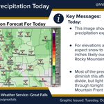



ALT Light Precipitation Today

ALT This graphic displays a special weather statement plotted on a map. The statement is in effect until 1:00 AM MDT. The statement includes Lakeview MT and Monida MT. A LINE OF SHOWERS AND THUNDERSTORMS WILL IMPACT SOUTHEASTERN BEAVERHEAD AND SOUTH CENTRAL MADISON COUNTIES UNTIL 1 AM MDT. The threats associated with this storm are wind gusts up to 30 MPH and no hail is expected. Seek shelter in a sturdy structure until the storm passes.

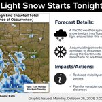
ALT Light Snow Starts Tonight

ALT Dense Fog Continues This Morning

ALT A Pacific weather system will bring light snow Monday night into Tuesday. Accumulating snow will mostly be confined to the mountains, especially along the divide and over SW MT. Plan for variable road conditions, particularly over the passes.

ALT Patchy dense fog will remain a concern through Monday morning and may expand in coverage tonight, especially along the divide, southwest Montana, and portions of the plains. Watch for highly variable visibility and slippery spots from frost deposition.

ALT Patchy dense fog will remain a concern for the remainder of the morning, especially along the divide and over the southwest valleys. Watch for highly variable visibility and slippery spots from frost deposition.

ALT Pacific weather systems will bring periods of light snow this week. The early week accumulating snow will mostly confined to the mountains, especially along the divide and over SW MT. Plan for variable road conditions, especially over the passes.


ALT Graphic showing temperatures for the week for select cities across North-central, Central, and Southwestern Montana. Most locations will see lows in the mid 20s this week and highs in the low to mid 40s this week.

ALT Gusty northwesterly winds continue and rain will change to snow at most locations by this evening. Watch for rapidly changing conditions including slippery roads and reduced visibility from snow, especially over mountain passes.

ALT Strong Winds Today

ALT A cold front dives southward and brings gusty northwesterly winds and a period of snow Friday afternoon and evening. Watch for rapidly changing conditions including slippery roads and reduced visibility from snow, especially over mountain passes.

ALT Three images show falling temperatures as time progresses on Friday. Most of the region will have the high temperature of the day occur during the morning.

ALT Strong Wind Gusts Possible Friday