

Official X account for the National Weather Service Duluth, MN. Details: https://xitter.cf/t.co/zdyadx9Kd9
- Tweets37.8K
- Following219
- Followers19.7K
- Likes3.4K






ALT A forecast graphic from the National Weather Service in Duluth, Minnesota, titled "Weather Outlook: Several rain chances into next weekend," issued October 27, 2026. Key text highlights: Today: Rain across the region, with mixed rain and snow along and north of the Iron Range during the morning. Wednesday: Another chance of rain with widespread totals of 0.25 to 0.50 inches, locally higher or lower, and a few possible thunderstorms. Weekend: Additional rain chances with temperatures gradually warming. Three line graphs span Tuesday, Oct 27 through Sunday, Nov 01: Regional Probability of Precipitation: Peaks at 76% Tuesday and 78% Wednesday night, drops near zero Thursday and Friday, and rises to 30% to 46% over the weekend. Regional Temperature Forecast: Highs range from the 40s to upper 50s, peaking at 59°F Wednesday and 58°F Sunday, with lows in the 30s. Regional Wind Gust Forecast: Gusts peak around 20 mph Tuesday and 17 mph Thursday, with wind arrows changing directions.

ALT A National Weather Service Duluth graphic titled Rain Tonight and Tuesday shows rainfall moving in late Monday afternoon, and lasting through most of Tuesday. The heaviest rain will fall across east-central Minnesota and northwest Wisconsin, where totals between 0.5 and 1 inch are forecast. Rainfall between 0.25 and 0.5 inches is expected across remaining areas south of the Iron Range, while the Iron Range and northward will receive 0.1 to 0.25 inches. An hourly precipitation table indicates the steadiest rain will occur overnight. A callout notes that slushy snowflakes may mix in across the Iron Range early Tuesday morning, with little to no accumulation expected.

ALT A graphic from the National Weather Service Duluth titled A Couple More Rounds of Rain outlines precipitation chances from Wednesday, October 28 through Saturday, October 31, 2026. A probability forecast table highlights two main periods of rain across the Northland. The first quick-moving system arrives Wednesday evening and continues into early Thursday morning, with precipitation probabilities peaking between 60 and 90 percent across most locations. A rumble of thunder is possible, with some areas seeing up to an additional half inch of rain. Mostly dry weather returns Thursday afternoon through Friday. Rain chances increase again from Saturday morning through Sunday, starting with slight chances during the day on Saturday and higher chances in the evening, when probabilities reach 20 to 50 percent across northeast Minnesota and northwest Wisconsin.

ALT A National Weather Service forecast graphic titled "Rain Tonight and Tuesday" with the subtitle "Heaviest rain in east-central Minnesota," covering 7 AM Monday to 1 AM Wednesday. Bullet points on the left note that rain moves in late Monday afternoon, continues into Tuesday before ending Tuesday night, and notes that the Iron Range could see a few snowflakes early Tuesday morning with little to no accumulation. A central table breaks down precipitation totals in 6-hour increments from Monday evening to Wednesday morning. A forecast map on the right displays rainfall totals shaded in green. The highest amounts of 0.5 to 1.0 inch are centered across east-central Minnesota and northwest Wisconsin, including Brainerd, Hinckley, Duluth, and Hayward. Surrounding areas, including Walker, Grand Rapids, Virginia, and Grand Marais, show 0.25 to 0.5 inch, while International Falls and Hurley indicate 0.1 to 0.25 inch. A callout points to northern Minnesota noting slushy snowflakes may mix in.

ALT A National Weather Service forecast graphic titled "Northland Weather Outlook" issued October 25, 2026, showing temperature and precipitation chances for northeast Minnesota and northwest Wisconsin from October 26 to October 30. Key bullet points state: cooler conditions today before warming to above normal; more rain expected through late overnight Tuesday; and a few flakes could mix in across the Iron Range early Tuesday morning. The left table lists Maximum Temperatures (°F) across 17 locations, showing highs mostly in the 40s on Monday, warming into the upper 50s and mid-60s Wednesday and Thursday, and remaining in the 50s on Friday. The right table lists Probability of Precipitation (%) in 6-hour blocks. Precipitation chances peak between 70% and 95% Monday night into Tuesday afternoon across most locations, taper off Tuesday night, and rise again to 50% to 85% Wednesday evening into Thursday morning.

ALT A graphic from the National Weather Service in Duluth, MN, titled "Northland Weather Outlook" on October 25, 2026 includes key messages: "Cooler Monday before warming to above normal once again," "More rain is expected early morning through late overnight Tuesday," and "Some in Iron Range could see a few flakes early Tuesday morning!" On the left, a "Maximum Temperature Forecast" from October 26 to 30 shows highs mostly in the 40s on Monday, warming to the 50s and 60s Wednesday, then dipping to the 50s and 60s Thursday and Friday. On the right, a "Probability of Precipitation Forecast" shows low percentages Monday, but high chances of rain (up to 100%) shifting from southwest to northeast early Tuesday, tapering off late Tuesday, with mostly low chances Wednesday and some low-to-medium chances Thursday.

ALT A multi-day forecast graphic titled "Early Week Outlook," issued by the National Weather Service Duluth, MN, on October 25, 2026, at 3:39 AM CDT. A subheader reads, "The next widespread rain arrives Tuesday (and maybe some slushy snowflakes too)". The background features a lake bordered by fall foliage in red, orange, and green.

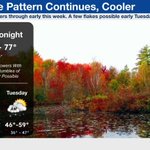
ALT Graphic from the National Weather Service Duluth, MN, titled Active Pattern Continues, Cooler, issued October 24, 2026. The subtitle notes more showers through early this week with a few flakes possible early Tuesday. Over a background of autumn trees with vibrant red and yellow foliage reflected in a pond, a forecast panel details the weather forecast through Tuesday. This afternoon and tonight features rain showers with a few rumbles of thunder possible, highs from 59 to 77 degrees, and lows from 31 to 46 degrees. Sunday shows shower chances across the far southern portions of the Northland with highs of 48 to 58 degrees and lows of 25 to 39 degrees. Monday brings more widespread rain chances with highs of 43 to 50 degrees and lows of 24 to 35 degrees. Tuesday features more rain and a few snowflakes chances early in the morning in the Iron Range and Borderlands with highs of 46 to 59 degrees and lows of 36 to 47 degrees.

ALT There is a picture of a dog trotting through a trail with fall leaves on the ground in the woods on the left of this graphic. On the right, there is a forecast graphic for today indicating showers. High and low temperature ranges are shown for the region. On the bottom right is a 3 day outlook, featuring Sunday, Monday, and Tuesday with a 20 percent chance of showers Sunday, a 30 percent chance Monday, and rain likely Tuesday. Highs today in the 60s and 70s, lows tonight in the 30s and 40s. Temperatures cool down starting Monday with highs in the 40s and 50s, lows below to around freezing. Highs mainly in the 40s Monday and similar lows in the 20s and 30s. On Tuesday, highs around 43 to 53 and lows 32 to 42.

ALT Graphic titled "Northland 4-Day Forecast" from the National Weather Service in Duluth, MN, updated at 4:03 PM CDT, with a background of autumn leaves. Four line-graph panels display weather metrics from Friday 6 PM through Tuesday 10 PM. "Probability of Precipitation (%)": Ranges from 4% to 50% (peaking Saturday afternoon). "Maximum Wind Gust (mph) & Wind Direction": Gusts range from 12 mph to 28 mph with directional arrows. "Temperature (°F)": Highs reach 66°F on Saturday afternoon, dropping to lows around 34°F by early Tuesday morning. "Sky Cover (%)": Ranges from 47% to 92%. A text box notes: "Find the forecast for your location at weather.gov/forecastpoints."

ALT NWS Duluth graphic issued October 23, 2026, at 4:28 AM CDT titled "Dense Fog This Morning." Left side shows a lit lighthouse on a cliff at twilight above a callout box. Box text states: "Dense fog is affecting parts of the area this morning. A Dense Fog Advisory has been issued for counties in Northeast Minnesota & Northwest Wisconsin near Lake Superior. Use low-beam headlights and allow for extra stopping distance if you encounter any fog." Right side displays a regional map labeled "Visibility in miles at 4:30AM" showing dense fog shaded gray near Lake Superior under a Dense Fog Advisory hazard. Numerical visibility readings near the lake range from 0.04 to 0.39 miles in places like Duluth and Carlton, while inland visibilities range up to 10 miles. Bottom banner includes NOAA and NWS Duluth logos alongside weather.gov/duluth.

ALT Three central bullet points state: Warm temperatures continue today and tomorrow. Rain chances return this afternoon across our west and spreads across the region for Saturday. Temperatures cool closer to normal to finish out the weekend into next week. Left table ("Maximum Temperature (°F) Forecast"): Displays forecasted high temperatures from Fri 10/23 through Tue 10/27 for 17 cities in MN and WI. Highs Fri–Sat range from 55°F to 75°F. Sunday through Tuesday high temperatures cool significantly, ranging from 42°F to 58°F. Right table ("Probability of Precipitation (%) Forecast"): Displays precipitation probabilities in 3-hour intervals for Fri 10/23, Sat 10/24, and Sun 10/25. Rain chances build Friday afternoon/evening up to 65% in Walker and 40% in Brainerd, Grand Rapids, and Hibbing. Saturday precipitation chances peak up to 40% region-wide before tapering off Saturday night and Sunday morning.

ALT An informational weather graphic from the National Weather Service Duluth, MN titled "Dense Fog Tonight". Text states that dense fog will expand again tonight, advising drivers to use low-beam headlights and allow extra stopping distance. A map of northeast Minnesota and northwest Wisconsin shows a Dense Fog Advisory in effect this evening until 10 AM Friday for shaded counties. A yellow circle on the map highlights the South Shore area (including Port Wing, Ashland, and Hurley), noting additional dense fog is possible there tonight. The left side of the graphic displays four traffic and web camera images showing extremely low visibility due to thick fog: Blatnik Approach in Superior, I-35 at Midway Rd, Duluth Canal Cam, and Allouez Bay Wisconsin Point.

ALT Infographic titled "Northland 4-Day Forecast" from National Weather Service Duluth, MN, displaying four timeline charts from Thursday evening to Monday night: Probability of Precipitation (%): Low overall, starting under 10% Thursday/Friday morning, rising to 29% Friday night, peaking at 41% Saturday afternoon, then dropping below 20% Sunday through Monday. Maximum Wind Gust (mph) & Direction: Winds 11 to 14 mph Thursday/Friday morning, increasing to 21-26 mph Friday night, peaking at 28 mph Saturday morning, then decreasing to 11-18 mph Sunday and Monday. Wind direction shifts from southerly to northwesterly. Temperature (°F): Highs around 67°F on Friday and Saturday afternoon. Lows drop to around 42°F Saturday night/Sunday morning. Sunday high is near 51°F, Monday high near 45°F, with Monday morning low near 36°F. Sky Cover (%): Variable cloudiness between 33% and 88%, remaining mostly cloudy Friday through Monday. Graphic directs to weather.gov/forecastpoints

ALT The graphic features three main bullet points in the center: Warm temperatures continue through the rest of the work week Rain chances return late Friday into the weekend Temperatures cool closer to normal to finish out the weekend into next week Left table ("Maximum Temperature (°F) Forecast"): Shows high temperatures from Thursday 10/22 to Monday 10/26 for 17 regional locations. Highs Thursday and Friday range from 55°F to 76°F. Saturday remains warm (60°F–73°F). Sunday and Monday cool significantly, with highs ranging from 47°F to 58°F on Sunday and 42°F to 48°F on Monday. Right table ("Average Probability of Precipitation (%) Forecast"): Displays precipitation chances in 6-hour intervals for Fri 10/23, Sat 10/24, and Sun 10/25. Friday stays mostly dry until 6 PM when chances reach 20–50% in western/northern areas. Saturday rain chances range from 5% to 40%. Sunday chances decrease to 0–30%

ALT Graphic by National Weather Service Duluth, MN titled "Rain Chances on Friday into the Weekend" updated at 3:46 PM CDT. The background shows a wooden boardwalk near a lake and trees. Tonight: Clear, areas of fog likely especially in NW WI, Low 32 to 42 degrees. Thursday: Mostly sunny to sunny skies, Potential for increased cloud cover near Lake Superior, High 64 to 72, Low 41 to 51 Thu night into Friday morning. Friday: Best chance for afternoon rain in north-central MN with lesser chances farther east, High 65 to 74, Low 49 to 59 Friday night into Saturday morning. Saturday: Partly to mostly cloudy, Chance of rain, High 66 to 73, Low 35 to 51 Saturday night into Sunday morning. A note states: High Temps will be around 5-10 degrees cooler near the North Shore Thu-Sat.

ALT The graphic displays two main data tables separated by three bullet points: Warm temperatures continue through the rest of the work week. Rain chances return late Friday into the weekend. Temperatures cool closer to normal to close out the weekend into next week. Left table ("Maximum Temperature (°F) Forecast"): Displays forecasted high temperatures from Wednesday 10/21 through Sunday 10/25 for 17 cities across MN and WI. Highs for Wed–Sat range mostly from 53°F to 72°F. Sunday temperatures cool significantly across all locations, ranging from 47°F (International Falls) to 58°F (Ashland). Right table ("Probability of Precipitation (%) Forecast"): Displays precipitation chances in 6-hour increments for Fri 10/23, Sat 10/24, and Sun 10/25. Friday remains mostly dry (0–5%) until 6pm when chances increase up to 50% in Walker. Saturday precipitation chances range between 5% and 70% (peaking at 70% in International Falls at 12am Sat). Sunday chances decrease to 5–40%

ALT An infographic titled "2026-2027 Winter Outlook" from the National Weather Service Duluth. Text highlights state the outlook favors above-normal temperatures and equal chances for above, below, or near-normal precipitation across the Northland, noting snowfall may be below normal. Two Climate Prediction Center maps for December 2026 through February 2027 show: Seasonal Temperature Outlook: A 50% to 60% probability leaning toward above-normal temperatures across northeast Minnesota and northwest Wisconsin. Seasonal Precipitation Outlook: Equal chances across most of the region, with a 33% to 40% lean toward below-normal precipitation across the northwest Wisconsin snowbelts. A chart for Duluth, Minnesota (normal low 4°F, high 22°F, precipitation 2.99 inches) shows: Temperature Probability: 58% above normal, 33% near normal, 9% below normal. Precipitation Probability: 33% below normal, 34% near normal, 33% above normal. Timestamp: Issued Tuesday, October 20, 2026 at 9:05 PM.

ALT Weather forecast infographic from the National Weather Service Duluth, MN, dated October 20, 2026, titled Warm and Dry, Weekend Rain Chances, with cooler temperatures into next week. Key highlights note that warm temperatures continue through the rest of the work week, rain chances return late Friday into the weekend, and temperatures cool closer to normal to close out the weekend into next week. Maximum temperatures from Wednesday, October 21 through Saturday, October 24 range from the mid-50s to low 70s across northeastern Minnesota and northwestern Wisconsin, before dropping on Sunday, October 25 into the upper 40s and 50s. Precipitation probabilities indicate dry weather through Friday morning, followed by rain chances developing Friday evening, peaking Saturday, and decreasing through Sunday.

ALT NWS Duluth forecast graphic updated October 20th at 3:57 AM CDT. The left side features a low-angle photo looking up at bright yellow fall tree foliage against a blue sky, credited to Sarah Lovejoy, with the NWS Duluth logo in the bottom left. The right side reads "Today, October 20th" showing a sun and cloud icon with "Highs: 55-68 °F" and text stating "Mostly clear skies. Winds out of the south gusting to 20 mph in the afternoon". Subtext notes: "Expect high temps to be coolest along the North Shore". Below is a 4-day forecast with icons and high/low temps: WED (partly cloudy, 59-69°), THU (partly cloudy, 55-70°, low 34-43°), FRI (rain cloud icon, "Rain Chances Cent/N.Cent MN", 57-68°, low 40-51°), and SAT (rain cloud icon, "Rain Chances Spread E in the afternoon", 59-70°, low 48-56°).

ALT A National Weather Service Duluth graphic providing a forecast for Tonight, October 19th, and the remainder of the workweek. For tonight, expect mostly clear skies, light winds, and lows between 31 and 40 degrees. A note states to expect high temperatures to be coolest along the North Shore this week. The forecast for Tuesday through Thursday shows partly cloudy skies with highs warming from 52-65 degrees on Tuesday to 59-71 degrees on Wednesday, and 55-70 degrees on Thursday. Lows will be in the mid-30s to low-50s. On Friday, mostly cloudy skies bring rain chances to central and north-central Minnesota, with highs of 57-68 degrees. The background features a scenic photo of autumn trees near a lake, credited to Ann Johnson.