

MU Meteorology Alum 2025 | Meteorologist | @accuweather Meteorologist | 1🌪| 9 🌌| Packers Fan! | Opinions my own
State College, PA
Joined March 2021
- Tweets14.6K
- Following1K
- Followers2.4K
- Likes27.7K




It could get interesting in Minnesota today with a conditional threat of tornadoes. There is plenty of DLS and long curved hodographs (SRH). The issue is can enough instability reach the area at the right time to produce supercells & bowing segments. A strong tornado is possible.


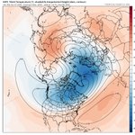
PV is stretching and can send a shot of cooler air to the US toward the end of November, with other players like NAO/AO going negative. However, it seems that the bulk of the cold goes to Europe. The PV should become strong at the end of November & stay that way till late winter.


Peyton Simmers retweeted

Very Severe Cyclonic Storm Arnab (top) will make landfall in India Wednesday. Typhoon In-Fa (bottom) will pass over the Mariana Islands Friday night, their 4th typhoon this season.
Cyclone Arnab is small but powerful as conditions are beginning to go downhill in portions of eastern India. Damaging winds, storm surge, power outages, flooding rains, and isolated tornadoes are likely as Arnab comes ashore.

Cyclone Arnab is a severe cyclonic storm and seems to have stabilized a CDO and working to clear the eye out. Additional strengthening is expected. Arnab will bring damaging winds, flooding rains, storm surge, and perhaps a couple of isolated tornadoes to Eastern India.

Cyclone Arnab is getting its act together quickly as it heads towards eastern India. Arnab is clearing an eye and trying to get the CDO established. This storm will continue to gain strength before landfall in India.

Between Sept. 19-Oct. 19 the EPAC gained around 164.2 ACE, which is more than an average Atlantic Season. Every storm since Hurricane Nolo has been a major with Hurricane Vance being the latest. This is how Super El Niño and a +PMM team up to produce a supercharged year!


A tropical depression in the Bay of Bengal is going to strengthen into a Very Severe Cyclonic Storm as it heads towards India. This tropical cyclone will get well into hurricane-equivalent strength. The name will be Arnab.

A positive East Asian Mountain Torque (+EAMT) and could setup early November and then extend the Pacific Jet only a few days later. This can negate the effects of the SPV disruption in the eastern US. The eastern US does not look cold at the moment.


Peyton Simmers retweeted

WOW! Kelvin-Helmholtz clouds seen earlier this year from Elmira, New York. These rare clouds form on windy days when two different layers of air move at different speeds. Photo courtesy of Alexis Stoner. #NYwx

I remain skeptical that this SWE with a stretch of the SPV is a potent as models say. The QBO is strengthening and this would be the earliest on record. The eastern US does not look cold out of this. Some chilly nights but not true cold. The SPV should get strong late November.


Peyton Simmers retweeted

🛰️ Storm Austen captured from space today
The swirl of cloud marks the eye of the storm as it sweeps across southern parts of the UK in today's satellite imagery
This puts into perspective on how quiet the Atlantic Hurricane Season has been with only 19.5 ACE. There have been 15 hurricanes/typhoons that have exceeded that. It just goes to show how El Niño has helped the Pacific produce long-tracked TCs and kept the Atlantic shut down.

A tropical cyclone is likely to form in the Bay of Bengal over the next few days and can track towards eastern India. Wind shear will be lighter with high SSTs. Some models are very aggressive (GDMI) with intensity. A hurricane equivalent cyclone is not out of the question.


Peyton Simmers retweeted
A powerful magnitude 7.0 earthquake struck northern Tibet, China, late Thursday, shaking a remote, mountainous region where communities sit at some of the highest elevations on Earth. bit.ly/488B6GO


