

📌🌐Putting Africa on the Map! Offices in 🇰🇪🇺🇬..Aerial and Land Surveys, Online GIS, Mapping.
Nairobi, Kenya
Joined August 2016
- Tweets974
- Following290
- Followers1.9K
- Likes681





Meet Josephine! 🌟 For nearly 20 years, her passion for GIS, LiDAR, and aviation mapping has shaped our work and driven real impact across the geospatial industry.
Thank you for helping us continue Putting Africa on the Map! 🗺️✨
#FeatureFriday #RamaniGeosystems #WomenInSTEM

1
57
Wrong answers only!
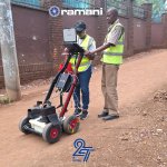
What is our team scanning for with the GPR system today?
A) Rebar & utilities
B) Buried treasure
C) Dinosaur fossils
D) The lost city of Atlantis
Drop your best guesses below! 👇

1
48
Honouring the courage, sacrifice, and resilience of those who shaped our past, and celebrating those building our future.
"Heroism isn’t only found in history books, it lives in everyday acts of courage and kindness." Shoutout to the everyday shujaa making Kenya a better place.
31
As we celebrate 27 years we want to take a moment to say a huge THANK YOU to all our incredible clients, partners, and team members.
Every project, every milestone, and every step of this journey has been possible because of you#27Years #Anniversary #TeamWork

51

To all our Esteemed Clients, Happy Customer Service Week. It is our absolute delight to always go #TheExtraMile for you.
44
Ramani Geosystems retweeted
Your trust inspires us to go the extra mile. 💙
To every client, past and present thank you.
Every point matters. Every client matters. We go the extra mile for both.
#CustomerServiceWeek #TheExtraMile #RamaniGeosystem
Your trust inspires us to go the extra mile. 💙
To every client, past and present thank you.
Every point matters. Every client matters. We go the extra mile for both.
#CustomerServiceWeek #TheExtraMile #RamaniGeosystem
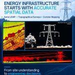
Before ground breaks, precision terrain data is everything. 🌍⚡
For major projects like Dangote’s Lamu refinery, @RamaniGeosystems delivers aerial LiDAR, 3D point clouds, and topographical surveys for energy infrastructure.
📩 [email protected]
#AerialLiDAR #Lamu


Meet Eva, our #FeatureFriday star & birthday girl! 🎉
As a photogrammetrist, Eva brings skill and dedication to every GIS dataset at Ramani. Today, we celebrate her hard work and wonderful spirit.
Happy Birthday, Eva! 💙
#HappyBirthdayEva #TeamRamani #GIS #Photogrammetry

2
169
No boardrooms. No formal introductions. Just a shared meal on the ground and stories exchanged after a long day of surveying.
These behind-the-scenes moments don't show up on a map, but they make the work possible. 🌍🍲
#PuttingAfricaOnTheMap

𝗪𝗵𝗲𝗻 𝘁𝗵𝗲 𝘀𝗸𝘆 𝗼𝗽𝗲𝗻𝘀 𝘂𝗽, 𝗽𝗿𝗶𝗼𝗿𝗶𝘁𝗶𝗲𝘀 𝗴𝗲𝘁 𝗿𝗲𝗮𝗹!
When surprise rain hit, our pilot turned human shield for our survey drone.
Gear stays safe
Data stays reliable
Free shower for the team!
That’s true 𝗗𝗿𝗼𝗻𝗲 𝗦𝗲𝗿𝘃𝗶𝗰𝗲𝘀 dedication. 😎


Surveying across vast waters?Earth curvature & refraction distort long levels
We use Reciprocal Leveling:
1️⃣ Simultaneous sights from opposite shores
2️⃣ Errors affect both readings identically
3️⃣ Averaging cancels environmental & instrument errors
Contact us:[email protected]

Cold mornings. Cool results. Unmatched dedication. 🧭✨
Celebrating our field surveyors @mnyamori and @NJERIKIARIE, Msc who go above and beyond every single day to put Africa on the map.
📩 [email protected]
#LandSurveying #Dedication #RamaniGeospatial #FieldSurvey

Road corridor mapping is essential for smart infrastructure planning. By combining drone mapping with rigorous ground control points, we deliver ultra-precise data that saves time, reduces costs, and keeps development moving smoothly.
Drop us a line at [email protected].

1
87
Smooth waters, complex data. Our field crew utilizing an unmanned surface vessel (USV) paired with high-precision GPS to capture accurate underwater bed profiles. At Ramani Geosystems, we provide the insights you need above and below the waterline.
Contact us: [email protected]

Managing roads without data is dangerous.
Smart road inventory using Ramani GV360 makes all the difference by helping:
💰Save millions with proactive repairs
🛑Fix missing signs/guardrails before accidents
📊Direct funds using geospatial data
📝Create a database for easy audit
2
85
A single buried cable can stop a project in its tracks.
Our GPR and EZiCAT technology helps detect underground utilities before excavation begins saving time, money, and unnecessary risk.
Detection depths of up to 4m may be achieved under favorable ground conditions.
#GPR

