Light snow continues to fall across the Cascades and the Siskiyous this morning. Not expecting any travel related issues. Here are the Crater Lake Steel Visitor Center and Mt. Ashland Lodge webcams.
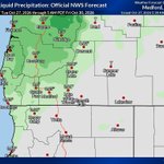
Updated precipitation estimates from now through early morning on Friday. These are from the NWS in Medford.
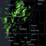
Radar returns are picking up on showers moving inland this morning. Here is a look at where they are currently focused.
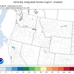
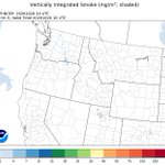
Regional Air Quality and Upper Level Smoke Mapping 10/27/26 6 AM
The first graphic shows the HRRR smoke modeling of upper level smoke and where it will be positioned by later this afternoon. The second graphic indicates the current air quality levels.
Highs today will remain below normal for this time of year. Most areas will be around 10-15 degrees below normal. Here is a look at the latest GFS model run projections.
We remain under a trough this morning with the potential for more lighter rainfall along the coast and inland locations later this afternoon. The low will continue to track east. Snow levels remain around 5,000 feet in elevation.
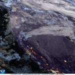
Satellite imagery this afternoon shows a few showers still across portions of the region. We are under a trough right now which will keep clouds and showers in place into tomorrow. The ridge rebuilds from Wednesday into most of Thursday with drier conditions inland.
RyanWeather.Com retweeted
Periods of heavy precipitation and high elevation snow are possible across parts of Northern California and the Pacific Northwest next week due to an approaching mid-level low pressure system. Coastal high winds and localized flooding are also possible within the risk areas.

ALT The Climate Prediction Center 8-14 Day Hazards Outlook released October 26, 2026 for the period of November 3 to 9, 2026 indicates a moderate risk (40 to 60 percent chance) of heavy precipitation for portions of southwestern Oregon and northwestern California November 6 to 8, and a moderate risk of heavy snow for portions of the northern Sierra Nevada and southern Cascades Nov 6 to 8. Slight risk (20 to 40 percent chance) of heavy precipitation is posted for portions of the Pacific Northwest and Northern California Nov 5 to 9, along with slight risks of heavy snow for the Cascades, Klamath and northern Sierra Nevada ranges Nov 5 to 9.
We could see light snowfall develop later in the week across portions of our region. Here is the NWS Medford snowfall forecast for higher elevations mainly above 5000 ft.
Regional Air Quality and Upper Level Smoke Mapping 10/26/26 6 AM
The first graphic shows the HRRR smoke modeling of upper level smoke and where it will be positioned by later this afternoon. The second graphic indicates the current air quality levels.
Here are the latest 24 hour observed precipitation amounts across the region. Some areas sold some healthy amounts from this last system.
Another cool day is in store for the region as we remain under a trough and cooler air filters in behind the cold front. Highs will trend below normal based off the GFS model run.
The cold front has moved well inland and east of the area overnight. We are still seeing some lighter shower activity develop this morning.
The cold front is progressing inland this evening. Here is a look at where it is tracking as of 6 PM this evening.
Radar is picking up on the outer edge of the bands of precipitation as they gradually track inland this afternoon. This is slowly progressing to the southeast.
RyanWeather.Com retweeted
An incoming front will bring precipitation across the region from west to east through tomorrow. Higher elevations are now expecting snowfall but amounts are relatively low for these areas. Rainfall chances continue most of this upcoming week due to an active pattern.