

Fusing artificial intelligence with satellite imagery to protect infrastructure and tackle climate change
Joined March 2019
- Tweets110
- Following74
- Followers74
- Likes28






Spacept retweeted

Experts have already raised the alarm about rising ocean levels. The town of Atafona is a perfect example of what could go wrong, explain @andrespigariol and Clara Hübinger, a scientist at @SpaceptAI. brazilian.report/environment…
Spacept retweeted

"On a geological timescale, we are this flimsy presence... we have to stick together as a human family to make sure we are a permanent presence on this planet and not just this blink of an eye."
- @AstroSamantha
📷 Our #WeekInImages 7-11 February 2022 👉esa.int/About_Us/Week_in_ima…


Spacept retweeted
AI Stories Episode 2 is Live !
What if we could prevent wildfires in California and everywhere else?
Spacept retweeted
That's also an opportunity to highlights greats startups operating in this space 😊
@LiveEO_space
@Preligens
@SpaceptAI
@tbotix
#Tesselo
Spacept retweeted

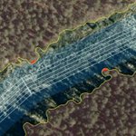
Identifying areas of high risk vegetation encroachment on power lines from satellite imagery #vegetationmanagement #geospatial @SpaceptAI geospatial.blogs.com/geospat…


Spacept retweeted

Our partner, @SpaceptAI has launched their Tree Detection and Height From Shadow algorithm on UP42! 🌲
The algorithm detects forests down to individual trees and computes its height based on its adjacent shadow length.
Try it out today: marketplace.up42.com/block/f…
