

Evening Meteorologist at KMTV @3NewsNowOmaha in Omaha, NE | Weather & Climate are my passion | Proud @Mizzou grad 🐯
- Tweets16.7K
- Following964
- Followers2.2K
- Likes6.5K
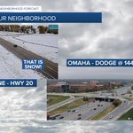










ALT Nebraska DOT traffic camera showing slushy ice on the road near Columbus, NE

ALT Map showing flood watch in effect through Monday. Bullets to the left of the map: Key Messages: Several consecutive days of forecast high temperatures ranging from the upper 40s to mid 60s suggest breakup and movement of river ice is imminent. This will lead to an increasing threat of ice jams, especially along the Platte, Elkhorn, and Loup Rivers. A Flood Watch is in effect for these rivers. The threat will continue into early next week or until rivers become ice-free. Those with interests along area rivers, especially in low-lying areas, should remain vigilant to the potential for rapidly rising water. A forecast confidence slider indicates high confidence in the forecast.


ALT Graphic showing how these funnels form. These funnels are usually very brief, rarely cause any damage, and nearly impossible to detect on radar. If one were to reach the ground, it could produce winds over 50 mph and minor damage. Take cover if one approaches your location. Please contact the National Weather Service if you observe a rotating funnel cloud or if one touches down as a tornado.


