

UARK Alumni 🐗 | Christ follower | Owner of @225Weather | Asperger’s is my super power! | Isaiah 6:8 | https://nitter.gq/t.co/KICNuIVGWy | Covering parts of AR, MO, OK 24/7
Dallas, TX ⏩ Fayetteville, AR
Joined April 2021
- Tweets7.3K
- Following433
- Followers411
- Likes10.8K






👋Good evening y’all!
.
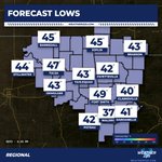
Here’s a look at tonight’s forecasted lows across the region!
.
Weather225.com
#arwx #mowx #okwx

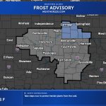
A Frost Advisory has been issued for Grant, Kay, Garfield, and Noble Counties from 4 AM to 8 AM CST Sat. Temps near 36F may form frost, which can harm sensitive outdoor vegetation; cover plants if possible.

⛈️ Here’s a look at the 24 hour rain totals map!
.
As mentioned yesterday, unfortunately not everyone was going to see rain from this system. Oklahoma received the most rain activity yesterday with totals between 0.10” to 0.57”.
.
📺 Weather225.com
#arwx #okwx #mowx

Freeze Warning issued for portions of south central, southwest, and west central IL and central, east central, northeast, and southeast MO. From midnight tonight to 8 AM CST Sat, temps may drop to 30F, risking frost/freeze damage to crops and unprotected outdoor plumbing.

A Frost Advisory has been issued for Bourbon, Crawford, Cherokee & Others in MO and KS from midnight tonight to 8 AM CST Saturday. Temps in the lower 30s may cause frost; cover sensitive plants to prevent damage.

7 PM Radar Update (11/5/2026) | Scattered showers continue to move across parts of the region this evening, especially in our Oklahoma coverage area.
.
Track the activity here: weather225.com/weather-maps/
#arwx #okwx #mowx

👋Good day y’all!
.
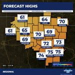
Here’s a look at the forecasted highs for this afternoon across the region!
.
Weather225.com
#arwx #okwx #mowx


📌 3 smaller earthquakes occurred just a short time ago between 6:48 PM and 7:15 PM in Meno, Oklahoma west of Enid.
.
The strongest of the 3 this evening was a 3.6 that occurred at 6:48 PM.
.
Did you feel it? Comment below👇
#earthquake #oklahoma #okwx


📡 5:55 PM Radar update (11/3/2026)
.
Some isolated showers are currently moving through parts of Northwest Arkansas this evening. Some light to moderate rainfall will be possible with this activity.
.
Track the activity on our app or here: weather225.com/weather-maps/
#arwx #mowx

Good day y'all! #Razorback basketball starts tonight in #Fayetteville! If you're headed to the game tonight here is your evening forecast planner!
.
Weather225.com
#arwx #weather

Special Weather Statement is in effect for Conway, Southern Pope County, Pope County Higher Elevations, Van Buren County Higher Elevations, and Yell Excluding Northwest through 10:15 AM. A radar-tracked strong thunderstorm near Galla Creek WMA may bring wind gusts up to 50 mph.

Training thunderstorms are bringing a corridor of heavy rain from northeast Texas into the Ozarks of north-central Arkansas this morning.

Special Weather Statement has been issued for Benton and Washington Counties and is valid from 2:48 AM to 3:15 AM. Radar-indicated strong thunderstorms may bring wind gusts up to 40 mph, with gusty winds possibly knocking down small limbs and blowing unsecured objects.

Tornado Warning has been issued for southwestern Washington County in northwestern Arkansas and southeastern Adair County in northeastern Oklahoma, valid from 2:23 AM through 3:15 AM CST. Radar indicated rotation near Stilwell moving NE at 25 mph; take cover now.

A Tornado Warning remains in effect for Crawford and Washington counties in Arkansas until 3:00 AM. A confirmed tornado is near Natural Dam moving NE at 45 mph; take cover now as damaging debris and possible mobile home and roof damage threaten.

A Special Weather Statement has been issued for Benton, Washington, Northern Crawford, Adair, Northern Sequoyah. Expires Tuesday, 11/3/26 at 2:45 AM | Hail: 0.0 inches | Wind: 40 MPH

A Tornado Warning has been issued for Crawford, AR, Washington, AR. | Max Hail: 0.0 inches | Expires Tuesday, 11/3/26 at 3 AM. Take shelter immediately!

