

Raleigh, NC -- Meteorology, NCSU 16'
Raleigh, NC
Joined May 2010
- Tweets13.5K
- Following1.5K
- Followers2.8K
- Likes37.3K
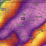


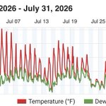


Meteorologists on twitter in shambles because they'll actually have to use meteorology again to forecast, instead of posting straight model data with a "Not a Forecast" disclaimer
We live-streamed (on Periscope & Facebook) a zero meter on a mile wide wedge in Albany, GA in 2017, before it was cool


Ground stop at RDU continues. The IAH-RDU flight I'm on boarded, deplaned, got delayed, boarded again, took off, diverted to ATL, tried leaving again, went back to gate, and now we are deplaning in ATL. No ETA on arrival, I bet the flight gets cancelled

Flights at RDU may be delayed today (Monday, Oct. 12) as crews work to repair a utility issue. Be sure to check your flight status on your airline's mobile app or RDU.com if you're traveling today.

ALT The image shows RDU's Terminal 2 concourse C, with travelers seated and standing. A large digital flight information board displays arrival details. The terminal has high ceilings and large windows, allowing natural light to illuminate the space.
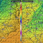
39 hour forecast from the RRFS vs the RTMA analysis. Temps in the CAD area are 5-7 degrees cooler than the forecast #ncwx


FYI 24mb in 24 hours is normalized to 60°N. The further S you go, the lower the pressure drop has to be for it to be considered explosive development.
While #Polo is not a mid latitude cyclone, a 7-8mb drop in 24 hours at 15N is considered "explosive"
arctic.som.ou.edu/tburg/prod…


Just to put into perspective with other Meteorological weather system, mid-latitude cyclones can get the term "bombogenesis" for a storm system that deepens 24 mb in 24 hours. Think of strong snow storms or Nor'easters and such.
While hurricanes are different in mechanisms, but for a storm to drop 75 mb in 24 hours, it's more on the comparison to a nuke. Bonkers.


@WxFront is truly a game changing app. During the second half of my Chasecation - a 9 day period - my screentime on WeatherFront was almost 37 hours 😳.
Chasing with a laptop is so last year


I'm the weatherman, whatever man retweeted
@WxFront is truly a game changing app. During the second half of my Chasecation - a 9 day period - my screentime on WeatherFront was almost 37 hours 😳.
Chasing with a laptop is so last year

