

Follow for more! Severe Weather Intelligence. High-res radar, AI predictions & forecasts, and predictive models. Available on iOS, Android & Web.
Stay safe →
Joined December 2024
- Tweets279
- Following135
- Followers1.1K
- Likes868




Pinned Tweet
The ZoneWatch Damaging Wind Risk Model offers a highly accurate dynamically updating risk assessment many hours ahead for severe convective wind threats. By analyzing real time radar signatures and environmental kinematics the algorithm effectively isolates corridors of peak momentum transfer to the surface.
Ground Truth Verification looking at the provided storm report map by the SPC shows the dense clustering of severe wind reports the blue data points shows a strong spatial correlation with the predictive footprint of the model. This maximizes the probability of detection while reducing the false alarm ratio for mesoscale wind threats marking a meaningful advancement in feature specific operational meteorology.
Now out on the web platform ---> Severe Weather Risk Assessment Models


ZoneWatch retweeted

SEVERE WEATHER OUTBREAK ROUND 2:
Good Morning, Thursday October 22nd, 2026 at approximately 9:55am PT.
Discussion: The same potent Pacific low responsible for Wednesday’s severe storms, including a potentially violent tornado, widespread large hail, and damaging winds, is moving across the Southwest and Great Basin today. This will shift the strongest activity eastward before much drier air arrives Friday. Southern California will continue to experience showers and isolated thunderstorms through tonight and into Friday morning, with localized street flooding, debris flows near vulnerable burn scars, damaging wind gusts, and a brief tornado still possible around Los Angeles and Ventura counties. Meanwhile, mountain slopes facing the deserts farther southeast could experience wind gusts of 45 to 55 mph today.
Arizona’s greatest severe weather threat shifts from northern Maricopa County this morning into eastern Arizona this afternoon, where rotating thunderstorms could produce hail measuring 1 to 2 inches in diameter, damaging winds, and a few tornadoes. Additional heavy downpours will increase flash flooding concerns, especially over already saturated ground and within normally dry washes. Heavy rain and thunderstorms will keep southern and central Utah at risk for flash flooding through early Friday, while eastern Nevada could experience severe thunderstorms today before colder air lowers snow levels to between 6,000 and 7,000 feet early Friday. Rain will spread into eastern Washington and northern Idaho this afternoon through early Friday, followed by wind gusts of 40 to 50 mph, blowing dust, and increased fire danger across portions of central Washington. Meanwhile, temperatures dropping near freezing could threaten sensitive plants across western Oregon on Friday and Saturday mornings, while western Washington remains mostly dry.
Stay tuned for many more updates as our severe weather coverage continues across the region. Additional alerts, notices, and Insider updates are on the way, including a detailed Halloween forecast breakdown. A comprehensive storm report covering the severe weather, significant impacts, and notable events will also be released once this system moves out of the forecast region.


ZoneWatch retweeted
UPDATE: 7:15PM MST: An impressive display of intense supercellular thunderstorms continue across central and eastern Arizona this evening, with several powerful cells producing frequent lightning, large hail and damaging winds. Most notably, a well defined hook echo is visible near Forest Lakes, AZ, raising serious concerns for strong storm rotation and the potential for a tornado.
The main areas of concern include Payson, Forest Lakes, Heber, Show Low, Pinetop Lakeside and surrounding communities, where storms could produce hail exceeding 1.5 inches, damaging winds over 60 mph and localized flooding. This event is far from over, with additional rounds of strong to severe thunderstorms possible through tonight and into Thursday.
Stay weather aware as conditions can deteriorate rapidly, especially near the strongest storm cores. I keep checking that im not looking at IL...No, its AZ.


SMART ThreatNet Storm Tracks in action across AZ. Classic tornadic supercell being spotted strengthening.

UPDATE: 7:15PM MST: An impressive display of intense supercellular thunderstorms continue across central and eastern Arizona this evening, with several powerful cells producing frequent lightning, large hail and damaging winds. Most notably, a well defined hook echo is visible near Forest Lakes, AZ, raising serious concerns for strong storm rotation and the potential for a tornado.
The main areas of concern include Payson, Forest Lakes, Heber, Show Low, Pinetop Lakeside and surrounding communities, where storms could produce hail exceeding 1.5 inches, damaging winds over 60 mph and localized flooding. This event is far from over, with additional rounds of strong to severe thunderstorms possible through tonight and into Thursday.
Stay weather aware as conditions can deteriorate rapidly, especially near the strongest storm cores. I keep checking that im not looking at IL...No, its AZ.
This isn’t Tornado Alley, this is Arizona! What a classic, well structured supercell thunderstorm, producing large hail and showing a history of rotation.
These are the types of storms you would typically associate with the Great Plains, but Arizona is getting a taste of that setup today. With plenty of instability, strong wind shear, and favorable atmospheric dynamics in place, these storms are capable of becoming very organized and dangerous rather quickly.
Large hail, damaging winds, and even tornadoes remain possible with the strongest cells. Track it and know when its strengthening or weakening with our exclusive smart storm tracks.


ZoneWatch retweeted
SEVERE WEATHER THREAT ON GOING:
Good Morning, Wednesday October 21st, 2026 at approximately 9am PT.
Multiple cells are already under severe thunderstorm warnings, and a previously tornado warned cell was moving toward Flagstaff, AZ (now under a severe thunderstorm warning). These are dangerous storms that can rapidly intensify and change, with all types of severe weather hazards possible!
Discussion:
A powerful Pacific low pulling in deep tropical moisture moves inland through Thursday, bringing the greatest rain and thunderstorm impacts to California, Arizona, Nevada and Utah. Rain expands across Central and Southern California today, with the heaviest periods around Los Angeles and San Diego tonight and thunderstorms continuing Thursday, bringing risks of localized flooding, debris flows near vulnerable burn scars and damaging gusts, along with isolated coastal waterspouts or brief tornadoes, particularly near Big Sur and portions of the Southern California coast.
Arizona faces multiple rounds of dangerous thunderstorms through Thursday, with the strongest rotating storms favored along the Mogollon Rim and north and east of Phoenix late this afternoon and evening before shifting east Thursday, potentially producing winds of 60 to 70 mph, hail larger than 2 inches and a few tornadoes. Repeated downpours could trigger significant flash flooding across northern, central and eastern Arizona tonight into Thursday, while heavy rain and strong thunderstorms spreading into southern and central Utah make washes and slot canyons especially dangerous. Nevada’s showers and thunderstorms peak Thursday, with a few severe storms possible in eastern areas, while rain reaches far eastern Washington and northern Idaho Thursday into Friday and widespread frost threatens parts of western Oregon Friday morning.
A very busy stretch ahead. Take these threats seriously, never drive through flooded roads, and stay out of washes and slot canyons in affected areas. Stay tuned for rapid updates through AWA Insiders and additional coverage. Image/Video from @ZoneWatchWX including the ML storm tracks.


ZoneWatch retweeted
What a nice classic storm cell, with our storm tracks in action showing it strengthening over New Mexico the timing of impact etc. This will also be great for tracking storms across the Southwest this week as well.


Radar shows the storm. But is it getting stronger as it heads toward you?
ZoneWatch 4.0’s AI storm tracks reveal strengthening, weakening or steady trends in single cells, lines and clusters, plus movement, direction and arrival timing. No matter how complicated the storm is, it will track it and give you a better idea than just a random line.
Worth a look before the next storm. Try it out before you commit as well. Apple first Android next. However, you can also use it on web. Check it out on zonewatchpro.com


NEW ZoneWatch ThreatNet Intelligence in action coming very soon!
Good Morning, Sunday October 11th, 2026 at approximately 11am PT.
Discussion:
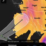
Rachel’s remnants are pushing north faster than anticipated, allowing the strongest winds and steadiest rain to move out of San Diego, but gusts of 30 to 50 mph linger along mountain and desert slopes into this evening, with additional Southern California showers through Monday. The greatest remaining threats today shift into northern Arizona, southern Nevada and Utah, where heavy showers and thunderstorms could produce flash flooding, locally damaging winds and an isolated tornado, while Phoenix and Tucson experience gusty winds and more scattered rainfall. Rain spreads across central and northeastern Nevada and Utah through Monday before colder air brings mountain snow into Tuesday, with more than six inches possible above 8,500 feet in Nevada and substantial accumulation possible in Utah’s higher mountains.
Dangerous coastal conditions continue after the main rain ends, including coastal flooding and strong rip currents along vulnerable Southern California beaches, while a few exposed Bay Area locations could see breaking waves of 18 to 20 feet today, making exposed rocks and jetties dangerous through Monday. Farther north, blowing dust could sharply reduce visibility in the Columbia Basin this afternoon, followed by frost in sheltered valleys near Portland and south of Seattle Monday morning and an increasing risk of freezing temperatures around Spokane Monday and Tuesday mornings. Map/Model from ZoneWatch
An article is expected later and coverage continuous...AWA Insiders, a breakdown of additional details such as severe weather, snow, and also the breakdown of the Santa Ana event expected on Thursday will be coming out shortly. If you had AWA Insiders you would already know the timeframe of peak activity and all other details sub region by region.


ZoneWatch retweeted
A more westward track is expected as I have been saying with the next NHC update likely being more westward. With model guidance coming into better agreement and looking back at Rachel’s historical track, Tropical Storm Rachel will likely impact either San Diego, CA directly or the Southern California Bight. AWA members, you’ll receive your full risk assessment within the next hour.
We’re monitoring two tropical threats: one to the southeast that could pose a direct threat, and another involving remnant moisture from Hurricane Rachel that could affect portions of the West Coast and Southwest. The main concerns include heavy rainfall, thunderstorms, and potential flooding, depending on how these systems evolve and where the deepest moisture moves. #HurricaneSeason2026 #CAwx #Azwx

Family in Shanghai or elsewhere around the world? ZoneWatch’s ZWCAST provides global precipitation guidance to help assess where rain may develop, how it could move, and when it may arrive. Stay informed about the weather near the people who matter most or a trip that requires extra attention.
Try it out here: zonewatchpro.com/dashboard


ZoneWatch retweeted
Once again a Category 5 Hurricane
Polo has restrengthened into a Category 5 hurricane with maximum sustained winds of 160 mph and a minimum pressure near 925 mb. Polo seriously has remained an exceptionally intense and well-organized eastern Pacific hurricane, with extremely cold cloud tops wrapping around its inner core and a structure that has continued to evolve through eyewall changes.
Check out this incredible look at the vertical structure from @ZoneWatchWX , organization, and intensity of one of the strongest hurricanes of the 2026 Eastern Pacific season. An update for what type of impact is anticipated for the southwest region will come tomorrow with the live updates. Stay tuned. #Polo #hurricane #elnino
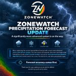
To our customers and supporters: We really appreciate your patience and understanding as we replace the current ZoneWatch Precipitation Forecast, which is currently experiencing issues, with a significantly more advanced system.
Instead of applying temporary fixes, we’re building a new micro-zone-driven forecasting system that separates short-term and longer-range forecasting, incorporates expert-backed analysis, and uses our most advanced precipitation algorithm yet to better predict rain, snow, thunderstorms, and other precipitation types. We’re working rapidly to complete and thoroughly test it before release because forecast accuracy comes first. Thank you for your continued support as we work to deliver something significantly better.

A free weather app may be enough on a normal sunny day, but that changes when severe weather threatens your area. A simple 45% chance of rain does not tell you whether flooding, strong thunderstorms, dangerous lightning, or rapidly worsening conditions are possible.
ZoneWatch goes beyond the percentage, showing rainfall timing and intensity, flood threat levels, severe alerts, and expert-backed storm guidance so you can better protect your plans, your family, and the people you care about. Built by people with backgrounds in risk management and meteorology, ZoneWatch is designed for the moments when weather details matter most. #AZwx #severeweather #Flood #riskmanagement #lightning #storms

Ever heard of a derecho? You definitely have.
These fast moving thunderstorm complexes can produce hurricane force straight line winds across hundreds of miles, sometimes with very little warning. The historic 2020 Midwest derecho even produced a measured 126 mph wind gust.
So what actually makes a storm a derecho, why are they so dangerous, and how much warning do you really get?
@MidwestWeathe_r breaks it all down here 👇
zonewatchpro.com/blog/what-i…

ZoneWatch retweeted
A strong to severe thunderstorm is about to move over the Temecula area. The right ingredients have come together, and no models had predicted it. However, @ZoneWatchWX and our Lightning Risk Model did. It showed the risk for thunderstorms over the inland areas, including Temecula. The timing was also pretty sharp, and at first, even I had my slight doubts.
It is not some random model or simply the use of multiple models. It is a very complex algorithm that took a very long time to build and has been calibrated every single day with the assistance of AI as well across the U.S. to get to where it is today. I am very fascinated and pleased with the results today, both for the Los Angeles region and the Temecula area.
It is not perfect, but the accuracy beat most other models today that failed to properly read the air mass. HRRR was drunk today over Southern California. #Temecula #Riversidewx #CAwx #SouthernCalifornia #Thunderstorms


ZoneWatch retweeted
Good Tuesday morning, September 1st, 2026, at roughly 12:15pm PT.
Dry Air Moving In, Stabilizing the Airmass for Most People Away from the Coast | Eyes Still on the Tropics Read for Details Below with Zoomable Images/Graphics
Read the full Live Update, Zoomable Images Here 👉: alphaweatheranalysis.com/liv…

STRIKE ZONE or CLEAR?
How close is the lightning? Try it out right on the ZoneWatch app which monitors nearby activity, closest strikes, flash counts and active lightning events across your saved locations. Fully customizable push notifications keep you informed when conditions change. We only provide the best data combined with our in-house technology.
Download now at zonewatchpro.com
