Robert Berry (@geo_compute) header
Robert Berry (@geo_compute) profile picture

Research Officer (Geospatial Software Engineering), Bangor University | Founder & Technical Director, Geodat AI Ltd

Wales, United Kingdom
Joined August 2009
Photo by Robert Berry (@geo_compute)Photo by Robert Berry (@geo_compute)Photo by Robert Berry (@geo_compute)Photo by Robert Berry (@geo_compute)Photo by Robert Berry (@geo_compute)Photo by Robert Berry (@geo_compute)Photo by Robert Berry (@geo_compute)Photo by Robert Berry (@geo_compute)Photo by Robert Berry (@geo_compute)Photo by Robert Berry (@geo_compute)
#30DayMapChallenge Day 22 (Projections) The world revolves around Wales. Centred on Cymru, every line from the middle is the shortest route and every distance is true: Milford Sound 18,960 km, Y Wladfa 12,130 km. Data: Natural Earth, OS
1
104
#30DayMapChallenge Day 21 (OpenStreetMap) Sorting 8,600 Welsh place names by language shows a 900-year-old line across Pembrokeshire: the Landsker. 92% of names south of it are in English; 90% just north of it are in Welsh. Data: OpenStreetMap
7
110
#30DayMapChallenge Day 20 (Hexagons) About 243,000 people in Wales, roughly one in thirteen, live where a river could flood them. 63,000 are at high risk. Mapped in 3 km hexagons. Data: Natural Resources Wales flood risk maps, OS
1
5
71
#30DayMapChallenge Day 19 (Smell) In 2025, Wales's storm overflows spilled for 777,000 hours: almost 89 years' worth in one year. Afon Teifi and its tributaries carry 58,000 spill hours from just 69 of them. Data: Dŵr Cymru, Hafren Dyfrdwy, The Rivers Trust,
1
55
The last bus of the evening: 34% of bus stops in Wales have no bus after 6.30pm on a weekday. Seven towns, from Tywyn to St Davids, have none at all. In rural Wales, 40% of households without a car are 800m+ from any 8pm bus. #Buses #Wales #OpenData
22
#30DayMapChallenge Day 18 (NULL) No bus on Sunday: of 18,827 Welsh bus stops with a bus on weekdays and Saturdays, 8,740 (46%) get none on a Sunday. Not one stop in central Tredegar, Burry Port or Kidwelly gets a Sunday bus. Data: BODS, OS
3
57
#30DayMapChallenge Day 17 (Light and dark) On the shortest day, 87% of buildings in Glenboi, Cwm Cynon (Cynon Valley), get no direct sun at all: the hill to the south rises 22°, the sun only 15°. The darkest of 347 places in the Valleys. Data: Welsh Government LiDAR, OS
2
42
#30DayMapChallenge Day 16 (Collaborative) Swansea buses on Friday 13 Nov: at the afternoon peak 37% of First Cymru departures left 6+ minutes late, against 20% in the morning. From my work with the USW GIS Research Centre on access by bus. Data: Bus Open Data Service (DfT)
1
1
54
Day 16, part 2, for John Lamb and Hugh Deeming: where Wales's fastest-rising rivers pass under main roads. 52 of 774 crossings peak in under 3 hours. Only 5 are that fast and carry 10,000+ vehicles a day, all in the South Wales valleys. Live rivers: riverpulse.wales
14
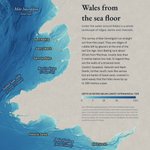
#30DayMapChallenge Day 15 (Inside out) Wales from the sea floor: the land left blank, the seabed in relief. The sarnau of Bae Ceredigion run straight out to sea, and the sand waves on the Bristol Channel's sandbanks move up to 180 m a year. Data: EMODnet, NRW, OS
3
85
#30DayMapChallenge Day 14 (Borgesian) Afon Tywi, every course at once. 1 m LiDAR, coloured by just the first 3.5 m above the estimated river level, shows the Tywi's old channels at Dryslwyn. Data: Welsh Government LiDAR, OS
1
1
70
#30DayMapChallenge Day 13 (Interactions) Welsh water, English taps. Two aqueducts and a river carry water from Welsh reservoirs to Birmingham, Cheshire and Merseyside. The Elan alone sent 286 million litres a day in 2019/20. Data: Dŵr Cymru, United Utilities, NRW, OS, OSM
3
90
#30DayMapChallenge Day 12 (Power) Eryri (Snowdonia) National Park covers a tenth of Wales but has 135 of the 322 river hydro schemes in Wales. Most are on small, steep streams: 4 in 5 sit on the steepest tenth of Welsh rivers. Data: NRW, DESNZ REPD, OS, NRFA
2
61
#30DayMapChallenge Day 11 (Sound) Where Welsh rivers roar: every river coloured by the power of its flow on each square metre of riverbed. The uplands are loudest; the big rivers are quiet. Data: OS Terrain 50, NRW rain, NRFA flows, Welsh Government LiDAR
4
102
#30DayMapChallenge Day 9 (Urban–rural) A dozen Welsh rivers as barcodes, source to sea: gold through built-up areas, green through countryside. The Dyfi never enters one; the Ebwy is more than half urban. Data: OS Open Rivers, ONS Built-up Areas
4
90
#30DayMapChallenge Day 8 (Utopia) Welsh rivers in 2024 vs the legal goal. Only 45% were in good health; the law says every river "good". Fish and phosphate are the most common failures. Data: NRW interim 2024 river classification, OS Open Rivers
3
71
#30DayMapChallenge Day 7 (A map in 10 minutes) At least 18 Welsh rivers are called Dulas or Dulais, "dark stream". Seven are Afon Goch, "red river". Seven more are Nant Hir, "long stream". Data: OS Open Rivers
4
119
#30DayMapChallenge Day 6 (Vintage) The rivers that made the South Wales Valleys. Under the old-style map, each river's width shows how much land drains into it. The Taf drains 529 km², the Garw just 23. Data: OS, NRFA, NRW
1
2
103
#30DayMapChallenge Day 5 (Senses: Sight) Wales has one Met Office weather radar. Across about half the country, its lowest beam passes more than 550 m above the ground. Just 3% is seen down to 100 m. Data: OS Terrain 50, Met Office
3
62
#30DayMapChallenge Day 4 (Clusters) 187 rain gauges, grouped only by how similar their day-to-day rainfall is, never by location. The groups still form regions: neighbours share weather. Data: NRW rainfall 2009 to 2024, OS
3
83