LiVEARTH (@livearthjp) header
LiVEARTH (@livearthjp) profile picture

LiVEARTH: 3D web-globe that visualizes various realtime data on this planet.

地球
Joined December 2014
Photo by LiVEARTH (@livearthjp)Photo by LiVEARTH (@livearthjp)Photo by LiVEARTH (@livearthjp)Photo by LiVEARTH (@livearthjp)Photo by LiVEARTH (@livearthjp)Photo by LiVEARTH (@livearthjp)Photo by LiVEARTH (@livearthjp)Photo by LiVEARTH (@livearthjp)Photo by LiVEARTH (@livearthjp)Photo by LiVEARTH (@livearthjp)
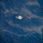
[Overview the Earth] No.2715: #ChubuRegion, #Japan. #AkaishiMountains (#SouthernAlps), #KantoPlain, #NobiPlain, #SeaofJapan are shown in this image. The Chubu Region, Central region, or Central Japan is a large and diverse region in the middle of Honshū, Japan’s main island.
18
【地球を俯瞰する】No.2715: #中部地方 です。#南アルプス #赤石山脈、#関東平野、#濃尾平野、#日本海 まで見えています。中部地方は日本の地域の1つで、近代以降における本州中央部の地方です。その範囲に法律上の明確な定義はありませんが、一般的に愛知県名古屋市を最大都市とする地方を指します。
37
[Overview the Earth] No.2714: #Sudan. Its capital #Khartoum is on the #NileRiver at the right end of this image. Sudan with 51.8 million pupulation is Africa's third-largest country by area. The area that is now Sudan witnessed the #Khormusan and many kingdoms thereafter.
19
【地球を俯瞰する】No.2714: #スーダン の首都 #ハルツーム は画像右方の #ナイル川 沿いに写っています。スーダンの東側は #紅海 に面しています。アフリカ大陸で3位の面積を有しており、2011年7月に南スーダン共和国が分離独立する前は、アフリカ最大の国土を有していました。#ヌビア #ヌビア砂漠
23
[Overview the Earth] No.2713: #Wildfire in #Canada and smoke over the #AtlanticOcean. Through June and July, the season accelerated, with more than 949 active wildfires across the country in mid-July, primarily in the Northwest Territories, Manitoba and other regions.
28
【地球を俯瞰する】No.2713: #カナダ の #山火事 と #大西洋 上の煙です。2026年のカナダの山火事は、6月から7月にかけて活動は急速に活発化し、7月中旬時点では全国で949件を超える山火事が発生しました。主な発生地域は、ノースウエスト準州、マニトバ州、ブリティッシュコロンビア州などです。
36
[Overview the Earth] No.2712: #MtFuji is the highest mountain in #Japan at 3776m, and is an active stratovolcano that last erupted in 1707-1708. Mt. Fuji’s exceptionally symmetrical cone is a well-known symbol of Japan and it is frequently depicted in art and photographs.
29
【地球を俯瞰する】No.2712: #ISS から撮影した #富士山 です。富士山は標高3776mの活火山で、懸垂曲線の山容を有した玄武岩質成層火山で構成され、その山体は駿河湾の海岸まで及びます。古来霊峰とされ、特に山頂部は浅間大神が鎮座するとされたため、神聖視されました。
40
[Overview the Earth] No.2711: #Typhoon 23 over Japan in Oct. 2025. A typhoon is a tropical cyclone which produces sustained hurricane-force winds of at least 119km/h. Northwestern Pacific Basin accounts for almost one third of the world's tropical cyclones.
45
【地球を俯瞰する】No.2711: 油井亀美也宇宙飛行士が #ISS から撮影した2025年10月に接近した、日本付近の #台風 23号です。台風は、北西太平洋および南シナ海で発生する、強い熱帯低気圧の呼称です。この海域の熱帯低気圧の下層中心付近の最大平均風速が一定の基準に達した場合、台風と呼称されます。
62
[Overview the Earth] No.2710: #CrescentEarth Astronaut on board Orion Spacecraft during the #Artemis II Mission captured #Moon and #Earth. Craters on the Moon, incredible crescent Earth, and the boundary of day and night are in this image. (Credit: NASA)
1
44
【地球を俯瞰する】No.2710: 三日地球 #アルテミス 2号の月周回ミッション中に宇宙飛行士がオリオン宇宙船から撮影した #月 と #地球 です。月表面のクレーターと、#三日地球、#昼と夜の境 が写っています。
52
[Overview the Earth] No.2709: Vast #PacificOcean and amazing #cloudscape. It is the largest and deepest of Earth’s 5 oceanic divisions. It extends from the Arctic Ocean in the north to the Southern Ocean in the south and is bounded by the continents of Asia, Oceania and Americas.
18
【地球を俯瞰する】No.2709: 太平洋と雲景 油井亀美也宇宙飛行士が #ISS から撮影した #太平洋 と #雲景 です。太平洋は、大西洋やインド洋とともに、三大洋の1つです。太平洋は地球表面のおよそ3分の1、世界の海の総面積の46%を占め、また地球の全ての陸地を足した合計よりも広いです。
67
[Overview the Earth] No.2708: Suthern Atlantic coast of #Morocco. The #StraitofGibraltar, the #MediterraneanSea, and #Algeria are also captured to the right of this image. The geography of Morocco spans from the #AtlanticOcean, to mountainous areas, to the #SaharaDesert.
30
【地球を俯瞰する】No.2708: #モロッコ 南部の #大西洋 岸です。#ジブラルタル海峡 と #地中海、#アルジェリア も見えています。モロッコ国土の海岸のうち約3/4は北大西洋に面し、残りは地中海に沿っています。東西1300km、南北1000kmに伸びる国土の形状は、約45度傾いたいびつな長方形に見えます。
45
[Overview the Earth] No.2707: #AlgoaBay is a maritime bay in the #EasternCape, #SouthAfrica. It is on the east coast, 683km east of the Cape of Good Hope. Algoa Bay is bounded in the west by #CapeRecife and in the east by #CapePadrone. #Gqeberha #PortElizabeth #PortofNgqura
23
【地球を俯瞰する】No.2707: #アルゴア湾 は #南アフリカ #東ケープ州 に位置する海湾です。喜望峰の東方約683kmの東海岸沿いにあり、西は #レシフェ岬、東は #パドローネ岬 によって囲まれています。湾内の水深は最大436mに達します。#グケベラ #ポートエリザベス #ングクラ港
40
[Overview the Earth] No.2706: #Toronto with 2.8 million population is the most populous city in #Canada and the capital city of the Canadian province of #Ontario. It is located on a harbour at the northwestern shore of #LakeOntario.
1
1
1
66
【地球を俯瞰する】No.2706: #カナダ #トロント の夜景です。トロントは、カナダの #オンタリオ州 の州都、同国最大の都市で、金融センターです。オンタリオ湖岸の北西に位置し、280万の人口を擁します。トロントはカナダ経済の商都であり、産業基盤が発達しています。
33