

Discovery and ETL tool for geospatial data. Find datasets worldwide, load them analysis-ready into your platform. Built for AI assistants too.
Finland
Joined November 2015
- Tweets100
- Following36
- Followers40
- Likes18

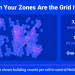





3,073,397 building footprints, one GROUP BY in Snowflake, 145,950 H3 cells. Roll up with H3_CELL_TO_PARENT and totals match. But hexagons don't nest perfectly, so re-indexing at the coarser level moves 6.2% of buildings. Pick one method.
#Snowflake #H3

11
Find geographic data worldwide. Bring it into your analysis, ready to use.
Geo Data Connector is a discovery and ETL tool for geospatial data. It works with Snowflake, Databricks, your browser and your AI assistant. Searching is free.
#GeospatialData #ETL

20
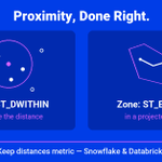
Same 32k real points, same 'within 100 m', measured twice: sphere (geography) 552,824 pairs; projected metric CRS 550,574. ~0.4% flip with the distance model. Neither is wrong — pick one semantics and state it. More in our user guide.
#GeoData #SQL #DataQuality

9
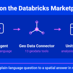
Geo Data Connector MCP Server is now on the @databricks Marketplace. Agents in Playground, Genie, or the Assistant discover + ingest geodata from sources worldwide — analysis-ready in Unity Catalog.
marketplace.databricks.com/d… #MCP

32
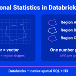
Zonal stats in Databricks is one query: AVG over an ST_WITHIN join — optimized out of the box (9.9M real pixels fast; a 110M-polygon corpus ~30 s in our tests). Zones a uniform grid? Group by h3_longlatash3 cells. More in our user guide.
#Databricks #H3 #GeoData

14
Proximity done right: Snowflake & Databricks both give true meters — sphere (ST_DWITHIN on GEOGRAPHY) vs plane (ST_Transform to a metric CRS, then ST_DWithin). Build buffers in a projected CRS on both. More in our user guide.

4

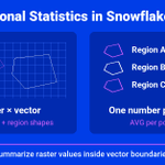
Zonal stats in Snowflake: AVG over an ST_WITHIN join — store geometry NATIVE first. A one-time TO_GEOMETRY convert took our real-data test join to 9 s (110M polygons: ~1 min). Don't compute geometry inside join predicates. More in our user guide.
#Snowflake #GeoData #SQL

8
Your AI assistant can now work with geodata inside Databricks. Register Geo Data Connector's MCP server as an external MCP service, add a connection, and Genie Code can discover, ingest + analyze geospatial data to solve the problem you describe.
#Databricks #AIAgents #MCP

3
Fast geospatial in @Snowflake:
1) Convert GeoJSON → GEOMETRY once, not in every query
2) Prefilter joins on H3 equality, then exact ST_WITHIN
3) Use the coarsest H3 that answers the question
4) Cluster big tables on H3
#GeoData #Performance

8

Geospatial data looks wrong in @Snowflake?
1) GeoJSON is lon-lat, not lat-lon
2) GEOMETRY measures degrees — GEOGRAPHY measures meters
3) Six-digit coords = projected CRS: set the SRID, then ST_TRANSFORM to 4326
Check order → type → CRS.
#GeoData #SQL

16


Geodata from Geo Data Connector lands in @Snowflake already H3-indexed — fine cells for precision, a coarse roll-up for fast joins. 3M buildings, zero indexing jobs.
#Snowflake #H3

13
H3 resolution in @Snowflake: each level down = 7× more cells. The same 60 km² area is 13 cells at res 7 — and 758 at res 9.
Index fine, roll up with H3_CELL_TO_PARENT. Pick the coarsest resolution your question tolerates.
#H3 #GeoData

11
Geo Data Connector Free Edition is live on the @Snowflake Marketplace: full search + discovery across thousands of geodata sources, real ingestion into your account — 10 tasks, 10K rows per run, 10 runs/day. Free to install — upgrade when you outgrow it.
#Snowflake #GeoData

7
Geo Data Connector is now a suite: @Snowflake Native App (paid + new Free Edition), hosted web app, REST API, and an MCP server for AI agents. Discover, explore, and ingest geodata wherever you work. All live today — tour on our website.
#GeospatialData #DataEngineering

26
Apache Iceberg v3 ships native geospatial types — GEOMETRY + GEOGRAPHY columns with CRS metadata and bounding-box pruning. @Snowflake is the first major engine to support it. No more WKT-strings-in-a-text-column workarounds.
#ApacheIceberg #GeoData

5