Dante Lee (@thisguymaps) profile picture

🌎 Occasional GIS dude 👨‍💻 Currently combing through datasets and models for data quality assurance 🌱 Plant dad ✨ Work hard. Be nice. Go outside.

San Diego, CA
Joined May 2018
Photo by Dante Lee (@thisguymaps)Photo by Dante Lee (@thisguymaps)Photo by Dante Lee (@thisguymaps)Photo by Dante Lee (@thisguymaps)Photo by Dante Lee (@thisguymaps)Photo by Dante Lee (@thisguymaps)Photo by Dante Lee (@thisguymaps)Photo by Dante Lee (@thisguymaps)Photo by Dante Lee (@thisguymaps)Photo by Dante Lee (@thisguymaps)
Replying to @thisguymaps
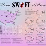
United Swift of America #EsriUC2024
1
3
198
999999 #gischat
This Post is from a suspended account. Learn more
36
Of these options, there’s only one correct answer. Choose wisely
0%.3
100%0.3
1 votes • Final results
1
33
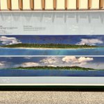
RIP - but also what a well-written post on Null Island
Sad news. It has come to our attention that the @NOAA weather station moored at 0º, 0º (nicknamed @NullIslandBuoy) no longer exists! Check out the update at the end of @mapppingmashups's @nullisland blog post for more details of the buoy's untimely demise. stamen.com/the-many-lives-of…
41
Wow, I attended my first UC 10 years ago 🥹 #EsriUC2024
6
152
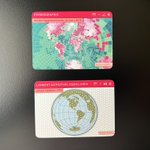
#EsriUC2024 PSA: complete the Esri passport activity in the Expo and get this really fun patch. I’ve been asking for patches for a few years and loved that they finally made them!
3
26
1,535
Here's another receipt printer #map; this time of the Boston Marathon and contained in an enduro route sheet holder. (Thanks Eric Seitz for the suggestion). The map includes distances, landmarks, uphill segments, and more.
8
51
13
454
67,286
🎉It's time to reveal our year-long project “Delicious Parks” A collaboration with @infowetrust. 5×5-mile sections of 20 famous US Nat'l Parks, depicted above sea level w/o vertical exaggeration. This project will be featured in the Atlas of Design v.7 soon. more in the 🧵
Today in BIG SMILES updates: ⬅️ @ShijiaWendy and me last June, starting on a cartography adventure together (it's been a secret!) ➡️ us this week, just before we submitted our project to @NACIS_Atlas
5
32
7
182
21,119
I regret to inform you that the secret to writing metadata is writing metadata
15
12
1
106
8,292
Dante Lee retweeted
The largest geomagnetic storm since 2003 occurred last Friday, delivering rare views of the aurora to areas far from the Earth’s poles. The solar storm affected power grids and more storms could be coming. gift link: bloomberg.com/graphics/2024-… w/ @hellococomo @naurtorious
3
25
1
50
26,277
15
881
50
4,878
250,457
There’s nothing wrong with following your heart, but it never hurts to check the map too.
49
829
55
8,456
356,091
Dante Lee retweeted
Want to make art with ArcGIS? Learn how to make a woodcut print (or linocut), using ArcGIS Pro. Esri cartographer Heather Smith shows you how. esri.social/RUPk50QQH1t #ArcGISPro #Maps
2
8
2
70
7,836
"Everything is related to everything else, but near things are more related than distant."
6
16
1
150
11,176
Just in time for tomorrow's #AnnularEclipse in the USA here's my map showing time of maximum eclipse, by location, and what extent you might expect to see (assuming no cloud cover). Use solar viewing glasses!!! #map #cartography #AnnularSolarEclipse #Eclipse
10
51
9
180
37,840
Dante Lee retweeted
Absolutely fabulous eclipse map from @13pt @NYTScience nytimes.com/interactive/2023…
7
1
22
2,238
New blog post! You designed a useful & fun color key? Great. Now you’ll want to make sure people don’t forget those associations between colors and categories. Our author @lisacmuth explores ways to do so, with >15 examples. Read her article here: blog.datawrapper.de/remind-r…
1
29
2
178
25,729
I’m working on a drawing of all 50 states so I never forget where they are
8
28
1
383
38,924