

Open civic data API and map widgets. National @CrimeScore API. @civicdataally co-founder. See our http://t.co/oOtjtKBeBM repo for open source projects.
United States
Joined May 2008
- Tweets2K
- Following246
- Followers325
- Likes163




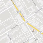
Lots of people parking on the sidewalks on Bradley Ave north of Eastern Parkway. @LouMetro311 maybe make one side no parking like it is near the Dairy Castle near Eastern?


Since it seems @LouMetro311 does not take 311 reports here on X/Twitter any more, I did it myself online. @LouPubWorks @LouisvilleMayor
Report id #18801161

Your Mapper retweeted

Main Remade should mimic designs below, or we as a city have failed. A slow street not for getting quickly in/out of downtown — other roads do that. No traffic lights unless they are for BRT — all way stops instead. Protected bike lanes. Wider sidewalks. No center turn lanes!


KYTC is converting Main St to two-way (from Wenzel to 2nd St).
Public meeting at Slugger Field (401 East Main St) is tomorrow, March 19, 5:30-7:30pm.
More details in the @VisionZero_Lou newsletter: content.govdelivery.com/acco…


Your Mapper retweeted
Map of all the HB242 transportation projects. Pretty evenly distributed, with a lot of fed expressway bridge work in #4 @jecoreyarthur. But remove bridges and #19 @CMPiagentini has the most funded district.
Map: cdolabs.carto.com/u/cdolabs-…
(general Metro funding project not shown)


Your Mapper retweeted
Louisville Twitter: Come meetup today at the @FriendsBtownRd tent to talk about how we can make Bardstown corridor friendly to people and local businesses, and keep it safe and inviting for everyone!
See suggestions for the forthcoming improvements here: docs.google.com/presentation…


It’s @Cyclouvia Day!
We will have a tent on Bardstown Road at the corner of Longest.
Come by, grab a T-shirt and sticker, and learn how YOU can get involved!

Your Mapper retweeted
Retweet this!
In summary, vote today (last day!) on these $50 million I-65 expressway changes through historic Old Louisville. Click the "NEW! Improvement Concepts and Survey" tab to get to the survey: aecomky.maps.arcgis.com/apps…
Vote: 1) F, J, L - 2) M, N - 3) G, I, W - 4) P/Q, U

Your Mapper retweeted
Vote for Louisville's @kehontas to be on the @codeforamerica's National Advisory Council and represent @codeforkyana! codeforamerica.co1.qualtrics…
If @codeforkyana gets the most votes today, they'll get free pizza🍕for their hackathon March 9 at the LouieLab: meetup.com/codeforkyana/even…


Your Mapper retweeted
Google search interest follows the path of the August 21, 2017 solar eclipse reddit.com/r/dataisbeautiful…
Your Mapper retweeted
See Louisville’s #OpenDataDay projects around public safety, Alexa, firearms and a recap of the day from @OPI2Lou. medium.com/louisville-metro-…

Your Mapper retweeted
Louisville, KY is the first city to be on @IFTTT with the help of @CivicDataAlly, @CNETSmartHome, and @mattgolsen! ifttt.com/blog/2017/01/louis…

Your Mapper retweeted

Check out the great maps & fact sheets scoring built character in #cities in @PresGreenLab's Atlas of ReUrbanism forum.savingplaces.org/act/p… – at Kentucky, USA

Your Mapper retweeted

Louisville is #1! ;) Other cities update here: us-city.census.okfn.org/year… @OKFN @codeforamerica nitter.gq/mattgolsen/status/8192…
Your Mapper retweeted
Indiana State Police & Management and Performance Hub (state’s open data portal) creates Daily Crash Prediction Map. in.gov/isp/ispCrashApp/main.…


Your Mapper retweeted

How @CityofKCK is using its new #opendata portal to strategically combat urban blight: bit.ly/2h00Rlj #WhatWorks

Your Mapper retweeted

Our friends @MapD visualized every political donation from 2001 to Oct 2016 on Mapbox GL JS maps #Election2016 mapd.com/blog/2016/11/01/fol…