

Associate Scientist at the University of Miami CIMAS. This is a personal account and tweets do not represent the opinions of NOAA or UM. 3x FSU Alum #GoNoles
Miami, FL
Joined October 2012
- Tweets33.6K
- Following825
- Followers44.6K
- Likes34K
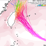




This trend has actually continued today...Google DeepMind's newer WNV3 ensemble has steadily ticked closer to Taiwan with #Champi. The ensemble mean is just offshore now, to the point where I think it may well be close enough for interaction with the island's mountainous terrain to play a role in the track.


Interesting trends for the track of #Champi. AI models (including Google Deepmind) have actually been trending a little west towards Taiwan over the last few cycles, though the mean track still turns just NE of the island. Physics-based models are holding firm in forecasting a direct hit on the island.
This is a rather short-term forecast at this point: only about 3 days.
This will be a fascinating case to continue to follow over the next few days, and folks in Taiwan should definitely prepare for the possibility of a strong typhoon landfall.


Andy Hazelton retweeted

NHC will initiate advisories on Subtropical Storm Josephine (formerly AL93), located offshore of the U.S. East Coast, at 500 PM EDT (2100 UTC).
We finally got a (partial) ASCAT pass that hit #93L. This looks like it's probably a subtropical storm, in my opinion. It looks pretty detached from the fronts on the southwest side of the circulation, and has core convection and a fairly small RMW on the NW side. It's a little hard to tell for sure on the NE side since we didn't get a pass there just yet.
Regardless of the classification, strong NE winds will affect the eastern seaboard.

Interesting trends for the track of #Champi. AI models (including Google Deepmind) have actually been trending a little west towards Taiwan over the last few cycles, though the mean track still turns just NE of the island. Physics-based models are holding firm in forecasting a direct hit on the island.
This is a rather short-term forecast at this point: only about 3 days.
This will be a fascinating case to continue to follow over the next few days, and folks in Taiwan should definitely prepare for the possibility of a strong typhoon landfall.
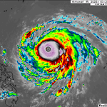
#Champi is looking extremely impressive after its latest ERC completed, and is up to 155-knot intensity.
There's still an interesting battle between the dynamical models and AI models for track. Dynamical models (including GFS and Euro) show a slightly stronger ridge to the north and take the storm right into #Taiwan. The AI models (including EC-AIFS and Google DeepMind) show the ridge eroding just enough for the storm to curve east of Taiwan and towards southern #Japan.
I wouldn't bet against AI on a large-scale setup and track given its recent history, but it will be interesting to see.


Invest #93L is firing some central convection while over the Gulf stream, and looks like it could be making an effort to become subtropical. Unfortunately last night's ASCAT pass missed the circulation, so it's hard to tell if it's detached from the old frontal boundaries or not. Today is probably the best chance it will have to become a subtropical storm. As it moves off to the NE, it will become more asymmetric and transition back to a fully non-tropical low over cooler waters.


Andy Hazelton retweeted

What's remarkable is how stubborn the EPS/GEFS vs. AI guidance split is - there is a near total split in track as soon as 2-3 days from now.
Much of this stems from AI models having weaker easterly steering flow, leading to a slightly slower storm that turns north farther east.


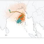
Models are indicating we could see a TC develop in the Bay of Bengal in the coming days. Quite a bit of spread in where it might go, with some members heading up towards Bangladesh and others taking it into the coast of India. A lot of members are developing a strong system, though, and this area can be very surge-prone, so this will be something to keep an eye on.


#Champi is looking extremely impressive after its latest ERC completed, and is up to 155-knot intensity.
There's still an interesting battle between the dynamical models and AI models for track. Dynamical models (including GFS and Euro) show a slightly stronger ridge to the north and take the storm right into #Taiwan. The AI models (including EC-AIFS and Google DeepMind) show the ridge eroding just enough for the storm to curve east of Taiwan and towards southern #Japan.
I wouldn't bet against AI on a large-scale setup and track given its recent history, but it will be interesting to see.
The Rays willingness to add pieces at the deadline this year is a big part of why they just won their 3rd pennant. Peralta has been awesome down the stretch. Should be fun to watch him against his former team this weekend (?) in the World Series!

FREDDY PERALTA IS YOUR AMERICAN LEAGUE CHAMPIONSHIP SERIES MVP
#ForTampaBay | #postseason


Let's do it tonight Rays! #ForTampaBay


Monday afternoon AI models blog taking a look at tropical systems across the Northern Hemisphere, including a look at a possible system in the Indian Ocean and also 94E, which could become yet another hurricane south of Mexico:
brightband.com/blog/several-…
With @danrothenberg and @brightbandtech

This area of disturbed weather to the south of Mexico will be the next candidate for development in the East Pacific. Models have waffled back and forth on the intensity. Interestingly, the new Google DeepMind WNV3 mostly shows it falling apart after developing. EC-AIFS shows something similar, due to westerly shear impinging on the system. Something else to watch will be the cold wake south of Mexico from several recent hurricanes. If a system tracks further right the shear might be lower, but there would be less warm water to work with.
Images from @Weathernerds, @cyclonicwx, and @TropicalTidbits


This is a really thorough breakdown of the damaging wind near Pensacola associated with that feature west of the eyewall in #Isaias. It's remarkable how extreme and also narrow that damage swath was. It may not have been a true sting jet in the classical mid-latitude sense, but definitely impactful and something worth studying I think.

This was awesome... especially as the announcers were basically openly rooting for him to hit a tying HR 😂

That was a really weak holding call to end the FSU game...don't usually see ones like that called in those situations.
Gotta love that October Cleveland weather. Rays gotta find a way to win tonight or tomorrow and get back to the Trop.


Got the YouTube TV multiplayer view going with FSU-UM and @RaysBaseball tonight. Noles are surprisingly competitive but leaving too many points on the field. Rays need the offense to wake up or they're gonna get knocked out of the postseason here soon.
