

Satellites, climate change, Canadian at heart. BU Center for Remote Sensing. Trying to make a difference every day. #landcover #climate #phenology
Boston, MA
Joined August 2016
- Tweets61
- Following222
- Followers549
- Likes18
New paper led by Dr. Xiaojie Gao at Harvard Forest: "Cross-scalar analysis of multisensor land surface phenology" Check it out! doi.org/10.1016/j.rse.2025.1…
We are looking for a post-doc to work on a joint project focusing on large-scale land use/land cover change, funding via BU's Global Development Policy Center. Please share. Interested applicants can email me at my BU address. bu.edu/gdp/2021/10/...
Please RT and spread the word: We are hiring a tenure-track Assistant Professor in Global Change Remote Sensing, as part of a cluster hire in Global Change & Sustainability at Boston University. A great place to work and live! jobs.silkroad.com/BUCareers/…
Cluster hire in remote sensing at Northern Arizona University. Great location, very cool department and program! #remotesensing #jobsearch
hr.peoplesoft.nau.edu/psp/ph…
As a certain for profit family of journals methodically displaces much of the traditional scientific publication space, I'm glad to see Science making this point. It needs to be said more often....
Proudly nonprofit | Science science.org/doi/10.1126/scie…

Mark Friedl retweeted

If you're still on "X", please share widely: Open-rank tenure track position in environmental science, Washington DC. The Department of Environmental Science at American University, Washington, DC is inviting applications for a faculty appointment starting August 1, 2024.
Mark Friedl retweeted

GFW and the Forest Resources Assessment (FRA), explained in 5 graphics.
[1/X] GFW and FRA both talk about “forests,” but what are we actually measuring and monitoring?
Take a look 👇

Mark Friedl retweeted

Fire Facts from a Boreal 🔥 Ecologist to help you understand what is really going on in Canada.
Fire Fact 1: The term “forest fire” is misleading in boreal regions. Also burning are peatlands and permafrost ecosystems, which store LOTS of ancient carbon. 1/

This is amazing - thanks for sharing @aravindEO

Here’s a breakdown of the at least 20 Earth observation satellites launching on the @SpaceX Transport-8 mission on Monday, June 12.
As always, there are first satellites from some companies, constellation updates for others and technology demonstrations 🚀
(Just look at this!)

Mark Friedl retweeted

Fires have burned more than 3 million hectares in Canada so far this year.
The ten-year average over the same timeframe was 254,429 hectares burned.

Mark Friedl retweeted

GLanCE has grown! The Global #LandCover Mapping and Estimation product now covers Europe. This product includes seven land classes or a greenness index as shown in this image over Venice, Italy.
Visit NASA’s #LPDAAC to learn more: bit.ly/3I8cjXB

ALT Global Land Cover Mapping and Estimation (GLanCE) Yearly 30 m Version 1 Data showing Enhanced Vegetation Index near Venice, Italy in July, 2018.
Congrats Zhe - well deserved and over-due! Now you can rest on your laurels 😎

UConn celebrates promotion and tenure of 96 faculty today.uconn.edu/2023/04/ucon…
After 10 years of hard work after my Ph.D., I have at last been granted tenure and elevated to Associate Professor at the University of Connecticut! Looking forward to this new chapter of my career.

Mark Friedl retweeted

Check out our brand new FLUXNET newsletter! Issue No. 1 is hot off the presses:
fluxnet.org/wp-content/uploa…
Hey all of you #remotesensing folks out there - here's a beer that's branded just for us 😎🍻 "Beer balanced by science" Science balanced by beer?

Bumped into an old friend from Montreal at the Bruins game in Boston last night: Yvan Cournoyer. 16 Seasons, 10 Stanley Cups. One of the greatest ever and a true gentleman! Huge thrill for a kid who grew up playing & obsessed with hockey in Montreal #GoHabsGo


Check out this new paper from recent LCSC PhD Leticia Lee in #AFM! We use UAV imagery and airborne LiDAR to show how variation in canopy shadows + solar zenith angle affect VIs, leaf area, and fAPAR from harmonized #Landsat and #Sentinel 2 imagery. doi.org/10.1016/j.agrformet.…

Mark Friedl retweeted
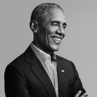
Today marks two years since the Biden-Harris administration began. I’ve been reflecting on how fortunate we’ve been to have the steady leadership of @POTUS and @VP—and all the public servants working to deliver for folks across the country.

ALT President Biden and Vice President Harris in the Rose Garden of the White House.
Mark Friedl retweeted

The single biggest “tell” that someone is inexperienced in the satellite imagery industry is thinking cloud detection is an easy problem (or a solved one!)
