





Ray_Me retweeted

7H872FXG+Q9
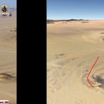
Yemeni forces positions on the Al-Jawf front. The footage appears to show control over these strategic heights.
(2026-11-07~)
~POV — 16.049438, 45.475917
@GeoConfirmed @viditbot
Source: nitter.gq/Of3uu/status/211908543…


PLC forces documented an Ansar Allah pickup truck withdrawing from Qarn al-Sayari.
Geolocation: 16.046361°, 45.507658°
@GeoConfirmed


PLC forces in defensive fortifications west of Huwaishan (حويشان).
Related: nitter.gq/LoLManya/status/211733…
The 7th Brigade of the NSF's 3rd Division used a drone to strike Ansar Allah personnel in the Al-Minsahah Valley.
Geolocation: 13.524742°, 43.960836° (Al Minsahah)
@GeoConfirmed
Source: facebook.com/share/v/1CBFRFW…

Yemeni Emergency Forces troops from the 3rd Division at Qarn al-Sayari (قرن الصيعري).
Geolocation: 16.042904°, 45.508940°
@GeoConfirmed
Source: facebook.com/share/r/1GnGghP…

The IDF 188th Brigade troops carried out demolitions of two buildings in Yohmor.
Geolocation:
33.309539°, 35.520481°
33.309532°, 35.525757°
@GeoConfirmed


خلال نشاط فريق القتال التابع للواء 188: العثور على أكثر من 340 وسيلة قتالية تابعة لتنظيم حزب الله الإرهابي في المنطقة الأمنية بجنوب لبنان
🔸تعمل قوات فريق القتال التابع للواء 188، تحت قيادة الفرقة 36، في منطقة مرتفعات الشقيف (البوفور) ونهر الليطاني، بهدف إزالة التهديدات عن دولة إسرائيل، وذلك بعد أن عملت لمدة نحو عام وثمانية أشهر في قطاع غزة، وخاضت فترة من التدريبات.
🔸خلال نشاطها، عثرت القوات على أكثر من 340 وسيلة قتالية، من بينها: قذائف RPG، وصواريخ مضادة للدروع، وقذائف هاون، وأسلحة خفيفة، وعبوات ناسفة، وقنابل يدوية، وذخيرة.
🔸بالإضافة إلى ذلك، عُثر داخل منزل مدني على فتحة نفق تحت الأرض بعمق نحو سبعة أمتار، احتوت على معدات طبية ومستلزمات للمكوث.
🔸لن يسمح جيش الدفاع لتنظيم حزب الله الإرهابي بالمساس بمواطني دولة إسرائيل وقواته، وسيواصل العمل لإزالة التهديدات مع الالتزام باتفاق وقف إطلاق النار.


The NSF's 2nd Brigade used a drone to strike Ansar Allah fighters west of Duhaydat al-Aqir.
Geolocation: 16.049622°, 45.467675°
@GeoConfirmed


مشاهد توثّق استهداف سلاح الطيران المسيّر التابع للفرقة الثانية بقوات درع الوطن تجمعات لمليشيا الحوثي في جبهة الجوف، ضمن عملية «فجر اليمن».
#فجر_اليمن
#قوات_درع_الوطن
Al Ekhbariya TV documented PLC forces inside Ansar Allah defensive fortifications south of Duhaydat al-Aqir (الحيضة العاقر).
POV: 16.038103°, 45.473085°
@GeoConfirmed


The Yemen Shabab reporter reported from Duhaydat al-Aqir (دحيضة العاقر), which had been taken over by PLC forces the previous day.
Geolocation: 16.038573°, 45.479543°
@GeoConfirmed
Related: nitter.gq/LoLManya/status/211799…


PLC forces in front of the government complex in Asdas, Raghwan District.
Geolocation: 15.767670°, 45.085270°
@GeoConfirmed


🔴 مشاهد من داخل المجمع الحكومي لمديرية رغوان بمحافظة مأرب، يظهر فيها العقيد بندر شتران، رئيس أركان اللواء العاشر حرس حدود، داحضًا مزاعم مليشيا الحوثي بالسيطرة على المجمع.
#فجر_اليمن
PLC forces and Ansar Allah forces continue to clash along the Ma'baq–Hayjat al-Abd road in Al-Maqatirah District.
POV: 13.165752°, 44.288872°


12:51 ظهرًا | المقاطرة
شاهد مقطعًا مصورًا طويلًا وخاصا، يوثق جانبًا من المعارك العنيفة بين القوات الحكومية وجماعة الحوثي في جبهة المقاطرة، بالقرب من هيجة العبد ومواقع أخرى جنوبي تعز.
#أحمدالشلفي
It appears that after failing to make progress along the Al-Labanat, PLC forces are now attempting to advance from the Huwaishan (حويشان) area toward Dahidha (دحيضة)
For example, the video shows them taking control of Hushat al-Qarn (حشة القرن)
Geolocation: 16.011797, 45.521672


Ray_Me retweeted

RSAF strikes on Houthi tunnel networks.
C: 15.536763°N 44.384500°E
S:nitter.gq/CJFCSpox/status/210866…
@GeoConfirmed


Geolocation: 13.449779°, 44.044165° (Ra's an Naqil/رأس النقيل)
@GeoConfirmed

This quoted post is unavailable.
Ray_Me retweeted
7H45MGXQ+R5
Strikes targeting Houthi positions along the Bab al-Mandab front, Yemen.
(2026-10-09~)
12.699541, 43.537938
@GeoConfirmed @viditbot
With the help of @Me1Ray, thx
Source: nitter.gq/Alsakaniali/status/210…


Footage shows today’s strikes on Iran-backed Houthi forces along the Bab al-Mandab front as operations continue to clear the strait and Mayun Island. Hundreds of Houthi fighters remain on the island, where they have been under partial siege for days.
#Yemen
Geolocation: 13.448314°, 44.054029° (As Sarm/الصرم)
@GeoConfirmed


More footage of PLC forces in Al-Misrakh.
Geolocation: 13.461234°, 44.018243° (Al-Misrakh)
@GeoConfirmed

