

I draw tornadoes and chase storms
Joined July 2025
- Tweets4.3K
- Following396
- Followers847
- Likes4.1K





StormArtz - XelArtz retweeted

The storm that produced the Heber tornado, about an hour later as it moved over Holbrook and was brewing up some big hail. (0300Z from SR77) #azwx

StormArtz - XelArtz retweeted

Frame grabs of the large tornado that went through Heber-Overgaard earlier this evening. This thing got quite large and unfortunately appears to have gone right through town. Chasing W @RealDLScales .


StormArtz - XelArtz retweeted

Just did a quick survey of the damage path in Heber, AZ. Here's what I can make out as a path as of now.
Damage seems to be the worst in the circled areas...
Pictures to follow in a thread🧵
@abc15 @weatherchannel @azfamily @NWSFlagstaff

StormArtz - XelArtz retweeted

Typhoon Champi's journey from a pinhole eye to a massive category 5 super typhoon:
StormArtz - XelArtz retweeted

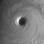
250-meter-resolution VIS image of Super Typhoon #Champi's eye today from Aqua MODIS.

StormArtz - XelArtz retweeted

Just an amazing supercell approaching Show Low right now. #azwx @NWSFlagstaff

StormArtz - XelArtz retweeted
EarthCARE passed near the eye of Super Typhoon #Champi earlier today as the storm was wrapping up its eyewall replacement cycle. The CPR and ATLID instruments revealed eyewall convection reaching an incredible altitude of ~18 km, approaching the upper limits of the troposphere! @esa_earthcare


StormArtz - XelArtz retweeted

24-hour loop of Super Typhoon #Champi
StormArtz - XelArtz retweeted

Beyond Unbelievable Dataset ‼️
Analysis Intensity Update
Super Typhoon Champi
160kts/893mb
The TC has rapidly organised, SAR RCM3 / RCM0 at 0929z observed 148kts, with WV min -18°C, now WV min -13°C, CDO expansion <600km (-80°C pink) is substantial of upper eschelon TCs.


StormArtz - XelArtz retweeted

This is what Typhoon Champi would look like if it was in the Gulf of *cough* sorry something was in my throat.

StormArtz - XelArtz retweeted

Without a doubt the most insane SAR scan I’ve ever seen with Super Typhoon Champi out in the Pacific. Unbelievable stuff and great data.

StormArtz - XelArtz retweeted

You are looking at the strongest storm on the entire planet tonight.
Super Typhoon Champi has been an absolute monster now for 24 straight hours.


StormArtz - XelArtz retweeted

Storm-following of Champi for ~5 hours as it passed south of Guam earlier today. One zoomed in on the eye for a look at those mesovorts and another wider shot. Multi-tilt loops to give a bit more temporal resolution/smoothness than it otherwise would be. Incredible data!
StormArtz - XelArtz retweeted

Imagine a storm being a high-end Category 4 and STILL rapidly intensifying.
The past ~24 hours of Champi have been absolutely unreal. This thing is now an ultra-symmetric buzzsaw with 185+ mph eyewall winds (as strong as Melissa).
The eye is now ~35 miles wide.
StormArtz - XelArtz retweeted

Meteorological perfection out of the Western Pacific this morning. Super Typhoon #CHAMPI’s CDO is exceptionally round, with a very thick ring of convection. Winds are up to 155 kts (180 mph) with a pressure of 902 mb.
Visually, it’s among the top of the year.

StormArtz - XelArtz retweeted
What Super Typhoon Champi is doing right now is almost unheard of.
We have seen many storms in the West Pacific achieve this kind of extreme intensity before, but few have done so with an eye and eyewall as physically massive as Champi’s.
At 185 MPH (298 kph), with gusts likely over 215 MPH (345 kph) and a near-buoy confirmed eye pressure of 895 MBAR, this is one of the most ridiculous cyclonic core structures we have ever seen in the satellite era.
StormArtz - XelArtz retweeted

#Champi is looking extremely impressive after its latest ERC completed, and is up to 155-knot intensity.
There's still an interesting battle between the dynamical models and AI models for track. Dynamical models (including GFS and Euro) show a slightly stronger ridge to the north and take the storm right into #Taiwan. The AI models (including EC-AIFS and Google DeepMind) show the ridge eroding just enough for the storm to curve east of Taiwan and towards southern #Japan.
I wouldn't bet against AI on a large-scale setup and track given its recent history, but it will be interesting to see.


