

Weather information you can trust. Degreed Meteorologist | Storm Chaser @msstate '26 & '28
Joined March 2026
- Tweets923
- Following206
- Followers1.6K
- Likes4K




We are LIVE covering a 5% Cig1 #tornado risk in the midwest, especially around the Twin Cities.
Convective initation is beginning to the southwest of Minneapolis. Make sure you are staying weather aware if you're in Minnesota or Wisconsin!


Great read here from CJ! Check it out.

With the incoming El Niño, there's lots of questions on how we in the Sunshine State could be affected this year. In this article, we'll take a look at how our state's deadliest tornado outbreak can warn us about what we could see in the coming months. Thanks to @willbrattonwx for giving me the opportunity to contribute! #FLwx willbrattonwx.com/news/the-n…

Holy cow this is INSANE from Chile. Prayers for those impacted. Wicked motion on that #tornado
🚨Jim Tang joins the Mets!
@wxmann joins Met Monday for a fantastic discussion about his work, including the incredible @chase_archive!
Tap in at 7pm on YouTube:
youtube.com/live/czuruLwh524…

Winter might be on the brink of arrival in North America.
Teleconnections provide the background that translates down to local weather. Much discussion has revolved around the strong El Niño, but there are plenty of other teleconnections that change things up.
A negative Arctic Oscillation and positive Pacific-North American are forecast to occur. This, paired with a surge of moisture from the El Niño-fueled subtropical jet that is expected to get active, will favor our persistent ridge shifting to the west, allowing a much more active storm track east of the Rockies.
It will also favor arctic air seeping down south paired with a weakening of the polar vortex, providing the cold air necessary for the first major cold snap and potentially impactful winter weather.
There is some uncertainty surrounding this, and teleconnections never guarantee localized weather, but it is something to continue to monitor closely over the next 7-14 days. #wx

We've got #tornado warnings in the desert southwest, and I am LIVE covering it! Tap in: youtube.com/live/5gNbwTYIu0E…


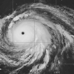
Can you guess which is Hurricane Katrina and which is Super Typhoon #Champi?


🚨Mikey Plemmons chased tornadoes in Brazil, and he is back to talk about it!
@TheNaderMike is joining the Mets for an exclusive 30-minute conversation about his trip to strom chase and spread severe weather awareness in Brazil.
Tune in TONIGHT on YouTube!
📅 Monday, October 19th, 2026
⏰ 7:00 PM CDT
📺 Live on YouTube, On-Demand after


CONGRATS!!!!! So much love for these two. Just incredible people.
Trying to keep my mouth shut was almost impossible 😭

I can’t even describe how much I love you @AngelaAlva45519 and I can’t wait to see what is next!
I can say with 100% certainty I would not be where I am today without having her by my side for the last 6 years.
Here is to many more tornadoes with you ❤️


Cooler temperatures are finally coming, but fire weather and a bit of severe weather are riding along with it. Tap into my latest forecast.
youtu.be/Nyr-ZCn53JM
Today's 2% #tornado risk in Illinois-Indiana screams 1 or 2 tornadoes in the year of Illinois (2026).
A few spinups possible along segmented cells, with the off-chance for a supercell that could plant one as well. Biggest fail mode pertains to cloud cover hindering instability.


The amount of surge foam that was leftover around this camera was insane.
Mark's equipment is just top notch. Dream come true to get to play a role in his mission with Hurricane #Isaias

Quick highlight reel from our remote cam that we placed on Santa Rosa Island just hours before Isaias made landfall.
The cam captured a lot of wave run-up and some surge but the overall water level did not get very high.
We also used some new tech to allow us to see better in the dark and also to collect surge data along with other wx data.
Will Bratton retweeted
My happy place... winds gusting to near 110mph
Inner eyewall of Hurricane Isaias near Fort Walton, FL
@willbrattonwx @floridamanwx
We also have a 2% #tornado risk reintroduced for western New York, which StormNet has been sniffing out for a few days now.
That one is much more conditional with less destabilization, but again, some potential.


The SPC has introduced a 5% #tornado risk zone for today's setup in the plains.
Still interested in a tornado or two in southern-central Kansas. Not the most robust setup, but has some potential.
We will be LIVE covering this event tonight!

The SPC has introduced a 5% #tornado risk zone for today's setup in the plains.
Still interested in a tornado or two in southern-central Kansas. Not the most robust setup, but has some potential.
We will be LIVE covering this event tonight!