

Weather information you can trust. Degreed Meteorologist | Storm Chaser @msstate '26 & '28
Joined March 2026
- Tweets927
- Following211
- Followers1.6K
- Likes4K




Will Bratton retweeted
My happy place... winds gusting to near 110mph
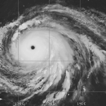
Inner eyewall of Hurricane Isaias near Fort Walton, FL
@willbrattonwx @floridamanwx
Will Bratton retweeted

Small sample (15 mins) of wind data from our wx station that was placed on the Destin Bridge.
RM Young anemometer.
More to come next week.
@foxweather


Will Bratton retweeted

VOLUME UP! Listen to that HOWL of the eyewall of Hurricane #Isaias from just west of Destin from our intercept! #FLwx @foxweather @willbrattonwx
Will Bratton retweeted
Very turbulent surf and an approaching eyewall in Destin, FL
@willbrattonwx
Will Bratton retweeted

We have our first tornado warning of Isaias right now. One thing I’m watching is that the down-shear right quadrant is not aligned with the front right quadrant in Isaias. Typically tornadoes in TCs are concentrated in the front right quadrant…


Will Bratton retweeted

Hurricane Isaias could make a run at Category 3 intensity tonight. Unfortunately, the Hurricane Hunters have aborted their final mission of the day due to maintenance issues, leaving us without aircraft observations for the time being.
@AtmosWX
Will Bratton retweeted
The @hurricanetrack team is OTW to the panhandle to cover #Isaias. Folks in the storms path, be sure to finish your preparations today.
See you from the field! @foxweather @willbrattonwx

Will Bratton retweeted

🚨 Fall break plans on the Panhandle? Here's what to know and do about #Isaias.
Isaias is expected to make landfall as a hurricane late Friday night. If you haven't left yet, don't go. Stay home until at least Sunday afternoon or preferably Monday. If you're already there, leave Thursday (tomorrow at the time of posting this). Thursday (tomorrow) is also the last full day for residents to prepare.

Will Bratton retweeted


🚨All-time #wxtwitter user and PhD candidate Isaiah Montgomery joins Met Monday!
@GumryWX is joining the Mets for an exclusive 30-minute conversation about his research and other pressing topics in the weather community.
Tune in TOMORROW on YouTube!
📅 Monday, October 5th, 2026
⏰ 7:00 PM CDT
📺 Live on YouTube, On-Demand after


Will Bratton retweeted

I'm joining shortly, quickly log out if you're tuned in quickly!
🚨All-time #wxtwitter user and PhD candidate Isaiah Montgomery joins Met Monday!
@GumryWX is joining the Mets for an exclusive 30-minute conversation about his research and other pressing topics in the weather community.
Tune in TOMORROW on YouTube!
📅 Monday, October 5th, 2026
⏰ 7:00 PM CDT
📺 Live on YouTube, On-Demand after
Will Bratton retweeted
Here is a helpful loop of the past several runs of this model to show how we are starting to get a better grip on this. Still lots to figure out tho, as typical with these types of setups.

New 1,000 member Deepmind ensemble run with a slight downtick as expected and more in line with the NHC. 85% of members become a tropical cyclone with 57% reaching hurricane strength. I think we are coming back down to earth here realistically. I do not think the most reasonable scenario is a strong hurricane. Regardless, a high impact storm is still expected with an elevated flash flooding and tornado threat. Stay tuned for updates.

Will Bratton retweeted

The Difference Between a Strong Hurricane and a Weak Tropical Storm
The two most recent runs of the GFS provide an excellent illustration of why many different outcomes are still on the table. Same model, six hours apart, and they do not agree on what reaches the northern Gulf. Both close off and become tropical cyclones within the next 48-60 hours. Both come north from the Bay of Campeche (BOC) toward the northern Gulf coast. The difference is how fast one develops, and whether it is still strengthening when the trough arrives.
The split is already there Wednesday morning. At 1 a.m. Wednesday, the 12Z run has a tight, circular 850 mb vorticity max in the Bay of Campeche and a 999 mb surface low. The 06Z run, at the same hour, is 1006 mb and elongated. By 7 p.m. Wednesday, the 12Z is already at 983 mb with a tight wind core. In contrast, the 06Z is 1002 mb and broad, and the jet is too far north to open an outflow channel. At 7 a.m. Thursday, both are still in the BOC, and both are still in the light-shear pocket. The 12Z low has deepened to 974 mb, with a tight wind core, a closed circular 850 mb max, and the streamlines already turning out to the northeast. The 06Z low has intensified much more slowly into a 996 mb tropical storm. Same pocket, but the 06Z has no outflow channel and is 22 mb behind. The environment is not what separates them. The vortex is.
From there, one strengthens all the way to the coast and the other does not. The deeper vortex extends up into the southwesterly flow ahead of the trough, so the trough can pick it up and ventilate it. It is 975 mb just off the southeast Louisiana coast at 1 a.m. Saturday, still in the light-shear pocket with the outflow channel still open, and it crosses extreme southeast Louisiana between 1 a.m. and 7 a.m. By 7 a.m., it has already made landfall near the Louisiana–Mississippi border as a strong hurricane. It got there before the shear axis did.
The slower one peaks early and weakens coming in. It is a closed tropical storm on Thursday, but it remains too weak to get picked up by the approaching trough and drifts slowly northward. By 1 a.m. Saturday, it is 1004 mb and filling, still in the western Gulf, while the other run is at the coast. It reaches the western Louisiana coast on Sunday as a weak tropical storm, a day and a half later, and that late arrival is the problem. The shear axis has already come through. The same trough that ventilated the faster storm is overhead by the time this one gets there, so it gets sheared instead.
Timing is the whole difference. A faster, stronger low in the short term is what lets it move north and arrive while it is still being ventilated, via the favorable trough interaction I mentioned in the previous post. A slower one does get to the coast. It just misses the window, and it arrives even weaker than it was on Thursday because the trough is no longer an outflow channel. It is destructive wind shear.
Nothing else in the pattern has to change. That is why a strong #hurricane at the coast and a weak tropical storm a day and a half later are both still on the table, and why one model cycle should not be taken verbatim as a definitive forecast.
#92L #Isaias


Will Bratton retweeted

Lights, camera, action! 🎥
A dream come true! The Discovery Channel season 4 finale “In the Eye of the Storm” Three Rivers: Four Tornadoes is out NOW!
Available on Discovery +, Amazon Prime, and HBO Max!


